

When browsing in the City Bookshop in Davey Place I came across Official Guides to Norwich for 1929 and 1935, in the reign of King George V. The contrast between ancient and modern was striking for while Ralph Hale Mottram was taking a backward look at the city’s rich history in the introductory section to the 1935 guide, businesses in the advertising section were gamely boosting their progressive credentials.

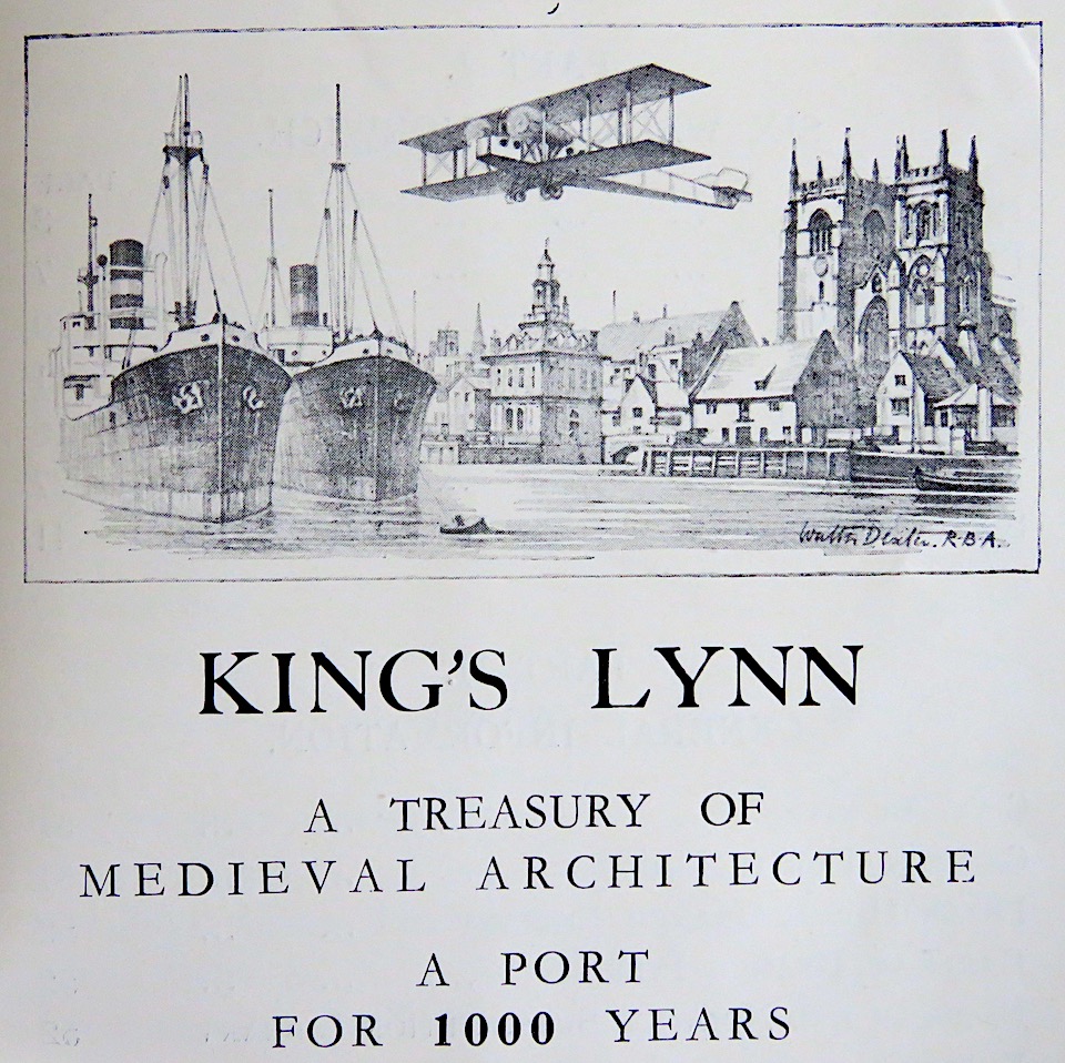
The rolling boundary between old and new is relentless and any marker of modernity quickly gets left behind as we see, not in an advert for Norwich, but in a puff for its distinguished neighbour, King’s Lynn. In the ‘Port for 1000 years‘ a passenger biplane is set against Henry Bell’s seventeenth century Customs House and the mid-twelfth century church of St Margaret.
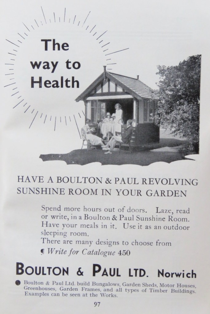
Norwich had several firms making planes, such as Boulton and Paul at their Rose Lane Works where they manufactured more Sopwith Camels during World War I than any other company. B&P’s best known plane of World War II was the Defiant, with a rotating gun turret operated by the gunner seated behind the pilot. But in 1935, unconscious of the imminent descent into further conflict that would cause their factory to be bombed, they were advertising health-giving rotating ‘Sunshine Rooms’.
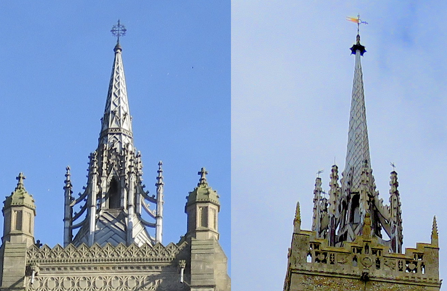
Mottram’s perspective on events from living memory is fascinating. About St Peter Mancroft, Norwich, he wrote: ‘The massive tower can be seen in any old picture of the marketplace to have had a much more homely appearance before the addition of the ornaments which … have been the object of some controversy.’ Controversy?
The sturdy tower overlooking the marketplace seems to have been designed to support a far more significant lantern stage for which the small spike was evidently judged to be a poor substitute. In the 1880s the Streets (father and son) were engaged to add a parapet with a stone pepperpot in each corner and in 1895 the son, AE Street, replaced the old spike with a lead-covered structure supported by crocketed flying buttresses. Not everyone liked it. Mortlock & Roberts [1] thought the old plain top and spike ‘infinitely preferable’, taking objection to the new model’s ‘cake icing effect’, while Pevsner & Wilson judged it ‘too playful to make a stand on this tower‘ [2].
Born in the 1880s, Ralph Hale Mottram was a small boy when the Streets were at work so his opinions about the Mancroft controversy are likely to have been borrowed from the ‘members of the last generation‘ – the witnesses who could ‘remember desperate faction fights here at election times, with a great chain drawn across the centre (of the marketplace) to separate the combatants, who used to kick up the old kidney-shaped cobbles for missiles, and frequently had to be driven from the field by force.’ Violence had long been a feature of Norwich political life [3]; at election time the marketplace was set out like a tournament field with the Blue and White (Whig) tent occupying one side and the Orange and Purple (Tory) tent the other.
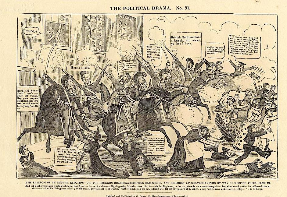
As we saw in the post on Revolutionary Norwich [4], political meetings in eighteenth century Norwich were corrupt, drunken and highly adversarial. This continued well into the late nineteenth century. When Mottram was three, a 500-strong meeting attended by the unemployed turned violent. After shops were sacked and a ham stolen the rampage was remembered as the Battle of Ham Run [3].
Mottram said of the marketplace that ‘the roadway is pure twentieth century, public service and private vehicles driven by the internal combustion engine pass in a continuous stream.’ The air quotes shimmering around ‘internal combustion engine‘ betray someone born in the age of the horse-drawn carriage.
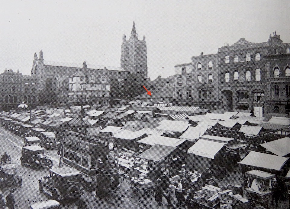
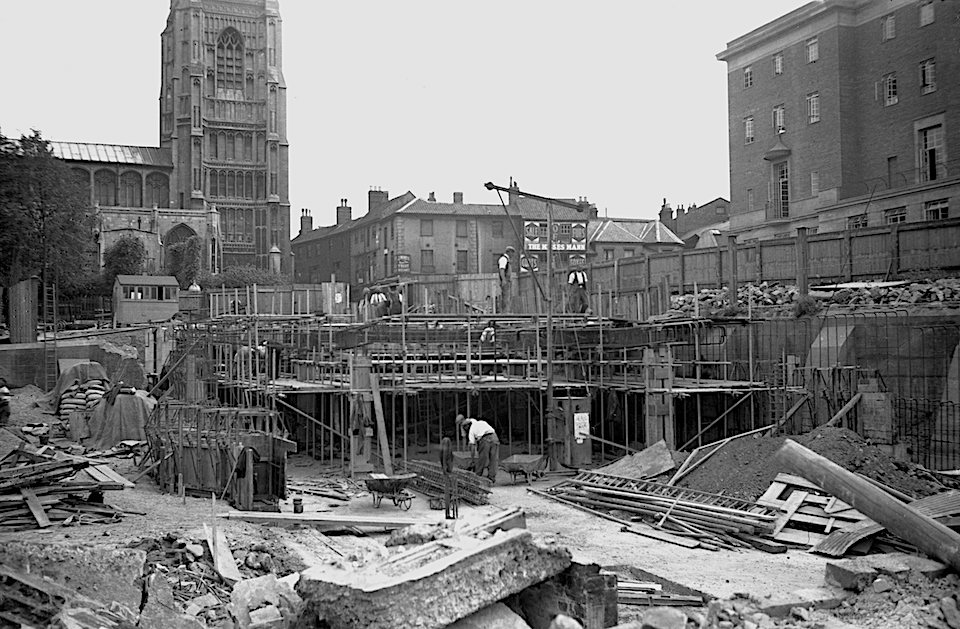
This photograph might be older than 1935 since the buildings at the back of the market were described as being ‘in course of demolition to make way for the New Town Hall’. The red arrow points to the tin hut that doubled as police offices and drill hall. Both the hut and the municipal offices on St Peter Street (top right) would be pulled down as part of the new City Hall project. In turn, these had replaced the old ‘butchery, spicery, Soper Lane, Worstead Row, herb market and Pudding Lane’ by which the medieval authorities had segregated the various trades. By May 1938 the old municipal buildings had been demolished to make way for the area to the back of the market containing the Garden of Remembrance, with the newly completed City Hall behind.
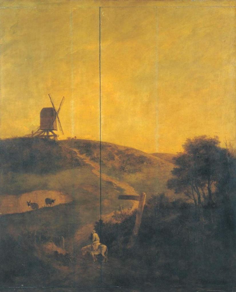
Mottram also wrote about another landmark that is no longer with us. In a brief section on Mousehold Heath (‘”Mussel” in local dialect’) he mentions George Borrow’s poem The Wind on the Heath – the high ground above the city where local hero Robert Kett was defeated and where John Crome painted his windmill (‘and only recently burned down’). At one time the painting was titled ‘A Windmill on Mousehold Heath, near Norwich No. 926′ although, as we will see, the location was brought into question.
Could ‘Old’ Crome’s windmill be one of the two depicted in Braun and Hogenberg’s (1581) prospect of Norwich?
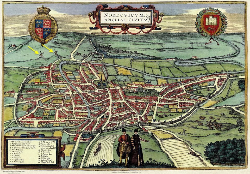
The excellent Norfolk Mills website lists two mills for Mousehold Heath, one of which is the Sprowston postmill, sometimes thought to have been Crome’s windmill [5]. In 1933, two days before the mill was due to be handed over to the Norfolk Archaeological Society for preservation, sparks from a gorse fire set the sails alight and the windmill burned down.
Except, a paper in Norfolk Archaeology 1966 [6] turned this idea – and the map – on its head with a convincing argument that ‘Old Crome’s Mill’ was not situated on Mousehold Heath to the north of the city but in Trowse to the south.
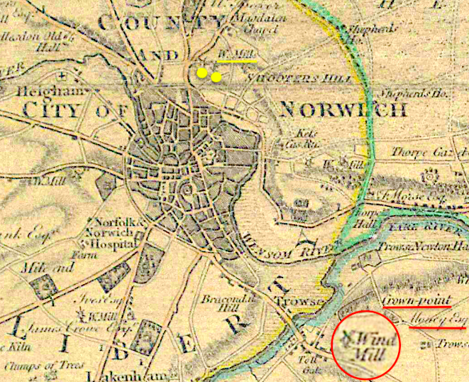
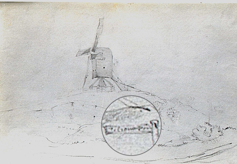
The fingerpost in Crome’s painting seems to carry no inscription but Miklos Rajnai [6] explained that the fingerpost on a very similar drawing of a mill by Norwich School artist George Vincent contains the words, ‘To Crown Point’. The clincher – revealed for the first time in Rajnai’s article of 1966 – was that an old label on the back of Crome’s painting stated: ‘Trowse Mill/near Norwich/painted by/Old Crome’. The windmill at Trowse (see map) is near Crown Point, then owned by intrepid balloonist Major John Money (1752-1817) and subsequently re-built by the banker Sir Robert Harvey.
In a suggested tour of the city, Mottram describes walking towards St Andrews Hall down ‘the new street made for the trams which here descend the hill‘. By the time Mottram wrote his article the ‘new’ street was 35 years old. The tramway had cut a swath through mainly Tudor buildings: the City Arms was demolished and another Tudor building, purportedly made from timbers salvaged from the Spanish Armada, was neatly bisected. (Read Frances and Michael Holmes’ recent book for a fascinating account of the Norwich trams [7]).
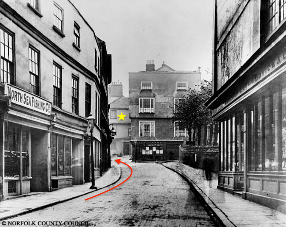
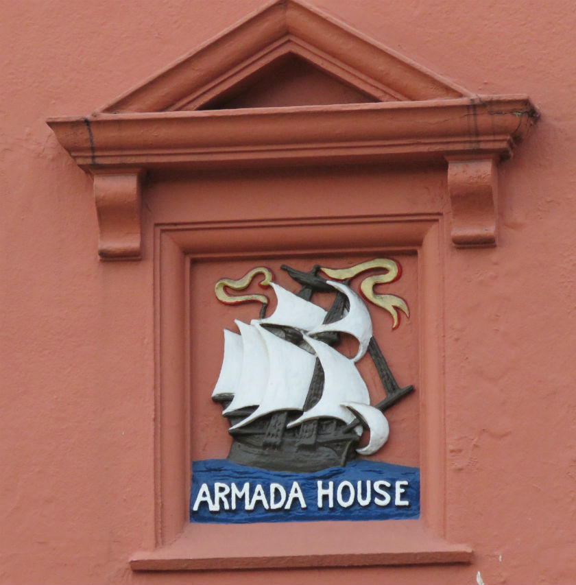
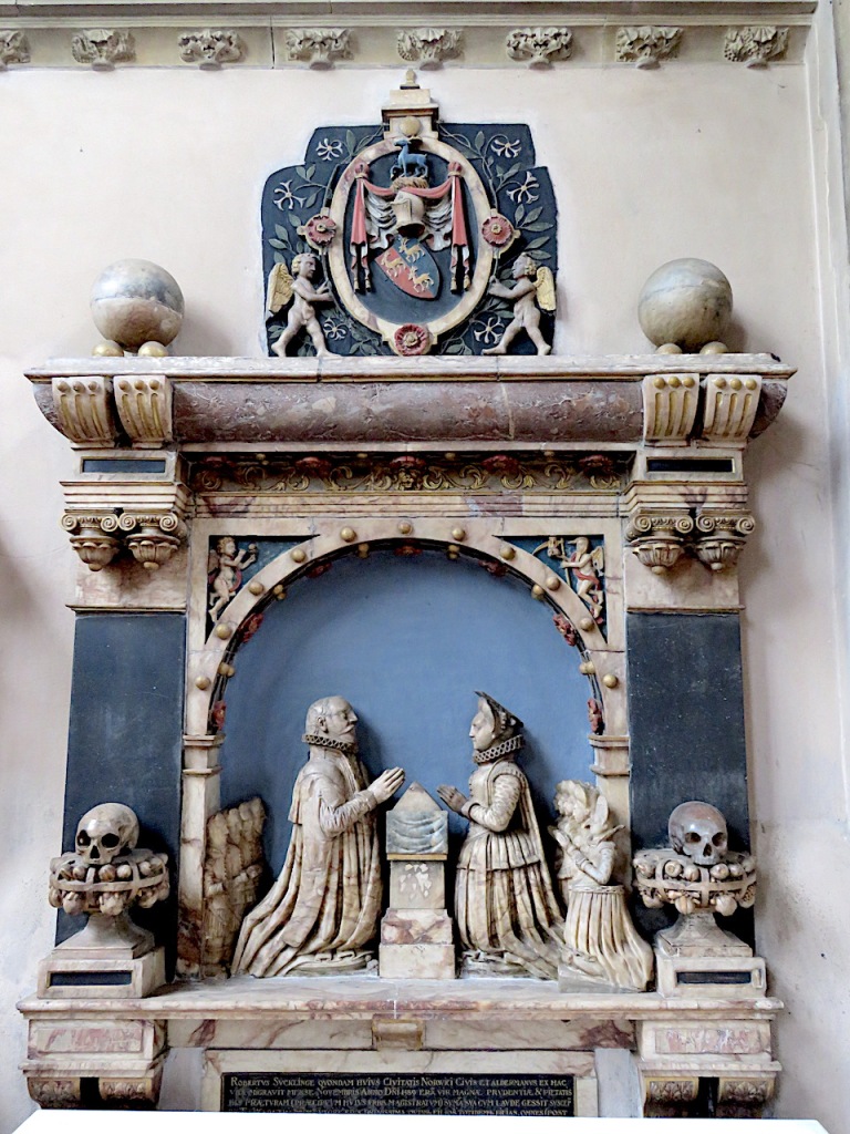
Across the road from Armada House was another Tudor building, now exposed to the new street – the home of 1572 mayor Robert Suckling whose kneeler monument is next door, in St Andrew’s church [8].
Ralph Mottram wrote that Suckling House ‘was lately purchased by the Misses Colman who opened it as a public Assembly Hall.’
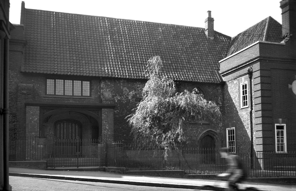
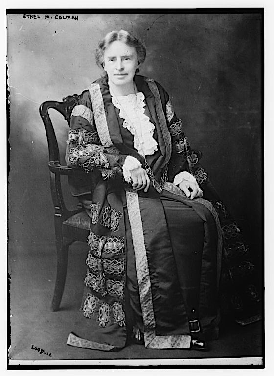
Ethel and Helen Colman, of the Colman’s Mustard family, bought this merchant hall-house in 1923, the year that Ethel became Mayor of Norwich and the first female mayor in the country. The philanthropic sisters had the building restored by their brother-in-law E.T. Boardman (son of architect Edward Boardman) and presented it to the city in 1925 as a place for public assembly. The complex is now Cinema City, housing an arts cinema and restaurant.
To the left of Suckling House (not in frame in the photo above) is the Boardman-designed Stuart Hall, named after the husband of Ethel and Helen’s sister, Laura Elizabeth Stuart. I hope to write about James Stuart in greater depth but he deserves a brief mention here. A fellow of Trinity College Cambridge, Stuart had been a Liberal MP concerned about the lot of ordinary people. He championed education for all and as a director of Colmans promoted their pension scheme for workers. After James Stuart’s death in 1913, his wife and her family commemorated his name with the almshouse-style Stuart Court apartments (1914). He is also remembered by Stuart Garden in Recorder Road, opposite the Court, but this wasn’t officially opened until after the war, making this year (2022) the centenary of the garden’s opening [9].

In another excursion, Mottram went to Norwich-over-the-Water and – foreshadowing the psychogeographers – took what he called a ‘wander’ off Oak Street, down Jenkin(s) Lane. Only 26 inches wide, the narrowness of this passageway was acknowledged in the rueful local alternative, Chafe Lug Alley [10]. Although he wrote that this led to the first Quaker meeting house in Norwich, the first such place of worship was built in Goat Lane in the city centre in 1676, replaced in 1826 by the chapel that stands there today [11]. The Goat Lane site of a quarter of an acre left no room for the Quakers to bury their dead, for which purpose they used an acre of land across the river (where Amelia Opie and the Gurneys were interred). It was here in 1700 that the Society of Friends built their second meeting house.
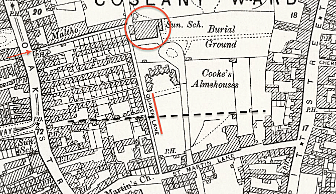
Because Quaker Lane (underlined red) was too narrow for funeral processions, land was rented so that the cortege could travel from St Martin Lane (now inside the ring road) up to a turning circle adjacent to the burial ground [10].
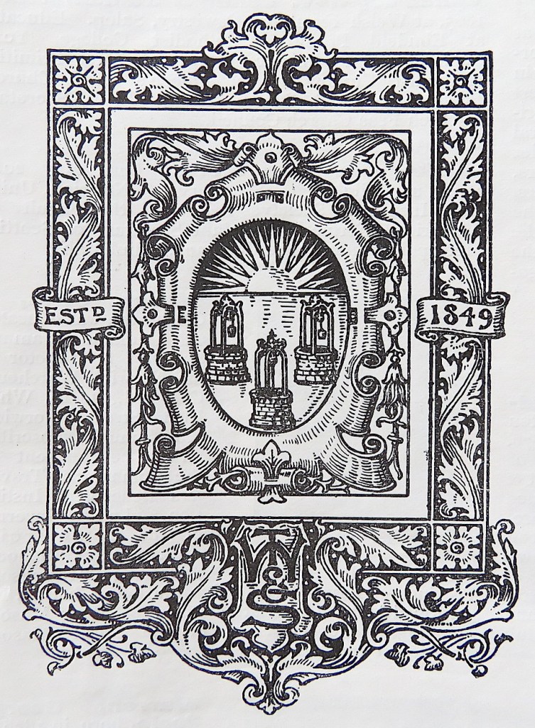
The advertisements are as fascinating as anything. In an older trade book (1910), the hatters and capmakers, T Wells & Son (estd. 1849) were enhancing their pedigree with an armorial plate. The hatmakers adopted three wells and a rising sun as their rebus, echoing the golden well used by the fifteenth century Bishop of Norwich, James Goldwell.
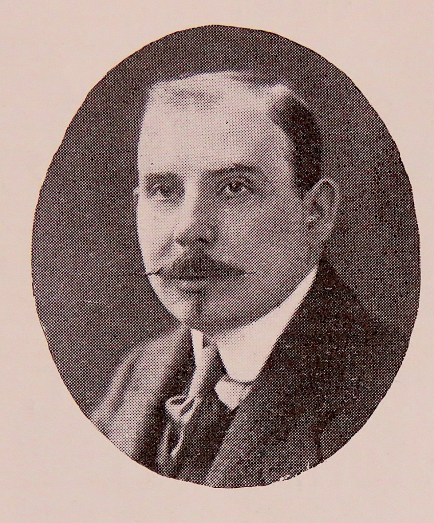
Accompanying this were photographs of the white-bearded father, Thomas Wells (b 1841) and the son, Herbert Rumsey Wells (b 1877). In Rumsey’s portrait, he sports a waxed moustache and that little patch of hair beneath his lower lip that might have once been called an imperial (in the fashion of Napoleon III) but now seems to be called a soul patch, demonstrating that even though you may change the name there is nothing new under the (rising) sun.
A quarter of a century later, in the Official Norwich Guide of 1935, Rumsey Wells was sporting the full goatee, flamboyantly advertising himself as ‘The most expensive Capmaker in the World’.
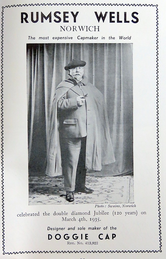
Famed for his ‘Doggie’ cap (modelled above in the ‘Watton’ shape), Rumsey Wells made headgear, like ‘The Brundall’ for men and the ‘Rumishanter’ for women. He died in 1937 but his shop – leased from the brewers Lacons – is now home to the Rumsey Wells pub in St Andrews Street.
Finally, I had occasionally wondered about the origin of the street name ‘Westlegate’ and Mottram provided the answer.

The name of the city street ‘Westlegate’ remains although, of its ancient fabric, only All Saints church and the adjacent thatched building still stand. In this Viking town we are familiar with ‘gate’ being derived from the Old Norse ‘gata’ for street or road, as in Fishergate, Colegate etc. According to Mottram the ‘westle’ bit derives from the fine wastel bread that used to be made there.
Wastel bread has its verbal root, guastel, from old French which is now gateau meaning cake, so it seems to have been a cake-like bread made from fine white flour [13]. Jacob Grimm of the German Brothers Grimm knew the word Gastel for ‘a finer kind of bread‘ which was also known as Wastel in Upper Germany i.e. Bavaria and Austria. In Italy, the guastella (guastedda in Sicily) has survived the times in different shapes, mostly flat, always white, and often sweet.
© Reggie Unthank 2022
Sources
- DP Mortlock and CV Roberts (1985). The Popular Guide to Norfolk Churches. No 2 Norwich, Central and South Norfolk. Pub: Acorn Editions.
- Nikolaus Pevsner and Bill Wilson (1997). The Buildings of England. Norfolk 1: Norwich and North-East. Pub: Yale University Press.
- Mark Knights (2004). Politics, 1660-1835. In, Norwich since 1550 (eds Carole Rawcliffe and Richard Wilson). Pub: Hambledon and London.
- https://colonelunthanksnorwich.com/2021/03/15/revolutionary-norwich/
- http://www.norfolkmills.co.uk/WindmillsN/thorpe-mousehold-postmill.html
- Miklos Rajnai (1966). John Crome’s Windmill’ Norfolk Archaeology https://archaeologydataservice.ac.uk/archiveDS/archiveDownload?t=arch-3749-1/dissemination/pdf/vol_34/NorfolkArchaeology34_P86_P87.pdf
- Frances and Michael Holmes (2021). The Days of the Norwich Trams. Pub: Norwich Heritage Projects.
- https://colonelunthanksnorwich.com/2021/08/15/sculptured-monuments/
- https://www.edp24.co.uk/news/history-of-james-stuart-norwich-8627120
- http://www.georgeplunkett.co.uk/Norwich/oak.htm#Oakst
- https://colonelunthanksnorwich.com/2017/08/15/post-medieval-norwich-churches/
- ‘Citizens of No Mean City’ (1910), a trade book published by Jarrold & Sons
- http://www.foodsofengland.co.uk/wastelbread.htm
Thanks
I am grateful to Clare Everitt of Picture Norfolk for permissions.

As always, a fascinating read. Thanks, Clive.
LikeLike
Thank you Jeremy.
LikeLike
Fascinating!
Sent from my iPhone
>
LikeLike
Pleased you enjoyed it, Sarah.
LikeLike
Such an interesting blog – always learn several things – thank you
LikeLike
Thank you, Marj.
LikeLike
Fascinating as usual – love the summer house – wonder how fast it could revolve.
LikeLike
As fast as a sunflower, one hopes 🙂
LikeLike
Excellent work, as ever. I believe the link to Faden’s map should point to http://www.historic-maps.norfolk.gov.uk/
LikeLike
Corrected. Thank you Jonathan.
LikeLike
Very enjoyable. Rumsey Wells was a wonderful old shop which supplied our school caps. A very quaint place. I bought a Norwich Silk tie in there in the late 1960s which was of an early Victorian paisley pattern and suited the flower power style of that time.
LikeLike
Wonderful to have that connection with Rumsey Wells’ shop, Stephen. Although he was gone by the 60s his flamboyant style would have been at home in that era.
LikeLike
A great read, thank you – some excellent material woven into that interesting meander around Norwich. I recently read the Spanish Farm by RH Mottram – an excellent novel set in the First World War and largely from a woman’s perspective – perhaps forgotten today in the literature of the time.
LikeLike
Hi Paul, I enjoy Mottram’s history writing but have never read his novels. With your recommendation, I’ll look out for them.
LikeLike
This is fascinating and all so well researched. Thank you.
LikeLike
Thank YOU David.
LikeLike
What a great read. Thanks Reggie
LikeLike
Thank you kindly Reggisdottir
LikeLike
Such an enjoyable read, Reggie!
LikeLike
It was great fun, Clare, stumbling across those old city guides; there was so much history in them.
LikeLiked by 1 person
A very enjoyable read which as usual raised some memories. Rumsey Wells was a fascinating shop which provided my school uniform and later a blazer which I wore for many years. Ralph Mottram is a forgotten author these days but his local writings are worth seeking out though I see that parts of what is possibly his best work, the Spanish Farrn trilogy, have fallen foul of the current thought police.
As a 11 or 12 year-old I had a copy of the then current Norwich Guide (late 1940’s) which was full of information about our city and led me to explore parts that at that time were foreign to me. Great days, thank you for bringing them back.
Don Watson
LikeLike
Hi Don, Rumsey Wells and his father seem to have featured in local guides over the first half of the twentieth century. His sales pitch of ‘the most expensive hat in the world’ is counterintuitive and I wonder if he had many takers in the city?
LikeLike
Very enjoyable Clive. Another terrific article.
LikeLike
Appreciate the kind comment, John
LikeLike
Most enlightening and informative as always. Particularly like the colloquial version of Jenkins Lane which was new to me – despite being a Norwich boy thru and thru! I will need to check my research, but pretty sure I have ancestors who lived in Jenkins Lane.
LikeLike
Hi Alan, Yes, I was tickled by Chafe Lug Alley and wonder how many other colloquial names we’ve lost.
LikeLike