• About
  • Colonel Unthank’s Norwich #2
  • Contact
  • Latest Colonel Unthank’s Norwich Book #3
  • Posts
  • Unthank Book #1

COLONEL UNTHANK'S NORWICH

~ History, Decorative Arts, Buildings

COLONEL UNTHANK'S NORWICH

Category Archives: Norwich maps

The Nursery Fields of Eaton

15 Friday Jan 2021

Posted by reggie unthank in Norwich history, Norwich maps

≈ 38 Comments

Tags

Norwich plant nurseries

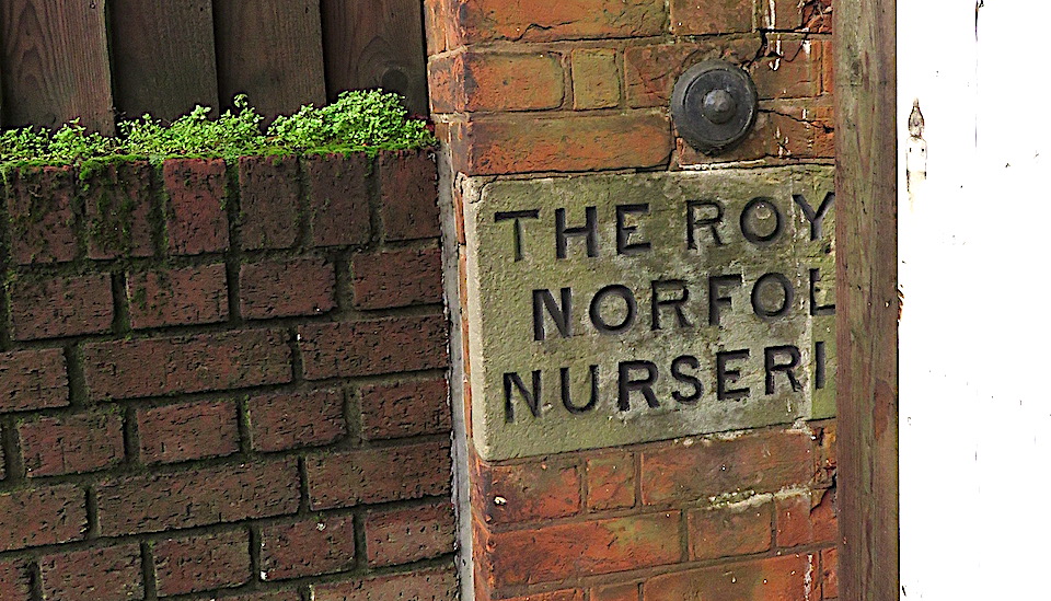
In these covid times I cycle. Along the celestial Unthank Road to the junction with Newmarket Road, down the hill to Eaton and out to open countryside. Before the crossing is a house with two intriguing names carved in stone on the gate pillars. The first is badly spalled and its few remaining letters … CRO … would be unknowable except for a modern house-plate, Hillcroft. Although a few of its letters are obscured the other sign can only be for the Royal Norfolk Nurseries.

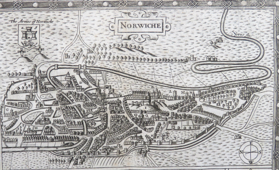
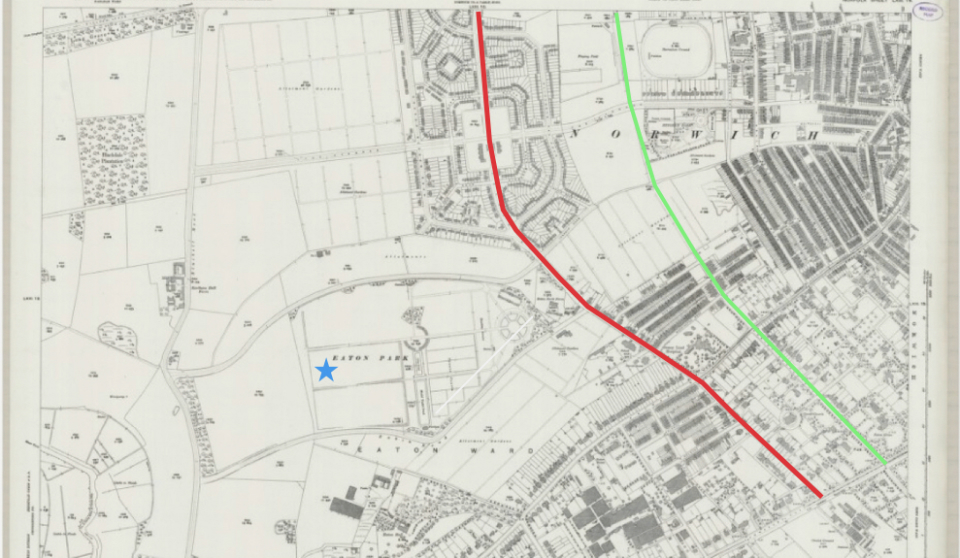
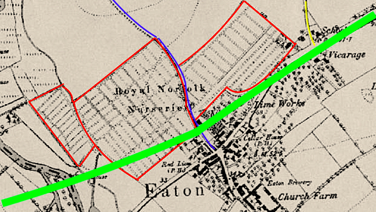
I was curious to look into this because for several years I’d wondered about the clear, unbuilt-upon spaces on the early maps marked ‘nursery ground’ or ‘garden ground’. The OS map of 1879-86 shows that the Royal Norfolk Nurseries occupied sites from the junction with Unthank Road (yellow) down the hill to Bluebell Road (blue) and a larger area between Bluebell Road and the river, now in the shadow of the A11 Eaton flyover/bypass (green).

Courtesy of Ordnance Survey

Much of the land, from the Unthank’s estate east of Mount Pleasant in Norwich [1] down to Eaton, was owned by the Dean and Chapter of Norwich Cathedral; this applied to the village itself with the notable exception of a few oases, including the 12 and 17 acre plots owned by the Corporation of Eaton.

Plots owned by the Corporation of Eaton (red), Blubell Road (blue), Unthank Road (yellow). Plan of Norwich 1807 courtesy of Norfolk Record Office.

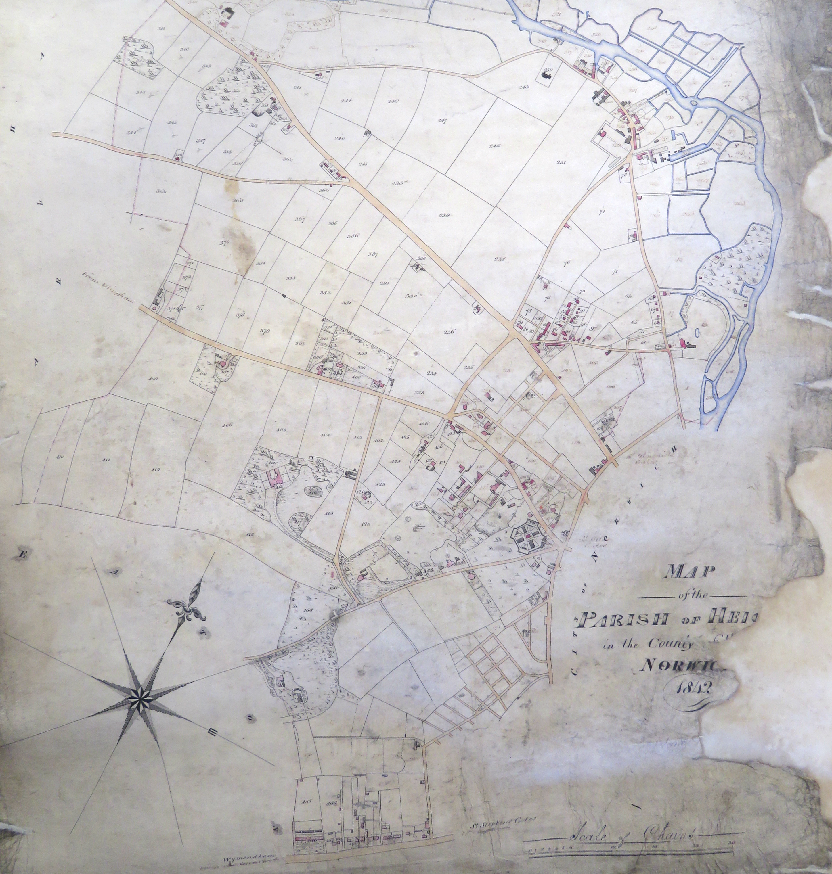
The 1838 tithe map and accompanying apportionment record (1839) gives the name of landowners liable to pay church tithes and, within the two outlined areas, William Creasey Ewing (1787-1862) owned most of the individual numbered plots.

Plots owned by WC Ewing. Tithe map of Eaton 1838, courtesy of Norfolk Record Office

The son of William Creasey Ewing, John William Ewing (1815-1868), evidently inherited the land from his father and is listed as Nurseryman, Florist, Lime burner (and there is a lime pit on the site) and Seedsman [2].

John William Ewing. Courtesy of Vivien Humber

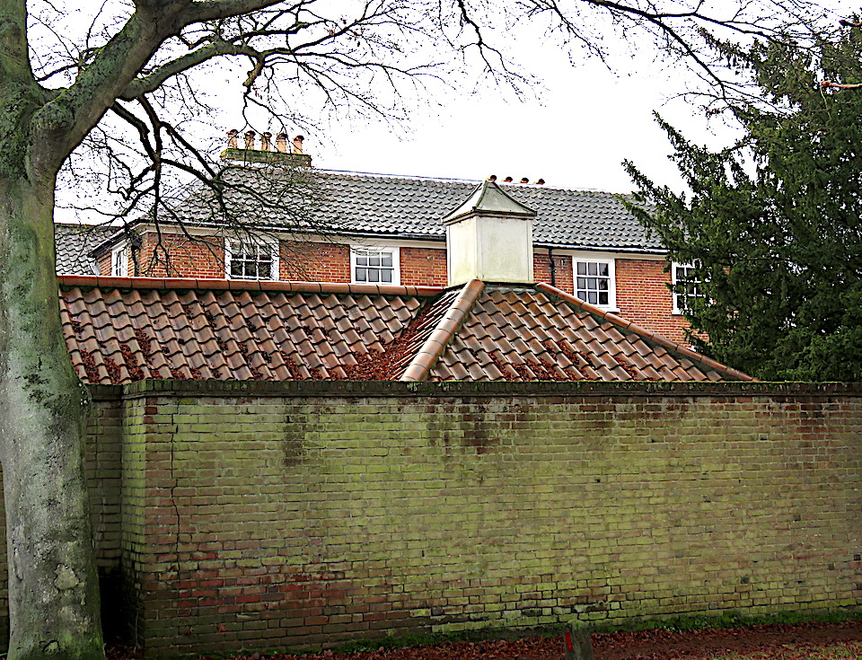
Below is The Old House, Church Lane, Eaton (formerly known as Shrublands) where William Creasey Ewing lived. The National Census records his son John William living there in 1851 [2].

Prior to this census return, John William Ewing lived in Shepherd’s House near Mackie’s, the city’s long-established and foremost nursery, founded in the 1700s on Ipswich Road [1]. We’ll come to Mackie’s shortly.

Ipswich Road (red), Newmarket Road (blue), present-day Daniels Road (green) with Mackie’s Nursery spread around the crossroad. Bryant’s map 1826 courtesy of georgeplunkett.co.uk

Between 1833 and 1840, John William Ewing and Frederick Mackie entered into a partnership, forming Mackie and Ewing’s Nurseries, but in 1845 the partnership was dissolved. A newspaper advertisement to this effect places JW Ewing in Ewing’s Nursery at Eaton, indicating that JW Ewing was managing the nursery when he was 30, if not before.

A year later, (incidentally the year his son and successor was born) an invoice from JW Ewing, Nurseryman and Seedsman, shows that the Eaton Nursery was selling ‘Forest & Fruit Trees, Flowering Shrubs etc’ and, in smaller script, ‘Garden & Agricultural Seeds, Dutch Bulbs, Russian Mats (anyone?)*, Mushroom spawn etc.’ *(A reader, Lyn, provided the answer. Russian Mats, exported via the port of Archangel, were closely woven from the leaves of aquatic plants and used to protect fruit trees and young plants etc).

Private collection, courtesy of Pamela Clark

When he died, Ewing’s Royal Norfolk Nurseries were inherited by his son, John Edward Ewing (1846-1933), but when John left Norwich in 1893/4 the business at Eaton was lost.

John William Ewing’s headstone at St Peter’s Church, Cringleford

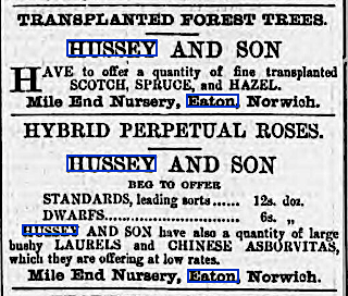
In his History of the Parish of Eaton (1917), Walter Rye wrote that ‘the chief trade of the village is now growing fruit trees and roses for the market’ [3]. He went on to say that other well known Eaton nurseries are the three rose nurseries of C Morse, E Morse and RG Morse and the ‘old-established nursery of Mr Hussey in the Mile End Road.’

From [4]

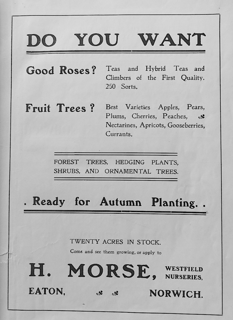
Ernest Morse appears in this 1910 book of local worthies and businessmen [4] advertising himself as a grower of fruit, cucumbers and grapes. His older brother Henry took out a full page advert announcing his 20 acres of rose bushes and fruit trees in the Westfield Nurseries, Eaton.

From [4]

John Ewing’s partnership with Mackie’s was dissolved in 1845, leaving Mackie’s to stand alone as the city’s predominant nurserymen.

Mackie’s receipt 1828. Private collection, courtesy of Pamela Clark

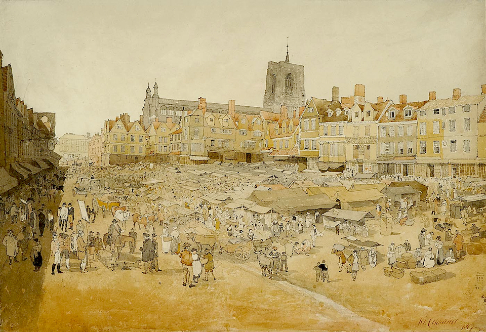
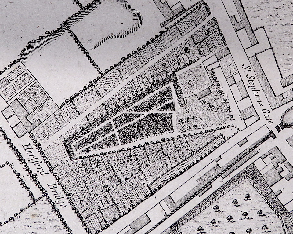
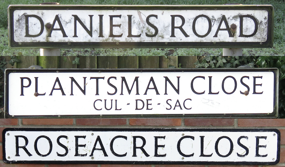
The industrial scale of Mackie’s operations made it one of the largest provincial nurseries [5, 6]. Bryant’s 1826 map (above) shows Mackie’s 100 acre site was situated around the crossroads where present-day Daniels Road intersects Ipswich Road but the business can be traced back to John Baldrey’s nursery in the city where, around 1750, he was selling plants and trees on a wholesale basis. In 1759, this was taken over by the Aram family – who were selling ‘Scotch firs’ at ten shillings per thousand – and in 1777 John Mackie joined the business. This was around the time the nursery moved to what, in its final days, was to be known as ‘the Daniels Road’ site.

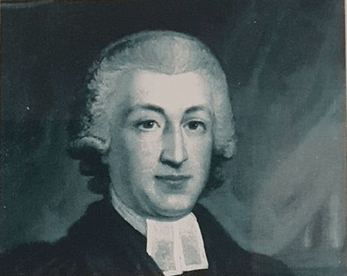
Parson Woodforde knew Mackie:

“Mackay, Gardener at Norwich, called here (the parsonage at Weston Longville) this Even’, and he walked over my garden with me and then went away. He told me how to preserve my Fruit Trees etc. from being inj’ured for the future by the ants, which was to wash them well with soap sudds after our general washing, especially in the Winter.”(from Parson Woodforde’s diary, July 13 1781).

As Louise Crawley describes in her essay on the Norwich Nurserymen, Mackie’s site was so extensive that clients recorded being driven around it by carriage [6]. Mackie’s was to remain in the family for four generations until it was sold in 1859 when they emigrated to America [5, 6].

The Norwich Nursery ca 1833. Courtesy Norfolk Record Office

Fifty years after this map was made the Ordnance Survey recorded that a portion of Mackie’s Nursery at Lakenham had become the Townclose Nurseries. Later still, this was to be purchased by the Daniels brothers.

Daniels Brothers’ receipt used at the nursery grounds in Eaton and their ‘shop front’ – the warehouses in the city centre. Private collection, courtesy of Pamela Clark

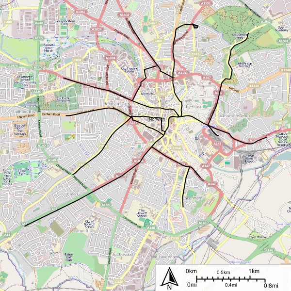
Daniels was sold to Notcutts in 1976. By superimposing modern roads on the nineteenth century map we can see how construction of the Daniels Road portion of the ring road in the 1930s (circled in red) bisected the Townclose Nurseries, with the ‘Notcutts’ portion on the south-western/left side.

Daniels Road bisected the Townclose Nurseries. Newmarket Road runs from lower left to upper right. Note also another nursery circled in green on the other side of Newmarket Road. 1883 OS map, courtesy of the National Library of Scotland.
From the Newmarket Road roundabout in 1933, the Daniels Road section of the new ring road cuts through the Mackie’s/Townclose Nurseries. ©georgeplunkett.co.uk
Plantsman Close and Roseacre Close both built on the eastern side of what had been Mackie’s nurseries

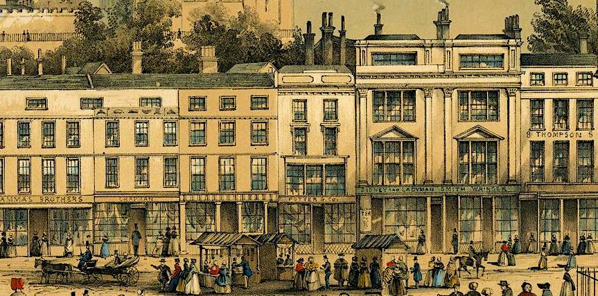
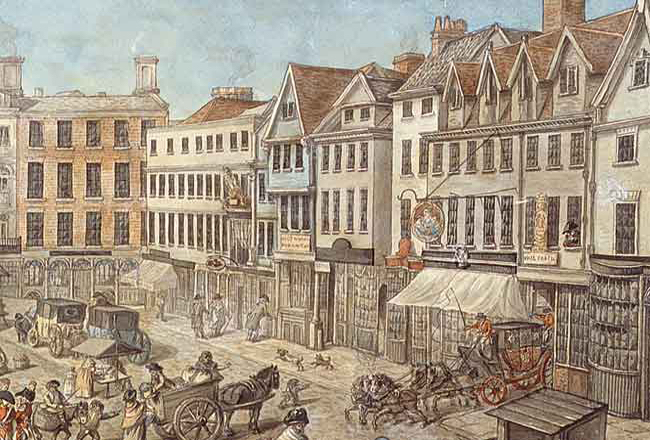
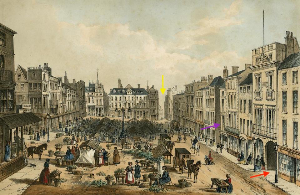
In 1849 Mackie’s ventured beyond the parish of Eaton when they bought The Bracondale Horticultural Establishment, situated in the crook between City Road and Bracondale. Patrons were welcome to visit the nurseries but orders could be placed at Mackie’s warehouses in Exchange Street where customers could also buy seeds and catalogues.

Mackie’s Bracondale Horticultural Establishment. City Road (red). The nursery is outlined in green. Six-inch OS map 1886 courtesy National Library of Scotland. The 1:2500 map (not shown) indicates the location of glasshouses and these are marked on the 6 inch version in blue.

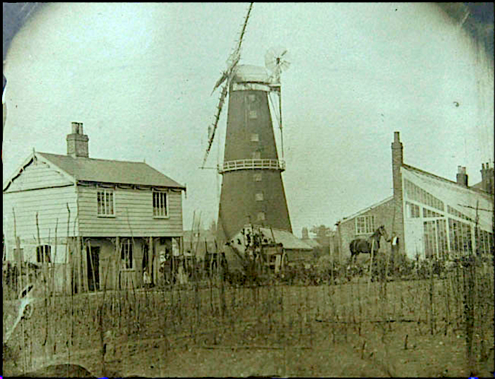
A print in JJ Colman’s album shows Read’s Bracondale windmill (1825-1900). Photographed from the Bracondale Horticultural Establishment it shows a plot with supporting canes and, in the background, heated glasshouses.

Bracondale Windmill c 1855. Courtesy of Norfolk County Council, Picture Norfolk

The trade card, below, from around 1830, shows the extent of the glasshouses that Mackie inherited when he bought the Bracondale Horticultural Establishment from JF Roe. Their exotic produce appears in the foreground:  grapes, melons, ‘forced fruits’ and – most romantically foreign – the pineapple.

This image has an empty alt attribute; its file name is roes.jpg
Trade card from c1830 when the Horticultural Establishment was run by Mackie’s predecessor, JF Roe. The engraving of extensive glasshouses is framed with grapes, pineapples, melons and ‘forced fruits’

As a young boy, before I knew words like ‘epicurean’, I visited Cardiff Castle and was shown a table with a hole through which a pot-grown vine would be placed for the Marquess of Bute’s family to snip their own grapes. Unless, of course, they are peeled for you, grapes are pretty low down on the totem pole of self-indulgence since they can be readily grown outdoors or in an unheated glasshouse. But in previous times the seriously rich would grow pineapples in hothouses, as much a show of wealth as a token of their hospitality. Indeed, from the sixteenth century onwards there was something of a pineapple mania. Large country estates with heated glasshouses and staff could afford to grow their own tender fruit and plants. Norfolk estates may have produced pineapples, but this would have been beyond the dreams of the villa-owning classes in the Norwich suburbs [5] who looked instead to commercial nurseries like Mackie’s to provide their hothouse products. 

Charles II presented with the first pineapple (reputedly) grown in English soil by his gardener John Rose (possibly). English School C17. Royal Collection Trust ©Her Majesty Queen Elizabeth II

On a national basis, however, Mackie’s reputation rested not with fancy fruit and bedding plants but with the quantity of their arboricultural stock. In 1849 they auctioned ‘one million forest trees’ and in 1796 they were able to send 60,000 trees to an estate in West Wales. The journey from Norwich to Pembrokeshire required the trees to be carted to London then onwards by sea: such transportational hurdles would be largely overcome by the arrival of the railways. When trains came to Norwich in the 1840s, Mackie’s were able to offer ‘instant arboretums’ of 650 varieties of trees and shrubs for £35 [5].

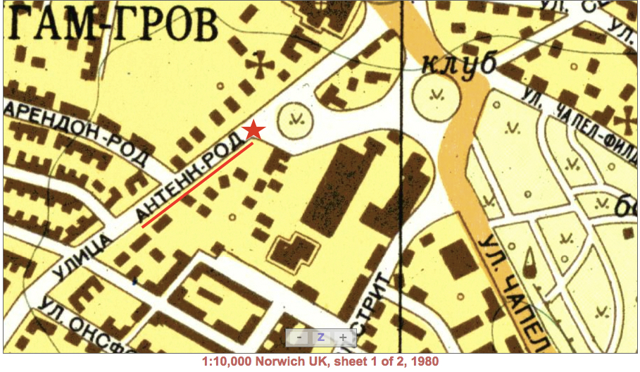
In his History of the Parish of Eaton (1917) [3], Walter Rye mentions ‘the old-established nursery of Hussey in the Mile End Road.’ An advertisement from 1869 shows that their Mile End Nursery was, like its larger competitor (Mackie’s) on the other side of the Newmarket Road, offering trees and roses.

Husseys 1869. Courtesy Vivien Humber

In 1885, Husseys occupied much of the area between Unthank(s) Road and Newmarket Road, stretching from the Mile End Road (now ring road) to what would become Leopold Road.

The 1885 Ordnance Survey map labels a tree-filled nursery (green) between the Mile End Road (yellow) and what would become Leopold Road (dotted purple line). Upton Road (dotted red line), Judge’s Walk (blue) was then Green Lane. Courtesy of National Library of Scotland.

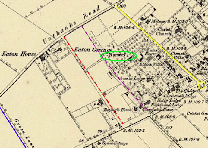
By the time of the 1908 Ordnance Survey (though for clarity I show the 1919 map), Hussey’s had another nursery on its doorstep. What had been open ground to the west/left of Upton Road was now occupied by large structures, longer and wider than the terraced roads that had arisen on Hussey’s land.

Glasshouses occupy the land between Judge’s Walk (blue) and Upton Road (red). OS map 1919 courtesy of National Library of Scotland

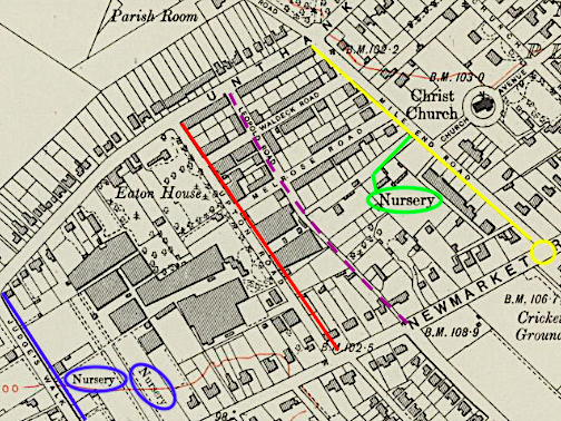
In the period between the 1885 and the 1908 Ordnance Surveys, EO Adcock had bought the open land to the west of Upton Road and established a nursery producing plants on an enormous scale. Meanwhile, Hussey’s had contracted, a good part having been sold to build Waldeck, Melrose and Leopold Roads. The remainder was still accessible through the entrance off Mile End Road [7].

Edward O. Adcock started as an amateur cucumber grower with eight glasshouses at a time when a dozen cucumbers commanded £1 [7]. To put this in perspective, in 1900 the pound was worth over a hundred times what it is today (although cucumbers are still 95% water).

Adcock’s Nursery ca 1904, including about 15 of his workers. ©Norfolk Industrial Archaeology Society 2014

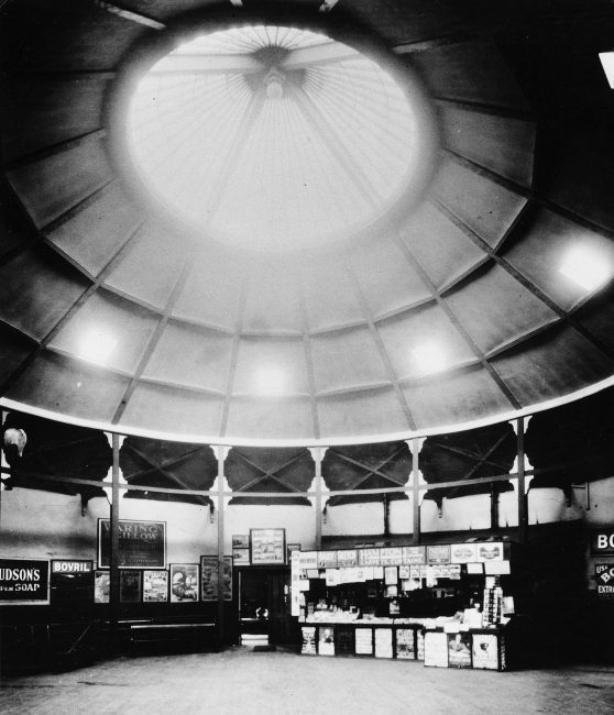
In an article eulogising Adcock as one of the ‘Men Who Have Made Norwich’ [7], he is said to have had 125 glasshouses, each 120 feet long, totalling a quarter of a million square feet of glass. As well as cucumbers, Adcock grew chrysanthemums and, by selling 300,000 per annum, he was claimed to be the largest grower in the world.

Packing chrysanthemums at EO Adcock’s Nursery ©Norfolk Industrial Archaeology Society 2014

Twenty two acres were devoted to asparagus. Adcock also grew tomatoes in prodigious quantities: in one day his staff picked and packed over two tons of tomatoes to be dispatched by rail [7].

Packing tomatoes. ©Norfolk Industrial Archaeology Society 2014

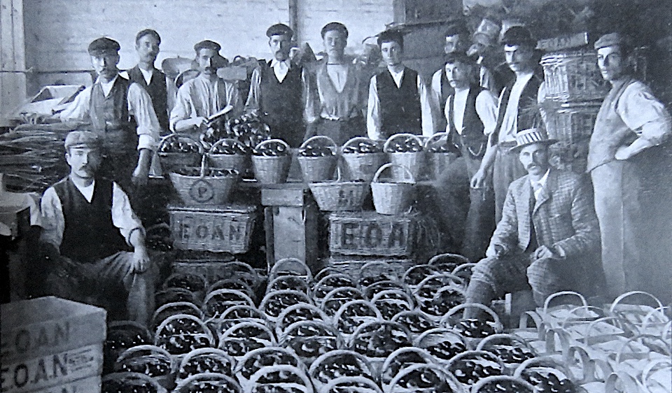
What fascinates is the sheer scale at which fruit, vegetables and flowers were produced in just one small part of Norwich. Adcock’s were operating well into the steam age and were evidently able to supply their produce around the country in reasonable time. On a less industrial scale, maps of nineteenth century Norwich give tantalising hints of allotments and other small nurseries such as: Cork’s nursery ground; Allen’s Nursery around Sigismund and Trafford roads in Lakenham; the nursery ground off Dereham Road; the Victoria Nursery in Peafields, Lakenham; George Lindley’s nursery at Catton. Long before refrigerated transport and the concept of food miles it was this web of horticultural enterprises that, together with our farms and markets, fed Norwich.

The Trafford Arms on the site of The Nursery Tavern where, in the 1860s, Robert Allen ran a nursery in this semi-rural parish of Lakenham

If you liked this article you may like the Norfolk Gardens Trust Magazine. Membership of the NGT is only £10 per annum, £15 joint, and for this you will receive two copies of the magazine annually, invitations to visit gardens not always open to the public, and talks by leading figures on gardens and the history of designed landscape. Click the link to see more: https://www.norfolkgt.org.uk/membership/

©Reggie Unthank 2021

Sources

  1. https://familypedia.wikia.org/wiki/William_Creasey_Ewing_(1787-1862)
  2. https://familypedia.wikia.org/wiki/John_William_Ewing_(1815-1868)?fbclid=IwAR0nbF2FtFgtEnV6xWSr66pwNxH0IxCt3TjeGZ09a16Apjz8B4DvjQ24DHo
  3. Walter Rye (1917). History of the Parish of Eaton in the City of Norwich . Online at: https://babel.hathitrust.org/cgi/pt?id=uc1.$b756725&view=1up&seq=7&q1=fruit
  4. ‘Citizens of No Mean City’ (1910). Pub: Jarrolds, Norwich.
  5. Louise Crawley (2020a). The Growth of Provincial Nurseries: the Norwich Nurserymen c.1750–1860. Garden History v48 pp 119-134.
  6. Louise Crawley (2020b). The Norwich Nurserymen . In, The Norfolk Gardens Trust Magazine No 29. This article appears in the magazine, available online at: https://www.norfolkgt.org.uk/wp/wp-content/uploads/2020/06/NGT-magazine-Spring-2020.pdf
  7. Edward and Wilfred E Burgess (1904). Men Who Have Made Norwich’. Reprinted in 2014 by The Norfolk Industrial Archaeology Society in 2014. A truly fascinating read – visit http://www.norfolkia.org.uk/publications.html

Thanks My main source for information on Mackie’s was Louise Crawley, postgraduate researcher at UEA, and I am grateful for her generosity in sharing her researches into ‘The Norwich Nurserymen’. Local historian Vivien Humber kindly shared information on nurseries in the parish of Eaton. I am also grateful to Pamela Clark, Susan Brown, Sally Bate, Tom Williamson and Beverley Woolner. Thanks to the Norfolk Industrial Archaeology Society for allowing me to reproduce the Adcocks photographs, to Clare Everitt of Picture Norfolk, and to the George Plunkett archive.

Share this:

  • Facebook
  • Twitter
  • Pinterest
  • Email
  • Print

Like this:

Like Loading...

Parson Woodforde goes to market

15 Sunday Nov 2020

Posted by reggie unthank in Norwich buildings, Norwich history, Norwich maps, Norwich streets

≈ 26 Comments

Tags

Norwich market, Parson Woodforde

In 1775, Reverend James Woodforde came to Weston Longville, a small village north of Norwich, and remained as rector until his death in 1803. During this time he kept a diary of his life as a country parson but city-dwellers will find it intriguing for his forays into late eighteenth century Norwich.

“… we both agreed it was the finest City in England by far …”

On first visiting Norwich with a friend (1775)

I am following a fascinating booklet on Woodforde’s walks around Norwich by the Parson Woodforde Society [1]. Much has changed across the two hundred and forty five years between his time and ours: World War II bombing raids; the Industrial Revolution; slum clearance; and fitting a medieval city around the motor car. These things changed the city but what is striking is how much of Woodforde’s Norwich still glimmers through. We start at the Marketplace but there is so much to see that we won’t wander far.

The Market established by the Normans, which supplanted the Anglo-Scandinavian trading place in Tombland, has been the thriving hub of the city for almost a thousand years. Here it is in Cotman’s illustration of 1807, not long after Woodforde’s death.

Norwich Marketplace from the North by John Sell Cotman. Courtesy Abbot Hall Art Gallery

Looking back from the south end, Robert Dighton’s illustration (below) just manages to catch the medieval Guildhall (red arrow), obscured by the tall buildings to the rear of the marketplace. Centre left, the gap between the buildings is Dove Lane but note the absence of a major north exit from the far right corner. To the right of the market is a range of inns and from one of them the London coach is exiting at speed (yellow arrow).

Norwich Market by Robert Dighton 1799.

In acknowledgment of the stables behind the coaching inns, Blomefield’s map of 1741 names the lane to the rear as Backside of the Inns.

Blomefield’s map of Norwich 1741. ©georgeplunkett.co.uk

But by 1766 Samuel King had dignified it as Back of the Inns – the name still used today. He also lists the inns along the east side.

Samuel King’s Plan of Norwich 1766

There were inns all around the marketplace but the ones on the east side are given as The Half Moon, The King’s Head, The Bear Inn and The Angel Inn. From The Angel, Parson Woodforde is known to have caught the coach, which he refers to as the ‘London Machine’ or ‘the machine’ [1].

A post chaise

In 1775, Woodforde’s journeyed from London to Norwich, by post chaise and four (horses): ‘109 miles, and the best of roads I have ever travelled.’ Arriving after ten o’clock at night he found the city gates shut (presumably St Stephen’s Gate), reminding us that the medieval defences were still largely intact at that time. In a telling metaphor for the changes inflicted upon a medieval city by the Victorian age, the stretch of city wall to the north of St Stephen’s Gate was to be used as hardcore for the new Prince of Wales Road. Built in the 1860s, this was intended as a grand approach to connect the new Thorpe railway station with the city centre. The advent of steam was to affect other routes to the city’s markets.

Small changes to the Marketplace accrued after Woodforde died. In 1840, when Queen Victoria married, the fifteenth century Angel Inn was patriotically renamed The Royal. In 1899 it would be demolished and replaced with a fashionable arcade designed by George Skipper [2]. Moulded in marble-like Carrara Ware by Doulton’s WJ Neatby, the figure above the Back of the Inns entrance commemorates the original Angel Inn. As the Royal Inn was disappearing (1896-7), Edward Boardman was building a new Royal Hotel on Agricultural Hall Plain, close to various livestock markets around the Castle, and closer to the railway station.

The Royal Arcade, 1899

The fronts of these inns were separated from the Norman Great Market by what appears on King’s Plan of 1766 as ‘Nether Row or Gentleman’s Walk’. ‘Nether’ refers to a lower row of market stalls arranged outside the inns but as early as 1681, Thomas Baskerville had written about ‘a fair walk before the prime inns and houses of the market-place…called gentlemen’s walk or walking place…kept clear for the purposes from the encumbrances of stalls, tradesman and their goods’. Evidently, the walkway outside the inns had become an acceptable place for members of an increasingly polite and enlightened society to promenade, separated from the hurly-burly of the market. An early photograph from 1854 shows The Walk as a paved boulevard set apart from the market by a line of posts [3].

Gentleman’s Walk and Market 1854 ©Norfolk County Council

Newman’s lithograph provides a sense of the fashionable shops along the east side of the marketplace – an early shopping parade.

Shops along Gentleman’s Walk from a print by J Newman 1850. Source: Norfolk Museums Collections NWHCM: 1929.90.5

Woodforde is known to have visited John Toll’s draper’s shop in the Marketplace. He paid seven shillings and sixpence for a pair of cotton stockings for his niece Anna Maria (Nancy) who was his housekeeper and companion [4]. At the shop of Mr Tandy (a ‘Chymist and a Druggist’) he spent three shillings on an ounce of ‘Rhubarb’, presumably tincture of rhubarb, taken for digestive complaints. For thruppence he also purchased Goulard’s Extract, used for inflammation of the skin, although this was later discontinued as it was found to cause lead poisoning.

Although Parson Woodforde drank coffee at The Angel he did not often stay there, preferring to lodge at The King’s Head. It was from here that the Norwich mail coach departed for Yarmouth [1]. And from 1802, two mail coaches left here daily for London, one via Ipswich and one via Newmarket [5].

Coach departing the King’s Head (From Dighton’s painting, see [5]. Courtesy of Norfolk Museums and Archaeology Service)

Below, Newman’s painting of 1850 shows key changes to the Marketplace as Woodforde would have known it.

Norwich Market, from the south. J Newman 1850. Red arrow = coach exit from the Royal Hotel (formerly the Angel Inn). Yellow arrow = Exchange Street. Note the gas lampposts. Courtesy of Norfolk Museums Collections

In Woodforde’s time there was no wide street exiting the square at the north-east corner but, in 1832, Exchange Street was cut through, connecting the market to St Andrew’s Street then over the newly erected Duke’s Palace Bridge and on towards North Norfolk [6]. On the painting above, the purple arrow points to something that would have rocked Parson Woodforde’s world.

Davey Place, for pedestrians. The steps at the end are blocked by a wagon cutting across Back of the Inns. Courtesy Norfolk County Council at Picture Norfolk

In 1812, Alderman Jonathan Davey – Baptist Radical of Eaton Hall –announced in a council meeting that he would put a hole in the king’s head. These apparently seditious words were taken sufficiently seriously for a guard to be placed upon his house but what he actually intended was to put a hole in Gentleman’s Walk. He bought the King’s Head Hotel at auction, demolished it and in place of Woodforde’s preferred coaching inn built a shop-lined thoroughfare that connected those attending the livestock markets around the Castle with the Marketplace [7]. Along with Exchange Street, Davey Place is one of the rare post-medieval streets of Norwich.

The ‘Davey Steps’ connecting Davey Place to Castle Meadow provided a barrier to animals, although the stairway was not insurmountable. In April 1823: “A man who sold sand about the streets of Norwich drove his cart and pair of horses up the flight of ten steps, leading from Davey Place to the Castle ditches. The horses did it with much ease and without receiving any injury, to the astonishment of the spectators” [8].

Running westward from the Guildhall, at the back of the market, was the fish market.

‘Fishmarket with St Peter Mancroft’ by GS Stevenson. Courtesy Norfolk Museums Collections

Here, Woodforde bought soles from Mr Beale, which were sometimes less than fresh [1]. In the days before refrigeration he would take home oysters from the market, although he could also buy them from ‘an old man of Reepham’ [4]. The insanitary Fish Market was replaced in 1860 by a Neoclassical building approximately where the Memorial Gardens are today. This building is at centre of the photograph below. To the right, the building with roof lucams is The Fishmonger’s Arms, a Youngs, Crawshay and Youngs house.

The Fish Market and buildings in St Peter Street, looking down to the Guildhall from the railings of St Peter Mancroft’s churchyard, ca 1890. Courtesy Norfolk County Council at Picture Norfolk

All the old buildings at the back of the market were cleared as part of the construction of City Hall and the Memorial Gardens (1938).

The back of the Marketplace in 1938, looking from Gentleman’s Walk. The City Hall and the Memorial Gardens have just been constructed and buildings at the back of the market demolished. The white stone structure at centre is Lutyens’ war memorial, moved from the Guildhall. © georgeplunkett.co.uk

In 1914 the Fish Market was transferred out of the Victorian building and re-sited to Mountergate.

Marking a plaque commemorating the Fish Market. On the Rose Lane car park

As the Back of the Inns followed the curve of Castle Meadow it flowed into medieval London Lane. This route was narrow and far from ideal. The opening of Norwich (later, Norwich Thorpe) railway station in 1844 created demand for better access to and from the market and London Street was widened accordingly[6]. Most of the medieval buildings familiar to Woodforde were demolished. He would, though, have known this grand doorway from the house of John Bassingham, a goldsmith from Henry VIII’s time, now inserted into the Magistrate’s Entrance of the Guildhall [10].

BasshmGate.jpg

The premises of Edward Freeman were in Back of the Inns. We previously encountered this family of cabinet makers when looking at a framed medallion of Amelia Opie [11]. Freemans made high quality picture frames and furniture for country houses like Felbrigg and Blickling Halls but Woodforde’s requirements were more humble: he paid a guinea deposit for two mahogany chests of drawers and half a dozen ash kitchen chairs.

IMG_2012.jpg

Cockey Lane was at the Guildhall end of London Street, just around the corner from Back of the Inns, and this is where Woodforde visited his upholsterer, James Sudbury. In 1793, two of Sudbury’s workmen – Abraham Seely and Isaac Warren – are claimed to have carried a ‘large New Mohogany Cellarett’ and a sideboard ‘on the Men’s shoulders all the way’; that is, nine miles to Weston Longville [12]. For this Herculean feat Woodforde fed and watered the men and gave them a shilling tip but I can’t help wondering if Sudbury’s cart was hidden down the lane.

A George III mahogany cellarett used for storing and/or chilling wine. Photo: © antiques.co.uk

Kerrison’s Norwich Bank in the Back of the Inns was where Woodforde brought tithe money collected on behalf of his friend Henry Bathurst (later, Bishop of Norwich) who was then non-resident parson of a neighbouring parish [4]. Woodforde would exchange bills and cash for a banknote that he sent by post to his friend in Oxford. On one occasion he celebrated his good deed by dining at the King’s Head on a mutton chop and a bottle of wine. Five years after Woodforde’s death, Sir Roger Kerrison was to die in an apoplectic fit after which his bank failed, unable to pay the Government the money he had collected as Receiver-General [13].

Kerrison & Kerrison bank note of 1807. Photo: ©Spink

In 1793, Parson Woodforde banked £2-12s-0d, collected at Weston Longville for emigré French clergy. These refugees from the French Revolution joined a line of French Protestants who had been finding sanctuary here since the sixteenth century [14]. Just south of the Marketplace, in the smaller Haymarket (and Cheese Market), Woodforde had his watchspring repaired by master watch-maker Peter Amyot, a descendant of French Huguenots [1]. In his diary, Woodforde also mentions other descendants of immigrants: like James Rump, grocer and tallow chandler (whose name had been anglicised from Rumpf [14]); Elisha de Hague, attorney; and the influential Martineau family, underlining the contribution that newcomers made to this city’s commerce.

Watch movement c1770 by Peter Amyot of The Haymarket, Norwich. ©catawiki

©Reggie Unthank 2020

Sources

  1. ‘Walks Around James Woodforde’s Norwich’ (2008). Published by The Parson Woodforde Society https://www.parsonwoodforde.org.uk/. The booklet is still available from  editor@parsonwoodforde.org.
  2. https://colonelunthanksnorwich.com/2016/03/12/the-art-nouveau-roots-of-skippers-royal-arcade/
  3. https://en.wikipedia.org/wiki/Norwich_Market
  4. https://archive.org/stream/in.ernet.dli.2015.227134/2015.227134.The-Diary_djvu.txt
  5. http://www.norwich-pubs-breweries.co.uk/norwich_pubs_past/norwich_pubs_past.shtm#
  6. Nikolaus Pevsner and Bill Wilson (1997). The Buildings of England. Norfolk 1: Norwich and North-East. Pub: Yale University Press.
  7. https://www.eveningnews24.co.uk/views/derek-james/street-has-its-place-in-city-history-1-1520880
  8. In, Norfolk Annals, edited by Charles Mackie. Available online https://www.gutenberg.org/files/34439/34439-h/34439-h.htm
  9. Michael Loveday (2011). The Norwich Knowledge. Pub: Michael Loveday ISBN 978-0-9570883-0-6
  10. https://colonelunthanksnorwich.com/2018/01/15/the-norwich-coat-of-arms/
  11. https://colonelunthanksnorwich.com/2020/01/15/behind-mrs-opies-medallion/
  12. https://bifmo.history.ac.uk/entry/sudbury-james-sen-1743b-1814d
  13. Roger Ryan (2004) Banking and Insurance. In, ‘Norwich since 1550’. Eds Carole Rawcliffe and Richard Wilson. Pub: Hambledon and London.
  14. https://colonelunthanksnorwich.com/2019/08/15/going-dutch-the-norwich-strangers/

Thanks to Alan Theobald for introducing me to the booklet, ‘Walks Around James Woodforde’s Norwich’. Copies are available from editor@parsonwoodforde.org. I am grateful to Martin Brayne of the Parson Woodforde Society for his assistance. To learn more about Parson Woodforde and the society in which he lived, visit  https://www.parsonwoodforde.org.uk. I am grateful to Clare Everitt for permission to use images from the wonderful archive of local photographs: Picture Norfolk. Thanks, also, to Jonathan Plunkett for allowing access to his father’s photographs of Norwich and Norfolk: www.georgeplunkett.co.uk

Share this:

  • Facebook
  • Twitter
  • Pinterest
  • Email
  • Print

Like this:

Like Loading...

Late Extra: The Norwich Pantheon

01 Friday Feb 2019

Posted by reggie unthank in Norwich buildings, Norwich history, Norwich maps

≈ 16 Comments

Tags

Norwich Pantheon, Norwich pleasure gardens, Norwich Victoria Station, Quantrell's Gardens, RanelaghGardens, Victoria Gardens

Once, I stayed in a hotel next to the Pantheon in Rome. Constructed some 2000 years ago it is a breath-taking example of the Roman genius for engineering – its circular rotunda spanned by the world’s largest unreinforced concrete dome. Surely, anything bearing that name in Norwich could only be a much-diluted version of the Roman Pantheon so what was ours really like? Two weeks after my previous post [1] I received fascinating correspondence that I show here in order to set the historical record straight. First, a brief recap.

RomanPantheon.jpg

The portico of the Roman Pantheon with the rotunda behind

Pantheon2.png

The dome was coffered with diminishing panels to lighten the weight. The central oculus is open to the weather. Built ca 100AD

In my previous post on Norwich Pleasure Gardens I mentioned London’s Pantheon  – an impressive structure that prompted the building of our provincial version. The 1000-seat Norwich Pantheon was erected in New Spring Gardens – later called Vauxhall Gardens – on the riverside, off King Street.

800px-Pantheon_painting,_probably_by_William_Hodges_with_figures_by_Zoffany_edited.jpg

The clues to Norwich’s own  Pantheon are few and start with Hochstetter’s map of 1789.

HochstetterOctagon.jpg

Hochstetter’s plan of 1789, courtesy of Norfolk Record Office

This map clearly shows that the Norwich Pantheon on Riverside was originally octagonal, as does Cole’s map of 1807.

Cole NMS2.jpg

Cole’s plan of 1807 with The Pantheon at centre. Courtesy Norfolk Museums Service

However, Cole is thought to have based his map on Hochstetter’s earlier survey [see 2] and in 1807 he wrongly drew The Pantheon in this riverside location from which it had been absent for about a decade. In the 1790s Samuel Neech had bought the defunct Vauxhall gardens, including its Pantheon, and used the building materials to construct a new rotunda (for which he retained the old name of The Pantheon) in his own Ranelagh Gardens. This rival garden – situated just off the present-day St Stephens roundabout – now had a building that is said to have accommodated 2,000 persons [3]. (These pleasure gardens had various owners who gave them different names but for simplicity’s sake I will call them ‘Ranelagh/Victoria Gardens’ here.)RanelaghPantheon.jpg

In 1849 the Ranelagh/Victoria Gardens were bought by the Eastern Union Railway Company who repurposed the existing buildings [3]. Fortunately, Norwich Victoria Station survived well into the C20 so photographs exist.

Pantheon30129028206374.jpg

The booking office of Norwich Victoria Station 1913. Courtesy Norfolk County Council at Picture Norfolk

I ended the previous post by asking if we could be looking at The Norwich Pantheon, a ghost from over two centuries ago.

––––––––––––––––––––––––––––––––––––––––––––––––––––––––––––––––––

It was at this stage that Bill Smith – a railway enthusiast who had come to Victoria Station from a different angle – asked if there was evidence that the above building was  the fabled Pantheon. The booking office in the photograph approximates to a circular form rather than the distinct octagon shown in Hochstetter’s map. Might it therefore be a different building, such as the ‘amphitheatre’ that a previous owner is said to have constructed eight years before The Pantheon appeared on the site [3]? Unfortunately, Hochstetter’s plan shows no large buildings on the Ranelagh/Victoria site.

IMG_0090.jpg

Ranelagh Gardens from Anthony Hochstetter’s Plan of 1789. Courtesy of Norfolk Museums Service

But, using the excellent Norfolk Map Explorer (http://www.historic-maps.norfolk.gov.uk/), Bill had downloaded the 1842 tithe map that does show a building on the Ranelagh/Victoria Gardens plot. It is hard to make out whether the building is circular or octagonal.

1840 Victoria station site Clive2.jpg

Building 230 on the 1842 tithe map. ©2012 Norfolk County Council

However, the 1830 map by WS Millard and J Manning gives a clearer view. Ignoring the flaps fore and aft the main building appears as an octagon, or is that a rectangle with rounded corners? Those rounded corners turn out to be useful.

Clive 3.jpg

From the 1830 Plan of Norwich by WS Millard and J Manning. Courtesy Norfolk County Council

By the time Ranelagh/Victoria Gardens had become Victoria Station the main garden building, now wider, was situated between the two platforms. Here, Bill has placed the rotunda on a 1905 OS map.

1905 Norwich Victoria plan rotunda2.jpg

 OS map, redrawing courtesy of Bill Smith.

On a more detailed map of 1880 Bill was able to scale the rotunda to fit two circular segments of the building (the ’rounded corners’) and, using the 56½-inch gauge of the railway tracks as a standard, to calculate the rotunda’s diameter at around 74 feet.

Rotunda large scale2.jpg

The rotunda sized by Bill Smith to fit the rounded corners.

The panelled conical ceiling with its roof light therefore sits on what is almost certainly a circular rotunda, not an octagonal one. Samuel Neech may have recycled material from the old Norwich Pantheon for his own building but it seems quite clear that he didn’t stick to the original’s octagonal floor plan (and Berry’s Concise History of Norwich, 1811, describes the Pantheon as ‘octangular’). Bill’s evidence strongly indicates that The Pantheon was the large circular building so an ‘amphitheatre’ has to be something else. Indeed, Fawcett supports the idea of two separate buildings when he describes the layout after the Eastern Union Railway Company took over the gardens in 1849: “Station platforms were laid on either side of the Pantheon … The Amphitheatre became a ticket office and luggage room.” The amphitheatre would therefore be the rectangular building behind, and extending either side of, the entrance portico.

VicStation.001.jpeg

Norwich Victoria Station in the early 1900s. Behind the entrance portico is situated the Amphitheatre. The roof light of the Pantheon (arrowed) peeps out to the rear. Wikipedia, Creative Commons

Below, this aerial photograph from 1935 provides interesting insight into the layout of the station inherited from the Ranelagh/Victoria Gardens. First, to the left, is the entrance off St Stephens Road as shown in the photograph above. Next, perpendicular to this, comes the Amphitheatre with a pitched roof; this is followed by the rotunda/Pantheon; followed by a smaller building with a pitched roof; then a glimpse of the triangular garden illustrated in the larger scale map (two images above).

Rotunda 1935.jpg

1935 aerial map, ringed by Bill Smith to show the Pantheon at Norwich Victoria Station. From Flickr user ‘mira66’ [4], Creative Commons Licence CC BY-NC-SA 2.0

In 1946, just after the war, the buildings in the station complex were roofless, providing an accidental glimpse into the internal layout, illustrating the large rotunda/Pantheon at centre.

Rotunda 1946.jpg

1946 aerial survey ©Norfolk County Council

Update: After posting this article, Grant Young recommended another 1946 aerial photograph from ‘Britain from Above’, which shows the roofless station complex in greater detail [5].

Pantheon Duo.001.jpg

The red star indicates the postwar Victoria Station on the site now occupied by Marsh Insurance. Below, the enlargement clearly shows the circular section of The Pantheon. ©Historic England/Britain from Above EAW001999

Bill then outlined the main compartments as far as possible.

1946 aerial outline.jpg

The plan drawn by Bill Smith

With this plan in mind it is now possible to walk ourselves through the rooms of the Ranelagh/Victoria Gardens as described in 1849 [3]:

“Two sides of the spacious area which presented itself on passing the entrance, to the west and the north were occupied with “boxes”, or “arbours”, where parties could sit, and enjoy their refreshments, or sip their wines, while they listened to the instrumental or vocal music … On the South, was a large room … used as a “Nine-pin-room”. It opened into a spacious and excellent bowling green. To the eastward, and nearly in the centre, of the grounds, stood a building, called ‘The Pantheon’. Over the entrance was an orchestra; and on each side of the entrance-passage were rooms, from the windows of which refreshments were supplied. The passage led to a spacious and lofty saloon, often converted into a ballroom; beyond this was an arena, which was, in the Assize-weeks, used as a Concert-room; at other times it was occasionally used as a circus … and anon a theatre … Beyond the Pantheon, the grounds were tastefully laid out, and several walks for promenading were constructed … The palmy days of these gardens is now fading fast … but there was a time, when they were the resort of our fashionable aristocracy; and the public breakfasts … were amongst the most gay and pleasant assemblages, that it was ever our good fortune to encounter.”

The illustration below gives a sense of these Gardens when they were ‘the resort of our fashionable aristocracy’.  [Added 7th March 2019]. 

Victoria Ranelagh Pleasure Gardens.jpg

©2019 Reggie Unthank

Sources

  1. https://colonelunthanksnorwich.com/2019/01/15/pleasure-gardens/
  2. Raymond Frostick (2011). The Printed Maps of Norfolk: a Carto-bibliography. Pub: Raymond Frostick.
  3. Trevor Fawcett (1972). The Norwich Pleasure Gardens In, Norfolk Archaeology vol 35, Pt 3, pp382-399.
  4. https://www.flickr.com/photos/21804434@N02/6652825845/in/photostream/
  5. https://britainfromabove.org.uk/en/image/EAW001999

Thanks. The idea for this supplementary post was prompted by Bill Smith’s key insights into Victoria Station and the buildings it had inherited from the Ranelagh/Victoria Gardens. Bill worked out where the Pantheon fitted into the station’s building plan and calculated its size; I am grateful to him for letting me reproduce his ideas. I also thank Grant Young for suggesting the final aerial view and Rosemary Dixon of the Archant Archives for the final print of Victoria Gardens.

Share this:

  • Facebook
  • Twitter
  • Pinterest
  • Email
  • Print

Like this:

Like Loading...

Putting Norwich on the map

15 Sunday Apr 2018

Posted by reggie unthank in Norwich history, Norwich maps

≈ 20 Comments

Tags

maps

Maps make sense of the world and of our place in it. We have a fundamental sense of place that turns out to be hard-wired; there actually is a mental map, composed of a grid-like arrangement of cells in the brain [1]. If the hippocampus of a London taxi driver can be changed by learning ‘The Knowledge’ [2], imagine what happens to Norwich residents over a lifetime of following byzantine routes around medieval streets.

Norwich road map.jpg

The Norwich brain ©Norwich City Council. 

The Anglo-Saxon settlement seems to have been around Fye Bridge and the presence of ‘Northwic’ on early C10 coins indicates the importance of the north bank of the river in that development. The conjectural map (below) shows that by the C10-11 the Anglo-Scandinavian settlement was aligned north-south, with Ber Street leading south down the old Roman road to Caister St Edmunds.

1895 Conjectural Map of Norwich in the Time of King Edward the Confessor c.jpg

Courtesy of Norfolk Museums Service

The developing town was, however, razed to the ground by the Vikings in 1004. When the Normans arrived in the second half of the century their monumental Cathedral and Castle – made from stone imported from Normandy – were considerably larger and more awe-inspiring than the predominantly wooden buildings of their predecessors. Importantly, these buildings were on the south bank. In addition, the old marketplace was moved from Tombland to its present position under the gaze of the Castle, from where the new French Borough extended westwards.

City of Norwich grew.jpg

How the city of Norwich grew into shape. William Hudson 1896. NWHCM: 1997.550.50:M

Even though the centre of gravity had shifted, the old Anglo-Scandinavian settlement on the north side of the river was still an important part of the Old Borough and, indeed, ‘Norwich-over-the-Water’ remained one of the city’s four wards until the electoral reforms of the early C19th.

NorwichOverTheWater.jpg

Norwich wards until 1835 [3]


This now familiar leg-of-mutton shape of the city had been set in stone by the building of the city walls; this took place from about 1294 to the middle of the following century [4], enclosing an administrative area larger than the City of London. The walls were built for the city’s protection at a time when the country was at war with France but they also served the civil function of controlling the passage of taxable goods through the 12 city gates.

‘Norwich’, however, was not simply the area within the city walls for the 1556 charter of Queen Mary I of England and Philip II of Spain specified that the hamlets of Earlham, Eaton, Catton, Thorpe, Trowse Millgate and Lakenham should be considered to be within the city’s wider boundary [5].

IMG_7975.jpg

The County of the City of Norwich [5]. Courtesy of Norfolk Record Office


Reminiscent of Roman maps showing that ‘All roads lead to Rome’, William Ionn’s map of 1836 shows the roads radiating out of Norwich into the surrounding county. By this time all gates had been demolished – the last disappearing in 1808 [4].

Norwich Routes.jpg

Routes from the city of Norwich through the County of Norfolk (1836). William Ionn. NWHCM: 1922.135.2:M

The lists on the plan recall a time when the traveller might need a strip map to confirm the sequence of, and the distance between, towns and villages encountered along the journey – all this supported by milestones and fingerposts on the ground.

The first authentic map of Norwich was made in 1558 by William Cuningham, a citizen of Norwich; it is notable for being the earliest surviving printed map of any English town or city outside London. The word ‘civitas’ on the banner recognises the city’s status as a self-governing body. In 1404, the second charter from King Henry IV proclaimed that the city should be considered a county in its own right, separate from the county of Norfolk. The words, The County of the City of Norwich, appeared on maps  until the local government reorganisation of 1974 [5].

CuninghamMapNorwich.jpg

Cuningham 1558. Courtesy British Library

Cuningham’s map seems to counter perspective by tilting the distant ground towards us without quite providing the bird’s eye view that would allow us to float above the city and look down upon it in scale [5]. ‘Prospects’ like this could therefore be taken from a viewpoint outside the city; here, the cartographers at the lower edge seem to be pointing across to the windmills on Mousehold Heath.

Georg Braun and Franz Hogenburg’s plan of 1581 is closely based on Cuningham’s, even reproducing the archers practicing in Chapelfield (clear area of the walled city, lower right). On the reverse was a poem delivered to Queen Elizabeth I during her visit to the city in 1578 [5]. The poem refers to ‘Belgic friends’, i.e., the Strangers recently arrived from The Netherlands who were to revitalise our weaving industry.

Georg Braun Map 2.jpg

Elizabethans surveying the City of Norwich. Braun & Hogenburg 1581 NWHCM : 1997.550.75

Cuningham’s was to provide the model for most of the maps over the next 150 years. For example, the inset below of Norwich on John Speed’s map of Norfolk of 1676 adopts Cuningham’s way of looking at the city (and, again, the archery practice). The ditch outside the city walls to the west is wrongly depicted as a moat.

Speed2.jpg

Inset of Norwich from John Speed’s map of Norfolk NWHCM:1951.219:M 1676

The two prospects below by Samuel and Nathaniel Buck, one from the south-east one from the north-east, show something of the city in the mid C18, when the city walls were just about intact. We are struck by how much unbuilt space was present – something that Daniel Defoe noticed when he made his tour of the country 1724-1726:

“The walls of this city are reckoned three miles in circumference, taking in more ground than the city of London; but much of that ground lying open in pasture-fields and gardens; nor does it seem to be, like some ancient places, a decayed declining town, and that the walls mark out its ancient dimensions; but the walls seem to be paced, as if they expected that the city would in time increase sufficiently to fill them up with buildings”[6]. 

Buck Duo.jpg

Upper: South-east prospect of the city of Norwich 1741 by S&N Buck NWHCM: 1922.135.4:M. Lower: North-east prospect 1743 NWHCM: 1922.135.7:M.

In 1696 the professional surveyor Thomas Cleer broke away from Cuningham’s template by publishing a plan of Norwich that did provide a bird’s eye view and, more importantly, was the first to be printed to scale [5]. (Note the old Market Cross to the left of the Castle, red star).

Cleer2.jpg

Detail from the map of Thomas Cleer 1696. NWHCM :1999: 71.49. Only two copies are known [5]

Hearne_undated_market_cross.jpg

Old Market Cross, Norwich (undated) by Thomas Hearne (1744-1817). Courtesy Norfolk Museums Collections NWHCM: 1903,36

Map piracy. In 1727, the land surveyor James Corbridge published a fine plan of the city. Subscribers paid two shillings down and 3s on delivery, while anyone wanting their houses or arms to appear in the margins had to pay 7s down and 3s on delivery [5]. Next, he advertised for subscriptions to allow him to make a new full-scale survey of Norfolk but before the county map could emerge two Norwich booksellers, William Chase and Thomas Goddard, planned to undercut him with a pirated version. To cast doubt on Corbridge’s work the booksellers got one of his employees – the improbably named Thermometer Elinett – to send a letter to the local paper stating, incorrectly, that the new map would be a copy of previous maps with all their imperfections. Corbridge’s reply in a rival paper settled the matter, accusing Elinett of not knowing the ‘South End of the Needle for the North.’ [7].

Corbridge.jpg

Corbridge’s map of Norwich 1727. NWHCM: 1936.5

Maps are not neutral, objective things: they can be influenced by those commissioning them. We would also do well to question the topological relationships between features on a map. On a globe, the vertical lines (meridians) converge at the poles but to convey them as parallel lines on his flat map – his famous projection of 1569 – Gerardus Mercator had to do some mathematical finessing. He also pulled the horizontal lines of latitude further apart as they approached the poles. As a result, land masses become seriously distorted the further you go from the equator, so that Greenland appears bigger than South America or Australia. Even so, Mercator’s Projection still appears to be the favourite way of representing the world and is the one adopted by Google Maps [8].

But Charles Lutwidge Dodgson, himself an Oxford mathematician, had the measure of Mercator and produced his own perfect map in The Hunting of the Snark [9].

SnarkDuo3.jpg

The Hunting of the Snark: An Agony in Eight Fits. Lewis Carroll (1876). Pub: Macmillan & Co.

He had bought a large map representing the sea/Without the least vestige of land:/ And the crew were much pleased when they found it to be/ A map they could all understand.

What’s the good of Mercator’s North Poles and Equators/ Tropics, Zones, and Meridian Lines?”/ So the Bellman would cry: and the crew would reply/”They are merely conventional signs!”

With the exception of the small suburbs of Heigham and Pockthorpe, there was little development of Norwich beyond the city walls until the late C18 [5]. When the walls and gates were pulled down, development did begin to creep outwards but, as the 1842 Heigham tithe map shows, there was still much open land, including fields and market gardens.

1842tithe map.jpg

1842 Heigham tithe map. Courtesy of Norfolk Record Office NRO BR276/1/0051. Open Government Licence. The octagonal building is the Gaol at the junction of Unthank and Earlham Roads, now the site of the Catholic Cathedral of St John the Baptist.

This was just before the sale of Unthank and Steward land that would lead to the explosion in terraced-house building across Heigham [10]. Workers from the expanding suburbs were brought into the city centre – where much of its industry was still concentrated – by a new form of transport. Between 1900 and 1935, the Norwich Electric Tramways provided routes around the city using electricity generated by the power station on Duke Street. The NET depot was on Silver Road and the central hub was in Orford Place. In 1933 the Eastern Counties Omnibus Company bought the tramways with the view to replacing them with petrol-driven buses [11].

Norwich_Electric_Tramways.jpg

Norwich Electric Tramways Map. By Andrew Abbott, Creative Commons Licence.  

Norwich tram.jpg

No 10 electric tram on the Earlham Road ca 1900, outside the Black Horse PH. Andrew R Abbot, Creative Commons Licence

By the late 1920s the radial development hadn’t quite enveloped the land around the south-western part of the ring road that was to define another boundary around the city. The gold standard for mapping in the UK was the Ordnance Survey, which had begun to map Norwich as far back as 1817 [5]. In this 1928 OS map, Christchurch Road (green) had yet to be built from Unthank Road to Earlham Road (completed 1935 [10]) and there was still much open land west of Colman Road and around the newly-completed Eaton Park (blue star).

Colman RdFinal.jpg

©Ordnance Survey 1928. Norfolk LXIII.14 showing the Colman Road stretch of the outer ring road (red) and the proposal to extend Christchurch Road across allotments to Earlham Road (green) [10]. Blue star= Eaton Park.


Captain Arnold Edward Sandys-Winsch had drawn the plan for Eaton Park as part of a job creation scheme following the First World War [12]; he also designed Wensum, Heigham and Waterloo Parks plus Mile Cross Gardens. Sandys-Winsch is credited with planting 20,000 trees in the city, of which his goblet-pruned London plane trees along Earlham Road and parts of the ring road are the most easily recognisable [10].

Sandys-Winsch.jpg

Sandys-Winsch’s plan for Eaton Park, opened 1928. Courtesy Norfolk Record Office. (See the fascinating history pages of friendsofeatonpark [12]).


In retaliation for the RAF bombing Lübeck in March 1942 the Luftwaffe said they would bomb every English city with three stars in Baedeker’s Travel Guide. These cities were to include Norwich, York, Bath, Exeter and Canterbury – all of cultural and historical importance. (This map also reminds us of a time when the city had three railway stations: Thorpe, Victoria and City).

Baedeker map of Norwich.jpg

Norwich in the 1906 (6th) edition of the Baedeker Guide. Map by Wagner and Debes of Leipzig. From my own collection. 

Norwich suffered badly in the 1942 Baedeker Raids. In the raid of 27th April 1942, it has been estimated that 185 heavy bombs of a total weight of over 50 tons were dropped , resulting in 258 deaths and 784 injured [13, 14]. The six-foot-square Norwich Bomb Map, now restored at the Norfolk Record Office, recorded 679 bombs that fell on the city between 1940 and 1945 [15].

Norwich bomb map.jpg

Detail of the restored Norwich Bomb Map, kindly provided by County Archivist Gary Tuson. CDs of the full map are available from the NRO. 

But even before the war had ended, the City Engineer HC Rowley – together with consultants CH James and S Rowland Pierce who had recently designed Norwich City Hall (1938) – were preparing the new City of Norwich Plan [16]. In this, they took a fresh look at the flow of traffic around a bomb-damaged medieval city. No longer do the contours follow the leg of mutton-shaped medieval city.

RingRoads.jpg

The inner and outer ring roads shown on the City of Norwich Plan dated 1944 [17].


The sedimentation of an unimaginably large number of marine organisms onto the seabed, some 60-95 million years ago, formed the deep layer of chalk interspersed with flints upon which this low-lying county is based. Much later, the mining for lime and flints for building purposes gave rise to the tunnels that run beneath the city. One extensive network runs beneath Earlham Road near St John’s Roman Catholic Cathedral, forming a street plan unrelated to the world above.

Chalk mines.jpg

Chalk tunnels beneath Earlham Road. Eastern Daily Press 1939. More precise mapping shows that the tunnel system was actually smaller and situated to the top left of this plan, away from the Catholic Cathedral (see Matthews Williams’ ‘Subterannean Norwich’ (2017) Lasse Press.

On the third of March 1988 the roof of one of these medieval chalk workings collapsed and an Eastern Counties bus, which had been slowly crawling up the hill, started to sink into a deep hole. Cadbury’s quickly adapted their advert for one of their chocolate bars, writing “Nothing fills a hole like a Double Decker.”

Bus in Hole.jpg

Bruce Adam, courtesy of Plantation Garden Trust

A postscript: The Ordnance Survey was originally motivated by the Jacobite Rebellion to make a military survey of Scotland but, when Napoleon threatened invasion, the survey was extended to the rest of the UK. In the decades following the last war the Soviets prepared their own detailed maps for similar purposes [17]. I never thought I would see Russian tanks roll down Unthank Road but there it is, targeted in Cyrillic script, АНТЕНК-РОД. Fortunately, there’s an Anderson shelter in our garden from World War II.

Soviet map.jpg

The city end of Unthank Road (АНТЕНК-РОД) from a Soviet map [17]. http://redatlasbook.com/

©2018 Reggie Unthank

‘Colonel Unthank and the Golden Triangle‘ is still available from Jarrolds, City Bookshop and Waterstones.

Colonel Unthank AD.jpg

Sources

  1. https://www.ncbi.nlm.nih.gov/pubmed/22288394
  2.  www.scientificamerican.com/article/london-taxi-memory/
  3. Hudson, W. and Tingey, J.C. (1906). The Records of the City of Norwich vol 1. Pub: Jarrolds.
  4. https://www.norwich.gov.uk/site/custom_scripts/citywalls/index.php
  5. Frostick, Raymond (2002). The Printed Plans of Norwich 1558-1840: A carto-bibliography. Pub: Witley Press Ltd, Hunstanton.
  6. Defoe quoted in: http://www.buildinghistory.org/primary/defoe/norfolk.shtml
  7. http://users.aber.ac.uk/das/texts/corb.htm
  8. Garfield, Simon (2012). On the Map: Why the World Looks the Way it Does.
  9. Carroll, Lewis. (1876)  The Hunting of the Snark. Pub: Macmillan.
  10. Lloyd, Clive (2017). Colonel Unthank and the Golden Triangle. (see ‘Unthank Book’ button at top of the blog page).
  11. https://en.wikipedia.org/wiki/Norwich_Electric_Tramways
  12. http://friendsofeatonpark.co.uk/history/
  13. http://www.edp24.co.uk/victims-of-the-blitz-in-norwich-2-5959
  14. http://www.georgeplunkett.co.uk/Website/raids.htm
  15. http://www.bbc.co.uk/news/uk-england-norfolk-26261969
  16. James, CH, Pierce, SR and Rowley, HC. (1945) City of Norwich Plan. Pub: The City of Norwich Corporation.
  17. Davies, John and Kent, Alexander J (2017). The Red Atlas: How the Soviet Union Secretly Mapped the World. Pub: University of Chicago Press.

Thanks I am indebted to Paris Agar (Project Curator, Norwich Castle: Gateway to Medieval England), for allowing me to photograph the collection of maps held at Norwich Castle Study Centre. I am also grateful to Dr Clare Haynes UEA for her help. I thank the County Archivist Gary Tuson for permission to use the Norwich Bomb Map and Clare Everitt of Picture Norfolk for permission to use Thomas Hearne image. John Davies kindly allowed me to use part of the Soviet map and Roger Hannah of the Plantation Garden gave permission for me to use the images on the wonderful Plantation Garden website. And to Anya Zouirova, thank you for the Cyrillic script.


Share this:

  • Facebook
  • Twitter
  • Pinterest
  • Email
  • Print

Like this:

Like Loading...

Enter your email address to follow this blog and receive notifications of new posts by email.

Recent Posts

  • Plans for a Fine City
  • The third Unthank book (‘Back Stories) now published
  • The new Colonel Unthank’s Norwich book #3
  • Female Suffrage in Norwich
  • Norfolk Rood Screens

Recent Comments

reggie unthank on The third Unthank book (…
notopaulum on The third Unthank book (…
norfolktalesmyths on Plans for a Fine City
reggie unthank on Plans for a Fine City

Archives

  • January 2023
  • November 2022
  • October 2022
  • July 2022
  • March 2022
  • February 2022
  • January 2022
  • December 2021
  • November 2021
  • October 2021
  • September 2021
  • August 2021
  • July 2021
  • June 2021
  • May 2021
  • April 2021
  • March 2021
  • February 2021
  • January 2021
  • December 2020
  • November 2020
  • October 2020
  • September 2020
  • August 2020
  • July 2020
  • June 2020
  • May 2020
  • April 2020
  • March 2020
  • February 2020
  • January 2020
  • December 2019
  • November 2019
  • October 2019
  • September 2019
  • August 2019
  • July 2019
  • June 2019
  • May 2019
  • April 2019
  • March 2019
  • February 2019
  • January 2019
  • December 2018
  • November 2018
  • October 2018
  • September 2018
  • August 2018
  • July 2018
  • June 2018
  • May 2018
  • April 2018
  • March 2018
  • February 2018
  • January 2018
  • December 2017
  • November 2017
  • October 2017
  • September 2017
  • August 2017
  • July 2017
  • June 2017
  • May 2017
  • April 2017
  • March 2017
  • February 2017
  • January 2017
  • December 2016
  • November 2016
  • October 2016
  • September 2016
  • August 2016
  • July 2016
  • June 2016
  • May 2016
  • April 2016
  • March 2016
  • February 2016
  • January 2016
  • December 2015

Categories

  • Aesthetic Movement
  • Amelia Opie
  • Art
  • Art Nouveau
  • Arts and Crafts
  • Decorative Arts
  • James Minns carver
  • Linnean Society
  • Norwich architect
  • Norwich Banking
  • Norwich buildings
  • Norwich Department Stores
  • Norwich history
  • Norwich libraries
  • Norwich maps
  • Norwich parks
  • Norwich School of Painters
  • Norwich streets
  • Paston Letters
  • River Wensum history
  • Shutter Telegraph
  • Sir Thomas Browne
  • Stained Glass
  • The Royal Society
  • Uncategorized

Meta

  • Register
  • Log in
  • Entries feed
  • Comments feed
  • WordPress.com

Enter your email address to follow this blog and receive notifications of new posts by email. It's free, no junk.

Join 4,558 other subscribers

Recent Posts

  • Plans for a Fine City
  • The third Unthank book (‘Back Stories) now published
  • The new Colonel Unthank’s Norwich book #3
  • Female Suffrage in Norwich
  • Norfolk Rood Screens
  • Norwich Guides: Ancient and Modern
  • Chapel in the Fields
  • Noël Spencer’s Norwich
  • Georgian Norwich
  • Cecil Upcher: soldier and architect
  • Sculptured Monuments #2
  • Sculptured Monuments
  • Madness
  • New Book: Colonel Unthank’s Norwich
  • AF Scott, Architect:conservative or pioneer?
  • Norwich Department Stores
  • Revolutionary Norwich
  • Parson Woodforde and the Learned Pig
  • A postscript on Eaton Nurseries
  • The Nursery Fields of Eaton
  • Vanishing Plains
  • Parson Woodforde goes to market
  • Norwich, City of the Plains
  • The Plains of Norwich
  • Twentieth Century Norwich Buildings
  • Thomas Browne’s World
  • The angel’s bonnet
  • After the Norwich School
  • A few of my favourite buildings
  • James Minns, carver
  • The Norwich Banking Circle
  • Behind Mrs Opie’s medallion
  • Norwich: shaped by fire
  • Street Names #2
  • Street names
  • The Norwich School of Painters
  • Going Dutch: The Norwich Strangers
  • The Captain’s Parks
  • Norfolk’s Napoleonic Telegraph
  • Catherine Maude Nichols
  • The Norfolk Botanical Network
  • City Hall Doors # 2
  • City Hall Doors # 1
  • Late Extra: The Norwich Pantheon
  • Pleasure Gardens
  • The absent Dukes of Norfolk
  • Nairn on Norwich
  • The Norwich Way of Death
  • Norwich: City of Trees
  • The Bridges of Norwich Part 2: Around the bend
  • The Bridges of Norwich 1: The blood red river
  • Norwich knowledge (libraries)
  • Street furniture: palimpsests
  • Putting Norwich on the map
  • Clocks
  • Faces
  • The Norwich coat of arms
  • New book: Colonel Unthank and the Golden Triangle
  • The Pastons in Norwich
  • Reggie through the underpass
  • Gildencroft and Psychogeography
  • Bullards’ Brewery
  • Post-medieval Norwich churches
  • The end of the Unthank mystery?
  • Barnard Bishop and Barnards
  • Public art, private meanings
  • Colonel Unthank rides again
  • Three Norwich Women
  • The flamboyant Mr Skipper
  • When Norwich was the centre of the world*

Archives

  • January 2023
  • November 2022
  • October 2022
  • July 2022
  • March 2022
  • February 2022
  • January 2022
  • December 2021
  • November 2021
  • October 2021
  • September 2021
  • August 2021
  • July 2021
  • June 2021
  • May 2021
  • April 2021
  • March 2021
  • February 2021
  • January 2021
  • December 2020
  • November 2020
  • October 2020
  • September 2020
  • August 2020
  • July 2020
  • June 2020
  • May 2020
  • April 2020
  • March 2020
  • February 2020
  • January 2020
  • December 2019
  • November 2019
  • October 2019
  • September 2019
  • August 2019
  • July 2019
  • June 2019
  • May 2019
  • April 2019
  • March 2019
  • February 2019
  • January 2019
  • December 2018
  • November 2018
  • October 2018
  • September 2018
  • August 2018
  • July 2018
  • June 2018
  • May 2018
  • April 2018
  • March 2018
  • February 2018
  • January 2018
  • December 2017
  • November 2017
  • October 2017
  • September 2017
  • August 2017
  • July 2017
  • June 2017
  • May 2017
  • April 2017
  • March 2017
  • February 2017
  • January 2017
  • December 2016
  • November 2016
  • October 2016
  • September 2016
  • August 2016
  • July 2016
  • June 2016
  • May 2016
  • April 2016
  • March 2016
  • February 2016
  • January 2016
  • December 2015

Follow me on Twitter

My Tweets

previous posts

  • About
  • Colonel Unthank’s Norwich #2
  • Contact
  • Latest Colonel Unthank’s Norwich Book #3
  • Posts
  • Unthank Book #1

Blog at WordPress.com.

  • Follow Following
    • COLONEL UNTHANK'S NORWICH
    • Join 673 other followers
    • Already have a WordPress.com account? Log in now.
    • COLONEL UNTHANK'S NORWICH
    • Customize
    • Follow Following
    • Sign up
    • Log in
    • Report this content
    • View site in Reader
    • Manage subscriptions
    • Collapse this bar
 

Loading Comments...
 

    %d bloggers like this: