• About
  • Contact
  • New Book 2021
  • Posts
  • Unthank Book

COLONEL UNTHANK'S NORWICH

~ History, Decorative Arts, Buildings

COLONEL UNTHANK'S NORWICH

Tag Archives: streetscape

The Bridges of Norwich Part 2: Around the bend

15 Wednesday Aug 2018

Posted by reggie unthank in Norwich buildings, Norwich history, River Wensum history

≈ 15 Comments

Tags

psychogeography, River walk, streetscape

In this second part of the river walk we turn 1800 around Cow Tower at the edge of deceptively tranquil meadowland before descending into Victorian industry south of Station Bridge.

New King 2.jpg

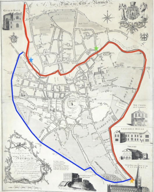
Continuing the river walk, I travelled from Whitefriars’ Bridge (green star) to Carrow Bridge (yellow star). Plan of Norwich 1776 by Daniel King. Courtesy of Norfolk Museums Service NWHCM: 1996.550.81.M

Downstream from Whitefriars’ Bridge and the former home of Jarrolds Printing Works, the John Jarrold Bridge (2011) connects the cathedral precinct (and the Adam and Eve pub) with the St James Place Business Quarter and to Mousehold Heath beyond. The curving box girder, clad in weathered steel with a hardwood deck, seems the most welcoming of the later bridges.  IMG_8735.jpg

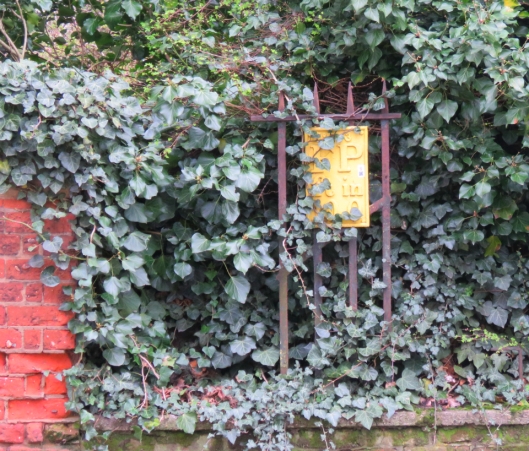
On the south bank, not far from this bridge, you will walk over a sluice that connects the river with the country’s last surviving swan pit where the Master of the Great Hospital fattened cygnets for feasts. This pit, in the grounds of the Great Hospital, was built in the late C18 by William, son of Thomas Ivory who designed the Octagon Chapel and Assembly Rooms [1].

IMG_8744.jpg

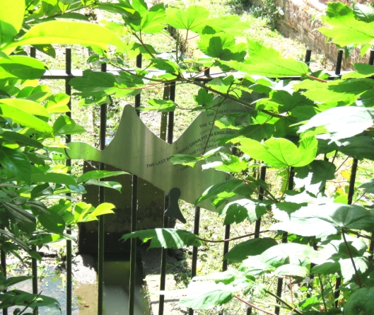
Half-hidden, a swan-shaped sign marking the sluice to the Swan Pit in the Great Hospital

The Bishop of Norwich also owned swans [2] but whether he feasted on them is not recorded.

Swan beak markings.jpg

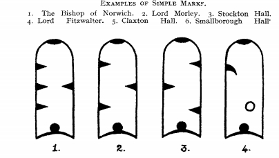
The Bishop of Norwich marked the beaks of his swans with four nicks. ©[15]

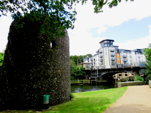
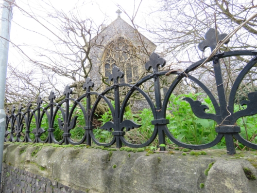
Fifty-foot-high Cow Tower (rebuilt late C14) was strategically placed to fire upon the higher ground across the river. It is an early example of Norwich brickwork into which, for nine shillings each, stonemason Snape inserted cross-loops that could have accommodated  longbows, crossbows and hand-held artillery [3]. Still, this didn’t deter Robert Kett’s rebels – during their righteous uprising against land enclosures – from firing down from Mousehold Heath and damaging the battlements.

IMG_8756.jpg

IMG_8755.jpg

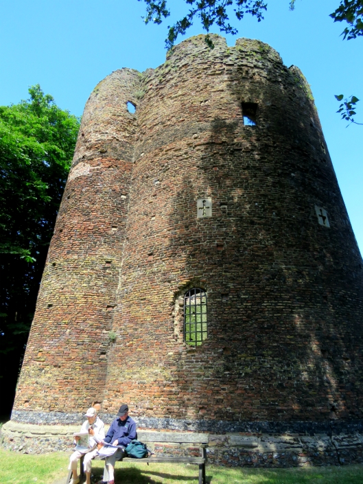
Tapered embrasures allowed a wide range of fire

Next, Bishop Bridge – the only surviving medieval bridge (c 1340)  [3]. From here you would have seen followers of John Wycliffe (d.1384) and later heretics burned just over the bridge in Lollards’ Pit. And in 1549, from what we now know as Kett’s Heights, you would have seen Robert Kett’s followers fire down upon, then storm, the fortified bridge. IMG_8760.jpg

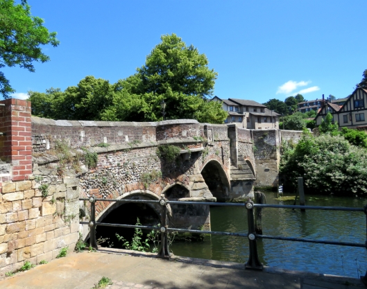
On the opposite side of the bridge, to the right of the Lollards’ Pit pub, is the superstructure that guided the rise and fall of the Gas Hill gasometer. Built in 1880, at the foot of the steepest hill in Norfolk, it stored town gas released by burning coal. But coal became increasingly redundant from the late 1960s when domestic appliances were adapted to use natural gas from under the North Sea.gasometer.jpg

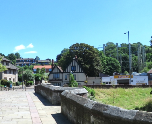
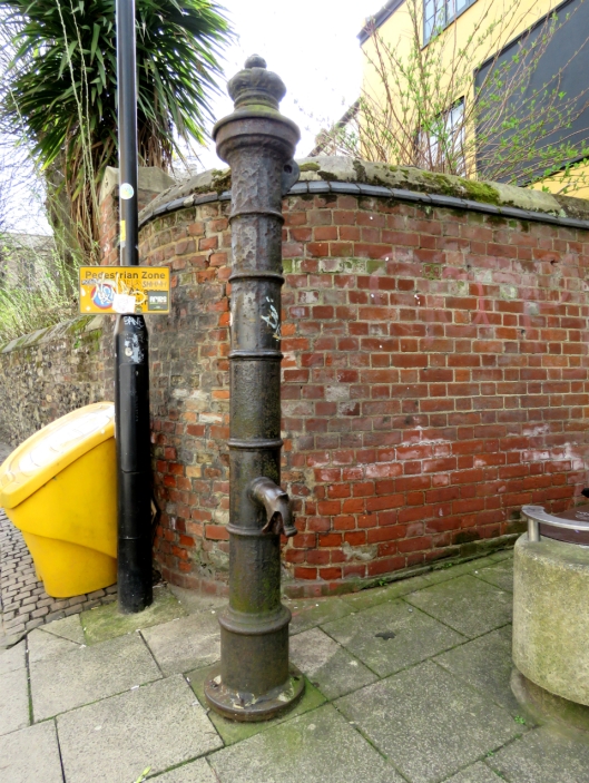
Downstream, a ferry once ran across to the cathedral watergate. In 1807, Cole referred to it on his Norwich plan as Sandling’s Ferry (after its C17 operator) although by then the ferry was being run by John Pull (active 1796 to 1841) [4]. Evidently, he managed to make a living despite the proximity of toll-free Bishop Bridge.

1807 Plan of Norwich by G Cole A.jpg

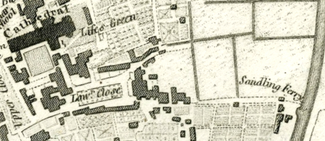
The Sandling Ferry on the 1807 Plan of Norwich by G Cole. Courtesy Norfolk Museums Collection NWHCM: 1954.138.Todd5.Norwich.19

Every piece of Norman sandstone for the building of Norwich Cathedral (from 1096) would have come across the Channel and up the Wensum to the mason’s yard via a canal that remained open until c.1780.

PullsFerry3.jpg

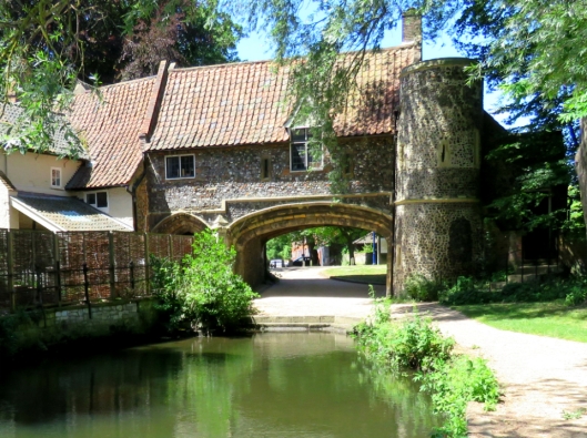
Pull’s Ferry. C15 watergate and C17 ferry house, restored in 1948/9 by Cecil Upcher [3]

In 1811 a toll bridge was built across the Wensum near the present day Thorpe Rail Station, taking its name from the iron foundry on the city-side bank.

star.jpg

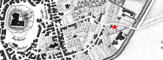
Foundry Bridge on the 1819 Longman map, courtesy www.georgeplunkett.co.uk

In 1844, the railway arrived from Yarmouth to the east. To make that next step across the river towards the city centre a wooden bridge was replaced by this iron one seen in the painting by John Sell Cotman’s son, John Joseph.

JJ Cotman.jpg
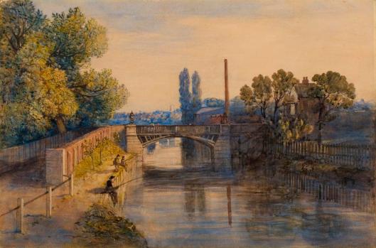
John Joseph Cotman’s Old Foundry Bridge. Courtesy Norfolk Museums Collections NWHCM: 1916.41.1

The Victorian solution to encroaching modernity was to build Prince of Wales Road (1850s/1860s) on rubble from the old city wall at Chapelfield [5]. This provided a wide direct route, connecting the station to the city centre and market [3]; in 1888 Foundry Bridge/Station Bridge was made correspondingly wider.

IMG_8774.jpg

Foundry Bridge, looking up Prince of Wales Road from the station side. Note the arrow pointing down the steps.

A diversion. Do not do as I did and follow the seductive  arrow on the side of Norwich Nelson Premier Inn for it leads to a dead end, not a riverside walk. Ploughing on, I walked up Prince of Wales Road, left on Rose Lane and left on Mountergate. A sign on the side of the new Rose Lane Car Park states that this was the site of the Norwich Fish Market that moved here in 1913.

IMG_8642.jpg

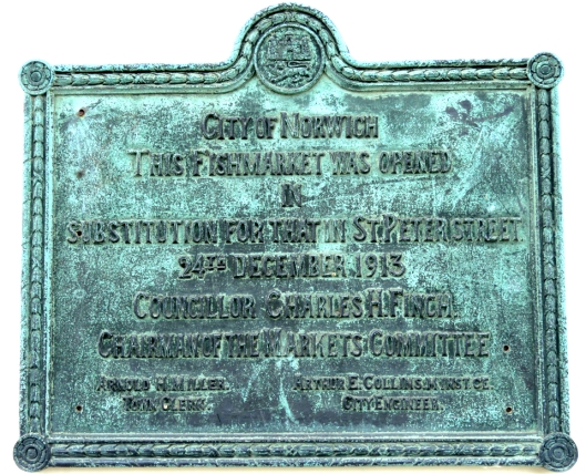
Before this, the fish market had been in the Norman marketplace for over 800 years [6]. In 1860 the shambolic stalls were replaced with a neoclassical building at the back of the present-day market but this was demolished in 1938 [7].

OldFishMarket.jpg

The Old Fish Market (1860-1938) on St Peter’s Street, roughly where the Memorial Gardens are today. Top left, the battlements of the medieval Guildhall grin through the mist. Courtesy Norfolk County Council, Picture Norfolk

On the opposite side of Mountergate is an old weavers’ building with one of the last remaining weavers’ or through-light windows.

IMG_8638.jpg

As Mountergate constricts to an alleyway, a tall wall screening Parmentergate Court is all that remains of the once-thriving Co-op Shoe Factory that had, itself, moved into premises vacated by Boulton and Paul. coop-factory.jpg

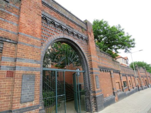
The real object of my diversion was to check on the progress of the restoration of Howard House, derelict so long its scaffolding is said to have gained listed status. Now, Orbit Homes are restoring the house as part of the residential St Anne’s Quarter. IMG_8637.jpg

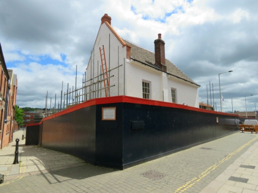
Howard House was built in 1660 by Henry Howard 6th Duke of Norfolk on land seized by Henry VIII from the Austin Friars [3]. The duke laid out a pleasure garden that was still referred to on C19 maps as ‘My Lords Gardens’. The garden wall peeping over the hoarding on King Street is probably the original boundary wall of the friary [8]. IMG_8635.jpg

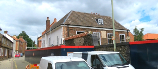
Instead of continuing down King Street, which I’ll save for another day, I retraced my steps, crossed Foundry Bridge and walked along the station side of the river. On the east bank the contrast between now and then couldn’t be more stark: modern leisure vs Victorian industry. From 1999 the Riverside leisure complex (gym, cinema, bowling, pub, restaurants) replaced the engineering works of Boulton and Paul, which moved here from the other side of the river during the First World War [9].

Boulton and Paul1939.jpg

Boulton and Paul’s Riverside Works 1939, just before it was bombed in the Blitz. The stadium of Norwich City FC can be seen to the right. Courtesy of Norfolk County Council, Picture Norfolk. 

Like their great rivals Barnard Bishop and Barnards, several bridges upstream, Boulton and Paul produced wire netting amongst an enormous range of products for farm, estate and garden. During World War I they were asked by the government to produce aeroplanes, making more Sopwith Camels than any other company.1024px-Sopwith_F-1_Camel_USAF.jpg

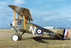
After WWI they were to produce light bombers to their own design, including the Norfolk-named Sidestrand and Overstrand. B&P also produced the ‘Daffy’ Defiant night fighter as well as a night-fighter named after that well-camouflaged bird of the Norfolk Broads – the Bittern [9].

BnPDuo.jpg

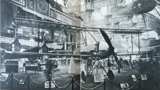
Boulton and Paul exhibited the world’s first all-metal plane, the P10, in Paris 1919. ©Boulton and Paul. From [9].

Looking across the river is the newly-coined St Anne’s Quarter – a seething building site whose name is explained on the 1884 OS map. Not only does it lie upon C17 ducal gardens but on the St Ann’s Ironworks (1847-1883) belonging to Thomas Smithdale & Son [10]. St Ann’s Works, where the Smithdales cast the iron required for their business as millwrights, was named for St Ann’s Chapel once on this site. The former foundry is now part of a larger site comprised of the Old Norwich Brewery on King Street, several maltings and the only-named Synagogue Street in the country (bombed in WWII).

StAnnesQuarter.jpg

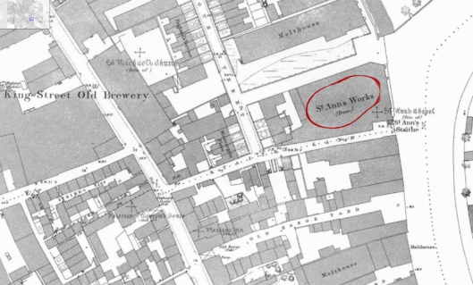
St Ann’s Foundry, opposite the Riverside complex. The zoomable 1884 OS map is courtesy of Frances and Michael Holmes [11].

Connecting the two sides of the river is the Lady Julian Bridge (2009) that commemorates Julian of Norwich, the anchoress (c1342-c1416) whose Revelations of Divine Love is said to be the first English book written by a woman [12]. If you were to cross her bridge, turn left on King Street then right on St Julian’s Alley you would come to her eponymous Anglo-Norman church and her cell, largely rebuilt after the Blitz. LadyJulianBridge.jpg

Along this stretch of the river is a building that georgeplunkett.co.uk lists as an old grain warehouse. The ownership is unclear but whoever owns the corrugated building occupies one of the last undeveloped sites on the river margin.old grain warehouse.jpg

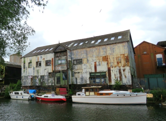
[Updated March 3 2019. Reading ref 15 I see this building at the A.B.C. Wharf was owned in 1910 by H Newhouse & Co Ltd whose Yarmouth – Hull steamers plied goods along the eastern seaboard.IMG_0476.jpg


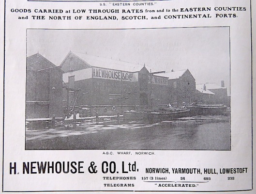
Connecting the profusion of riverside apartments around the Old Flour Mill with the railway station is the Novi Sad Friendship Bridge, built by May Gurney (2001) to mark the twinning of Norwich with the Serbian city.

NoviSad3.jpg

The Old Flour Mill started life in 1837 as the Albion Yarn Mill for making worsted, silk and mohair thread to be used in our weaving industry but by the time of the 1884 OS survey it had become a ‘Confectionery’. In the 1930s, the building was taken over by RJ Read of Horstead Water Mill. Latterly, known as the Read Woodrow flour mill it closed in 1993 and was converted to apartments from 2005 [13].

ReadsMill.jpg

The redbrick buildings of the former flour mill 

King St 237 Read's flour mills across river [6597] 1990-03-18 (1).jpg

King Street Flour Mill 1990. Courtesy http://www.georgeplunkett.co.uk

Carrow Bridge, the final pedestrian bridge inside the old city.CarrowBridge3.jpg

Within living memory the Wensum would have been alive with ships, some much larger than picturesque Norfolk wherries. Below, the movable section of this bascule bridge is being raised to allow a sea-going ship through.

Wensum Carrow bascule bridge open for ship [4765] 1964-05-09.jpg

Carrow Bridge opening for a ship in 1964. Courtesy http://www.georgeplunkett.co.uk

River trade was also regulated by the paired boom towers near Carrow Bridge, part of the early C14 walled defences. A boom – originally a beam but in this case chains of Spanish iron – was strung across the river to regulate access and extract tolls [14]. The chains were raised by a windlass in the twin tower on the west/city side.

Boom Tower.jpg

The eastern boom tower – the Devil’s Tower – downstream of Carrow Bridge

This two-part walk around the river underlines the richness of the city’s industrial past. Once, Norwich made things. Its pre-eminent textile trade survived into the C19 to be replaced by a variety of trades of the Industrial Revolution: shoe-making, iron-working, brewing, general engineering, aeronautical engineering and other light manufacturing industries. But, in the later stages of this riverside walk especially, there is now little to show of those old trades as all traces of productive industry are being erased in favour of  housing and leisure. We stopped at the last road bridge, just short of Colman’s mustard factory that was synonymous with this city for a century and half. After the business closes next year the future of the site is unclear but what price riverside apartments?

©2018 Reggie Unthank

BONUS TRACKS

Wensum body loves you. Frank Sinatra

Blood Red River Blues. Josh White (to accompany the previous post on Norwich Red dye). Click: https://www.youtube.com/watch?v=hs2_6LRPgqo

Red River Blues. Henry Thomas (1928)

Moody River. Pat Boone

Down by the River. Neil Young

Down by the Riverside. Traditional

Time and the River. Nat King Cole

Take me to the River. Al Green

Cry me a River. Julie London

Moon River. Andy Williams

Ol’ Man River. Paul Robeson

Down to the River to Pray. Alison Krauss

Travelling Riverside Blues. Robert Johnson

River. Joni Mitchell

The River. Bruce Springsteen

Up a Lazy River. Louis Armstrong

River Deep Mountain High. Ike and Tina Turner. Not for Norfolk

Sources

  1. http://www.geograph.org.uk/photo/2418563
  2. Ticehurst, N.F. (1936). On Swan-Marks. British Birds vol 29, p266.
  3. Pevsner, Nikolaus and Wilson, Bill (1962). The Buildings of England. Norfolk 1: Norwich and North-East. Pub: Yale University Press.
  4. https://en.wikipedia.org/wiki/Pulls_Ferry,_Norwich
  5. Meeres, Frank (2011). The Story of Norwich. Pub: Phillimore.
  6. https://en.wikipedia.org/wiki/Norwich_Market
  7. http://www.georgeplunkett.co.uk/Norwich/markets.htm
  8. http://www.georgeplunkett.co.uk/Norwich/kin.htm
  9. The Leaf and the Tree: The Story of Boulton and Paul 1797-1947 (1947). Author: Anon. Pub: Boulton and Paul Ltd.
  10. http://www.norfolkmills.co.uk/Millwrights/smithdale.html
  11. http://www.norwich-heritage.co.uk/norwich_maps/Norwich_map_1884_zoomify.htm. Do visit the Holmes’ exciting new site on Norwich history http://www.norwich-heritage.co.uk/
  12. https://en.wikipedia.org/wiki/Julian_of_Norwich
  13. https://www.geograph.org.uk/photo/5768436
  14. https://www.geograph.org.uk/photo/5766195
  15. ‘Citizens of No Mean City: Norwich – the East Anglian Capital’ (ca1910). Pub: Jarrold and Son, London & Norwich.

Thanks: Frances and Michael Holmes; Clare Everitt of Picture Norfolk; and members of the Dragon Hall Local History Group (Sheila Fiddes, Richard Matthew and Barbara Roberts).


Share this:

  • Facebook
  • Twitter
  • Pinterest
  • Email
  • Print

Like this:

Like Loading...

Street furniture: palimpsests

15 Tuesday May 2018

Posted by reggie unthank in Norwich buildings, Norwich history

≈ 20 Comments

Tags

architectural palimpsests, street furniture, streetscape, victorian ironwork

I’m fascinated by the idea of the city as a palimpsest – a parchment scraped down to be used again with signs of previous lives grinning through.

inside-archimedes-palimpsest-in.jpg

On the 1000-year-old Archimedes Palimpsest, previously unknown works by the Greek mathematician were poorly erased then overwritten with religious texts (http://www.pbs.org/)

Old street furniture illustrates this perfectly: usually it will be discarded if it doesn’t fit the current style guide but where it is allowed to remain it can tell us much about the layering of time.

Gybson’s Conduit on the boundary wall of Bullards Anchor Quay Brewery in Westwick Street once faced the road but when the brewing hall was converted into apartments in the 1980s the pump was restored [1] and re-sited to face into the development. This early Renaissance monument was built by Norwich Sheriff and brewer, Robert Gybson. It appears to be a philanthropic gesture (‘for the ease of the common people’) but it was actually a condition of buying the site on which St Lawrence’s Well had stood since at least the time of Edward the Confessor [2, 3]. Gybson seems to have been an angry man and for ‘failing to be buxom to the mayor‘ he was deprived of the freedom of the city and condemned ‘forever henceforth to be a foreigner‘ [2]. Coo!

GybsonsConduit.jpg

In 1860, John Henry Gurney erected this drinking fountain and obelisk to mark the site of an earlier wellhead (ca 1700-1850) that had raised water to be stored for the higher parts of the city [3].

IMG_8278.jpg

The Gurney Drinking Fountain and Obelisk (1860) in Tombland

Sewell Park – the triangle of land between Constitution Hill and St. Clement’s Hill –was given to the city in 1908 by the Sewell family. Anna Sewell wrote Black Beauty when she lived about a mile away at Old Catton. The triangular horse trough – now a flower bed – that guards the park entrance is doubly appropriate.

SewellFountain.jpg

Black Beauty was published by local printing firm Jarrolds and Anna Sewell’s name is commemorated on one of the shields decorating the first floor of Jarrolds department store in London Street.

Sewell.jpg

The trough on Castle Meadow, commemorating the popular Dr Darrell, was moved from outside his practice at All Saints Green [4]. It is reminiscent of a time when water troughs were placed along the road between the railway station and the old cattle market, beneath which Castle Mall now stands.

CastleFountain.jpg

Following John Snow’s pioneering example of epidemiology in 1854, when he mapped an outbreak of cholera to a particular pump in London’s Soho [5], the importance of clean public water was foremost in the Victorian mind. Erected in 1860, this Portland Stone fountain outside St George Colegate was for public consumption: the marble basin for people and the troughs beneath for dogs.

ColegateFountain.jpg

Presented by Mr JC Barnham, designed by architects Messrs Benest and Newton, and sculpted by Mr. Joseph Stanley of Norwich

Bearing in mind John Snow’s findings about the source of water, this parish pump – patented by Shalder of nearby Redwell Street – is worryingly situated next to the raised burying ground of St John Maddermarket. The water was once described as ‘pure essence of churchyard’ [2].

Pump.jpg

At a time when potable water was only just being piped into some homes, the need for fresh drinking water for the poor was often met by philanthropic commissions. Charles Pierre Melly had already provided many drinking fountains in Liverpool and in 1859 he presented Norwich with this fountain situated at the east end of the Guildhall [6].

IMG_8195.jpg

FH fire hydrant signs are everyday parts of the streetscene but this FP sign in Unthank Road refers to an earlier ‘fire plug’. The small stretch of railings to which it is attached only survived because of the fire hydrant sign – most other railings and gates having been removed in WWII in a morale-boosting bid to make guns. However, the inferior quality of the metal was such that it was likely used for other purposes, if not dumped in the Thames [7].

Firepoint.jpg

Near Bay Cottage, 14 Unthank Road

… and to round off the water theme, what is thought to be the earliest example of a concrete pissoir is now closed [2].

pissoir.jpg

St Crispins Road near Barn Road roundabout

Due to that programme of scrappage in WWII there are precious few examples of locally-sourced ironwork on our streets. These curvaceous Art Nouveau-like railings around St Giles on the Hill reflect the flowing tracery of the beautiful east window from the Curvilinear Decorated period of the early C14 [8]

StGiles.jpg

Some domestic gates have survived; Mill Hill Road has several examples, some refurbished. The gate below, with inverted curve, is a common pattern still copied when gates are replaced.

MillHillRd.jpg

From a time, pre-Ocado, when tradesmen brought your orders to your (back) door …

IMG_8220.jpg

Mount Pleasant

Clarendon Road has some of the best examples of Victorian ironwork.

ClarendonRdRailings.jpg

Clarendon Road

Again on Clarendon Road, these cast-iron railings and gates separate two fine Victorian houses from the roadway. But further examples of street furniture can just be glimpsed in the side alley: a bollard and a puzzling pipe.

Clarendon Rd.jpg

Another fine set of cast-iron railings on Clarendon Road. Just creeping into shot is a bollard (bottom left) and a curious pipe (top left).

First, the bollards. The Norwich City Council’s Streetscape Manual (2006) [10] mentions two designs: a plain octagonal post – generally painted dark green – used in the city centre, and a more ornate cast-iron bollard that was photographed by George Plunkett in 1931 and is probably Victorian [11]. Here, just outside the city walls, in the Heigham Grove Conservation Area, two of these latter bollards guard the alleyway between Clarendon Road and Neville Street. Two years ago I wrote about the bollards when local residents campaigned against the council’s plan to remove them to allow access for a mechanical street sweeper [11].

bollards2.jpg
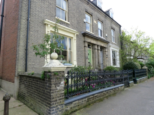
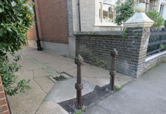
It’s worth repeating the message that vestiges of a previous age are a vital part of the feel, the texture, of the streetscape. This design of bollard is entirely appropriate to one of the city’s finest late Victorian streets – as recognised in the council’s own planning appraisal:

“Several surviving cast iron railings along Clarendon Road are particularly fine and rare examples of once common Victorian ironwork found in Norwich cast by local firms such as Barnard, Bishop and Barnard(s)” [9].

This more ornate version can be found around churchyards, such as St Peter Mancroft and St Gregory’s but it can also be found at secular locations like Bishop Bridge (below) and the steps to the Castle at Davey Place.

BishopsBridge.jpg
A convocation of traditional cast-iron bollards on Bishop Bridge. (Note the electric ‘gas’ lamp).

The historic Norwich Lanes [12] have been delineated by painting the modern octagonal bollards red instead of the more usual green. This references the colour of the plant dye, madder, that was so important to the city’s once-thriving cloth industry. Twenty-one of these bollards are crowned with bronze sculptures designed by Oliver Creed [13].

LobsterLaneDuo2.jpg

Oliver Creed’s bronze capitals to red bollards in Lobster Lane (L) and Swan Lane (R).

Within the jurisdiction of Norwich Cathedral, distinctive canon-style, cast-iron bollards are used. Since the partnership of Norwich ironfounders, John Francis & Thomas Blyth, was dissolved in 1840 the bollards must be at least 178 years old [14].

cathedral duo.jpg

Back in the alleyway on Clarendon Road we glimpsed what was a tall, cast-iron stench pipe. If we think of such pipes at all we probably think of vent pipes that extend above the eaves. However, the pipe belonging to Anglia Water is part of the public sewerage system, its function being to regulate the pressure in the sewer when waste passes through.

stench pipe trio.jpg

Stench or stink pipe in the alleyway between Clarendon Road and Neville Street. The cast iron pipe bears the city’s coat of arms and was made by Barnards Ltd, who superseded Barnard Bishop and Barnards Norwich Ironworks in 1907. 

I did wonder whether a column at the junction of Newmarket and Christchurch Roads might have been left over from the electric tramways or electric lighting of the early C20 but it is identical to the Clarendon Road example and the wire balloon on top confirms it to be another stench pipe.

IMG_8231.jpg

Newmarket Road at Christchurch Road 

Another such pipe, by another of the city’s famous foundries – Boulton and Paul, is on Waverley Road. Listing stench pipes may sound train-spotterish except these are living reminders of our industrial history that should not be airbrushed from view in search of a uniform modern look. Only a year ago, the Cambridge News reported that residents on Hills Road/Queen Edith’s Way, Cambridge were – in their words, not mine – ‘kicking up a stink’ about plans to remove a tall, cast iron, Victorian stench pipe [15]. And last September the Eastern Daily Press reported that a tram standard had been removed for ‘safety reasons’ (Pah!) from the junction of West Pottergate and Heigham Road [16]. This matters because it was the very last post belonging to the Norwich Electric Tramways that had replaced horse-drawn omnibuses in 1900. The post that once carried its electricity was sturdy enough a century later when George Plunkett photographed it reincarnated as an electric lamp post. Now that link is lost.

Heigham Rd former tram standard [7787] 2000-11-24.jpg

The last relic of the Norwich Electric Tramways 1900-1935 ©georgeplunkett.co.uk

On Bank Plain is a fine cast iron lamp post base ca 1900, updated with an electric lamp.

Lampost trio.jpg

In the early C19 the city was lit by oil lamps but the fuel was replaced by coal gas from about 1825-30. Although a few electric lamps had begun to appear at the end of the C19 it wasn’t until 1910-13 that the gas lamps were converted to electricity, except for a few in unadopted streets. This may explain the survival of the old gas lamp in St Giles Terrace, photographed by George Plunkett in 1955 [2]. It has been converted to electricity but retains its original lantern.

gas lampost.jpg

St Giles Terrace off Bethel Street

Walking the streets of Georgian or Victorian Norwich would undoubtedly leave mud on your boots and before entering the house this had to be removed with a boot scraper. The French are more direct in naming their scrapers decrottoirs, acknowledging that excrement (crotte) is a major component of ‘mud’ from streets populated by horses and dogs. A walk past the rich merchants’ houses in St Giles Street reveals several examples of cast-iron scrapers, either free-standing or (usually paired) set into the walls.

boot scraper.jpg

Now that most of us carry a mobile phone we can only wonder when phone boxes will become obsolete. The iconic model below, designed by Sir Giles Gilbert Scott, went into production in 1936 although modern ‘heritage’ versions are still made in the official colour, currant red [17].

IMG_8175.jpg

At the corner of St Saviour’s churchyard in Magdalen Street

There are several styles of red post box in the city. Left, is a Victorian ‘Penfold’ with an acanthus bud on top, designed by architect John Penfold. I remember a Penfold post box at the bottom of Guildhall Hill; the present one outside the City Hall is probably a replica made in the 1980s [17]. The modern post box derives from the version made in the reign of Victoria’s son, Edward VII (centre); the advantage was that the post slot was integral to the door so that no letters could skulk in the top of the box [17].  The current Elizabethan ERII box is virtually identical.

Postbox Trio.jpg

(L) Penfold-type, St Peter’s Street/City Hall. (C) Edward VII, Opie Street. (R) Elizabeth II, Unthank Road.

A personal favourite is the original Victorian wall box in Upper St Giles. This now fronts The Post Room antiques and interiors shop but I first encountered it when it belonged to the Upper St Giles sub-post office. Remember post offices?

IMG_8204.jpg

Bonus track

IMG_3983.jpg

Villagers of Mellis, Suffolk, converted this £1 postbox to a colour therapy room

Sources

  1. http://norwichpreservationtrust.co.uk/gybsons-conduit-westwick-st-scheduled-ancient-monument/
  2. http://www.georgeplunkett.co.uk/Norwich/streetfurniture.htm An excellent resource for old Norwich street furniture.
  3. http://www.racns.co.uk/sculptures.asp?action=getsurvey&id=291
  4. http://www.waymarking.com/waymarks/WMJRMA_Dr_Harrington_Wyndham_Darrell
  5. http://johnsnowbicentenary.lshtm.ac.uk/about-john-snow/
  6. http://www.racns.co.uk/sculptures.asp?action=getsurvey&id=47
  7. http://www.christopherlong.co.uk/pri/wareffort.html
  8. https://colonelunthanksnorwich.com/2016/03/12/the-art-nouveau-roots-of-skippers-royal-arcade/
  9. https://www.norwich.gov.uk/downloads/file/3010/heigham_grove_conservation_area_appraisal
  10. https://www.norwich.gov.uk/downloads/file/3252/streetscape_design_manual (see page 25).
  11. https://colonelunthanksnorwich.com/2016/09/24/hands-off-our-bollards/
  12. https://norwichlanes.co.uk/about/
  13. http://racns.co.uk/sculptures.asp?action=getsurvey&id=806
  14. https://www.gracesguide.co.uk/Francis_and_Blyth
  15. https://www.cambridge-news.co.uk/news/cambridge-news/cambridge-stink-pipe-hills-road-13039347
  16. http://www.edp24.co.uk/news/last-link-to-norwich-s-tram-route-is-removed-from-busy-street-over-safety-concerns-1-5199416
  17. https://en.wikipedia.org/wiki/Red_telephone_box

Thanks to: Lesley Kant-Cunneen for information about ironwork in Clarendon Road and Alan Theobald for discussions about street furniture.


Share this:

  • Facebook
  • Twitter
  • Pinterest
  • Email
  • Print

Like this:

Like Loading...

Enter your email address to follow this blog and receive notifications of new posts by email. It's free, no junk.

Join 4,135 other followers

Recent Posts

  • Norfolk Rood Screens
  • Norwich Guides: Ancient and Modern
  • Chapel in the Fields
  • Noël Spencer’s Norwich
  • Georgian Norwich
  • Cecil Upcher: soldier and architect
  • Sculptured Monuments #2
  • Sculptured Monuments
  • Madness
  • New Book: Colonel Unthank’s Norwich
  • AF Scott, Architect:conservative or pioneer?
  • Norwich Department Stores
  • Revolutionary Norwich
  • Parson Woodforde and the Learned Pig
  • A postscript on Eaton Nurseries
  • The Nursery Fields of Eaton
  • Vanishing Plains
  • Parson Woodforde goes to market
  • Norwich, City of the Plains
  • The Plains of Norwich
  • Twentieth Century Norwich Buildings
  • Thomas Browne’s World
  • The angel’s bonnet
  • After the Norwich School
  • A few of my favourite buildings
  • James Minns, carver
  • The Norwich Banking Circle
  • Behind Mrs Opie’s medallion
  • Norwich: shaped by fire
  • Street Names #2
  • Street names
  • The Norwich School of Painters
  • Going Dutch: The Norwich Strangers
  • The Captain’s Parks
  • Norfolk’s Napoleonic Telegraph
  • Catherine Maude Nichols
  • The Norfolk Botanical Network
  • City Hall Doors # 2
  • City Hall Doors # 1
  • Late Extra: The Norwich Pantheon
  • Pleasure Gardens
  • The absent Dukes of Norfolk
  • Nairn on Norwich
  • The Norwich Way of Death
  • Norwich: City of Trees
  • The Bridges of Norwich Part 2: Around the bend
  • The Bridges of Norwich 1: The blood red river
  • Norwich knowledge (libraries)
  • Street furniture: palimpsests
  • Putting Norwich on the map
  • Clocks
  • Faces
  • The Norwich coat of arms
  • New book: Colonel Unthank and the Golden Triangle
  • The Pastons in Norwich
  • Reggie through the underpass
  • Gildencroft and Psychogeography
  • Bullards’ Brewery
  • Post-medieval Norwich churches
  • The end of the Unthank mystery?
  • Barnard Bishop and Barnards
  • Public art, private meanings
  • Colonel Unthank rides again
  • Three Norwich Women
  • The flamboyant Mr Skipper
  • When Norwich was the centre of the world*
  • Arts & Crafts pubs in the C20th
  • Entertainment Victorian style
  • Jeckyll and the Japanese wave
  • Dragons

Archives

  • March 2022
  • February 2022
  • January 2022
  • December 2021
  • November 2021
  • October 2021
  • September 2021
  • August 2021
  • July 2021
  • June 2021
  • May 2021
  • April 2021
  • March 2021
  • February 2021
  • January 2021
  • December 2020
  • November 2020
  • October 2020
  • September 2020
  • August 2020
  • July 2020
  • June 2020
  • May 2020
  • April 2020
  • March 2020
  • February 2020
  • January 2020
  • December 2019
  • November 2019
  • October 2019
  • September 2019
  • August 2019
  • July 2019
  • June 2019
  • May 2019
  • April 2019
  • March 2019
  • February 2019
  • January 2019
  • December 2018
  • November 2018
  • October 2018
  • September 2018
  • August 2018
  • July 2018
  • June 2018
  • May 2018
  • April 2018
  • March 2018
  • February 2018
  • January 2018
  • December 2017
  • November 2017
  • October 2017
  • September 2017
  • August 2017
  • July 2017
  • June 2017
  • May 2017
  • April 2017
  • March 2017
  • February 2017
  • January 2017
  • December 2016
  • November 2016
  • October 2016
  • September 2016
  • August 2016
  • July 2016
  • June 2016
  • May 2016
  • April 2016
  • March 2016
  • February 2016
  • January 2016
  • December 2015

Follow me on Twitter

My Tweets

previous posts

  • About
  • Contact
  • New Book 2021
  • Posts
  • Unthank Book
Follow COLONEL UNTHANK'S NORWICH on WordPress.com

Enter your email address to follow this blog and receive notifications of new posts by email. Your details remain private.

Join 4,135 other followers

Blog at WordPress.com.

  • Follow Following
    • COLONEL UNTHANK'S NORWICH
    • Join 4,135 other followers
    • Already have a WordPress.com account? Log in now.
    • COLONEL UNTHANK'S NORWICH
    • Customize
    • Follow Following
    • Sign up
    • Log in
    • Report this content
    • View site in Reader
    • Manage subscriptions
    • Collapse this bar
 

Loading Comments...
 

    loading Cancel
    Post was not sent - check your email addresses!
    Email check failed, please try again
    Sorry, your blog cannot share posts by email.
    %d bloggers like this: