• About
  • Contact
  • Posts
  • Unthank Book

COLONEL UNTHANK'S NORWICH

~ History, Decorative Arts, Buildings

COLONEL UNTHANK'S NORWICH

Tag Archives: Norwich Plains

Vanishing Plains

15 Tuesday Dec 2020

Posted by reggie unthank in Norwich history, Norwich streets

≈ 11 Comments

Tags

Norwich Plains

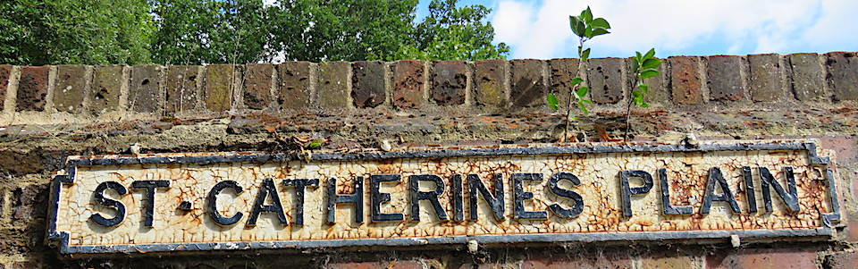
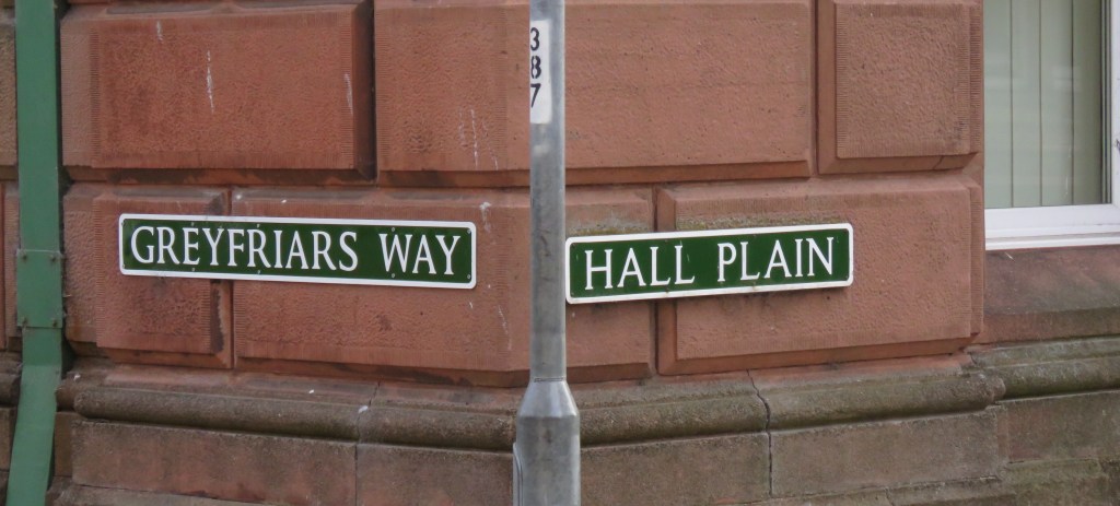
In two recent posts [1,2] I wrote about Norwich’s ‘plains’, a loan-word from the Dutch for the city’s open spaces that were largely established before the fashion for urban squares. Only five of the 15 Norwich plains identified by Richard Lane in his book, The Plains of Norwich [3] are recognised by a formal street sign, some of the others don’t appear on early maps and some of this final six may not seem to you like defined spaces at all.

St Margaret’s Plain on Westwick Street to the rear of St Margaret’s Church. From OS map 1884.

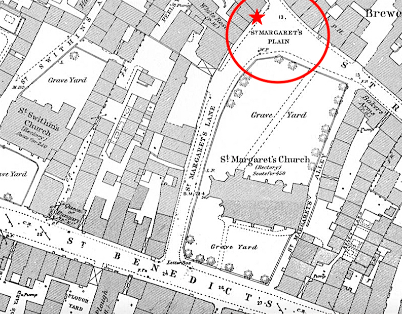
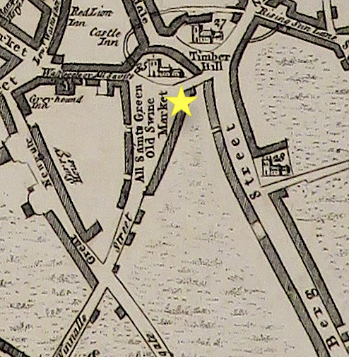
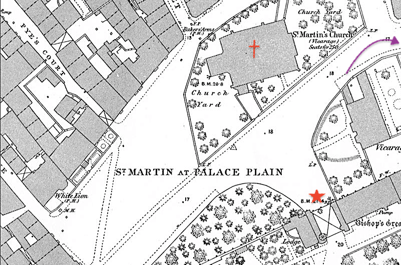
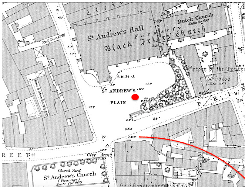
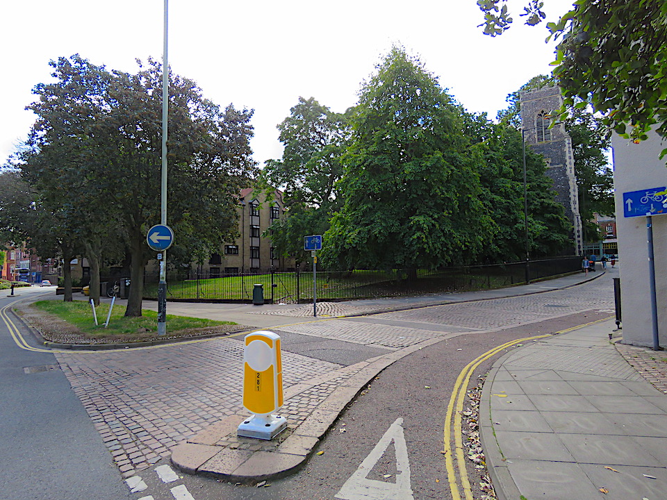
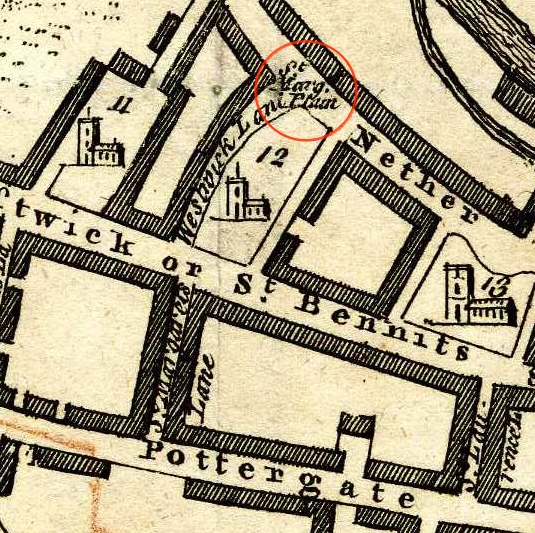
The 1884 Ordnance Survey map appears to show St Margarets Plain occupying much the same space as it does today, although Richard Lane [3] notes that Westwick Street ‘used to widen slightly at this point until pre-war demolition and German bombs altered the northern side completely.’ The demolished houses to the west of St Margarets churchyard are marked with the red star.

St Margaret’s Plain from Westwick Street, the church top right.

In general outline, a similar open space appears on King’s map of 1766 but I wonder if this northern end of the churchyard was lost to pedestrianisation.

St Margaret’s Plain on King’s Plan of 1766

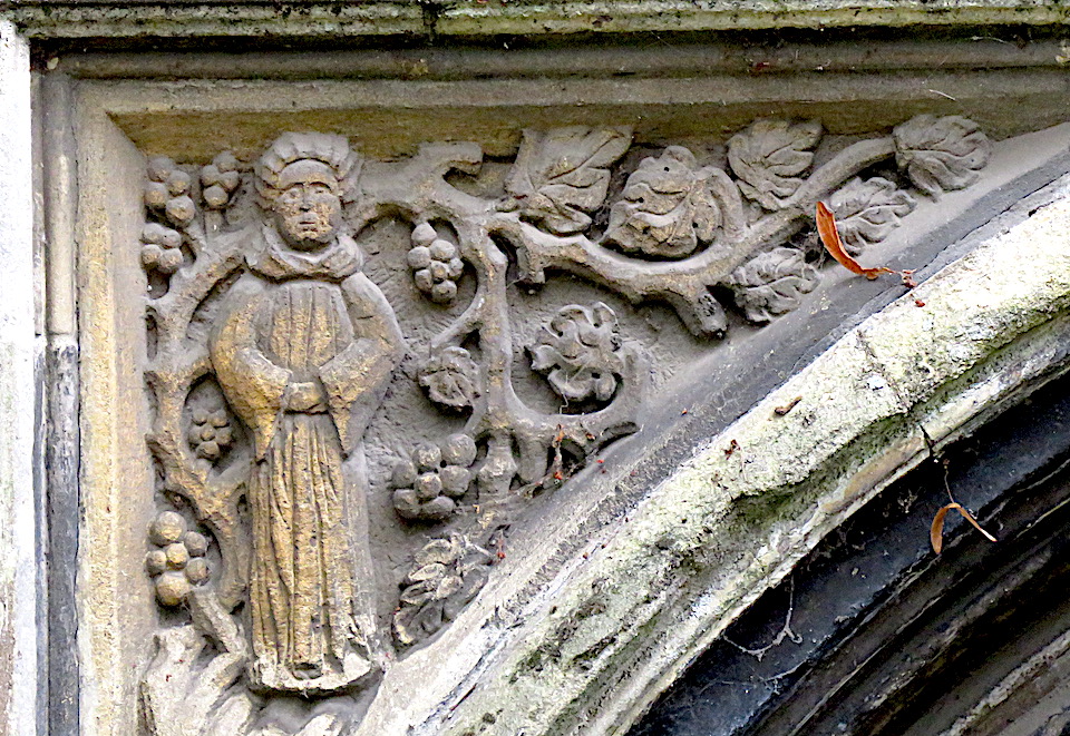
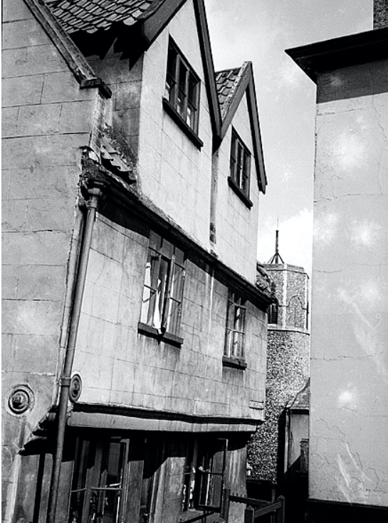
St Margaret is purported to be the figure carved in the left hand spandrel above the porch.

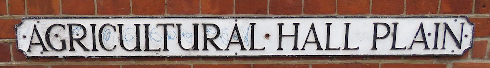
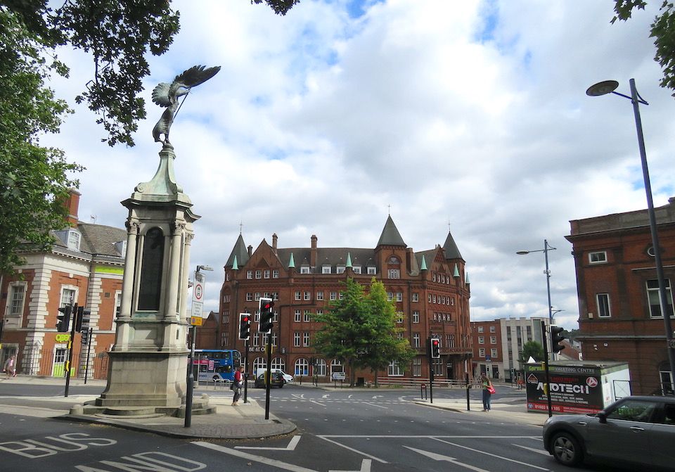
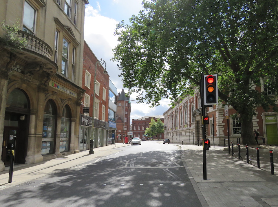
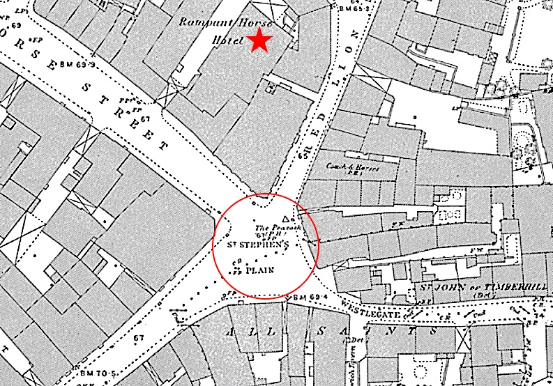
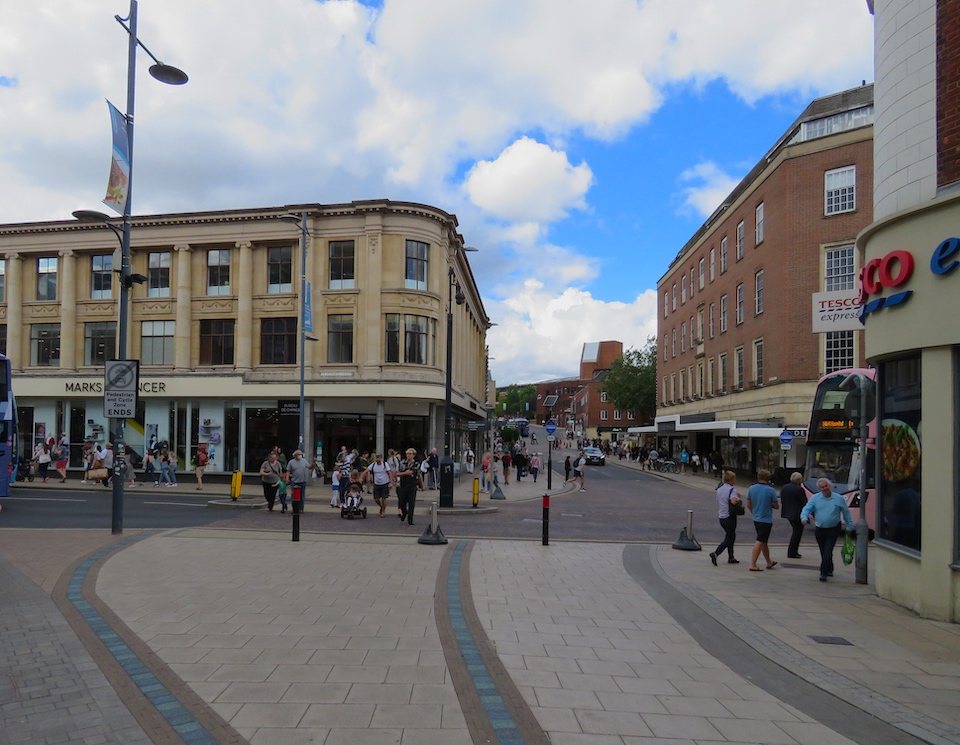
The crossroads in the main shopping area, dominated by Marks and Spencer, and Debenhams, is St Stephens Plain. St Margarets Plain was treated kindly by history but St Stephens’ Plain has been pulled hither and yon by planners, trams and the Luftwaffe.

St Stephens St lower left; Rampant Horse St top left; Red Lion Street top; and Westlegate right. OS map 1884. Starred, The Rampant Horse Hotel, which gave name to the street.

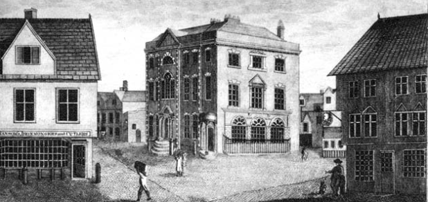
Here is St Stephens Plain on Braun and Hogenberg’s map of 1581.

Circled, St Stephens Plain; starred, St Stephen’ Gates. St Stephens Street runs between the two. Yellow arrow marks site of The Boar’s Head. From Braun and Hogenberg 1581

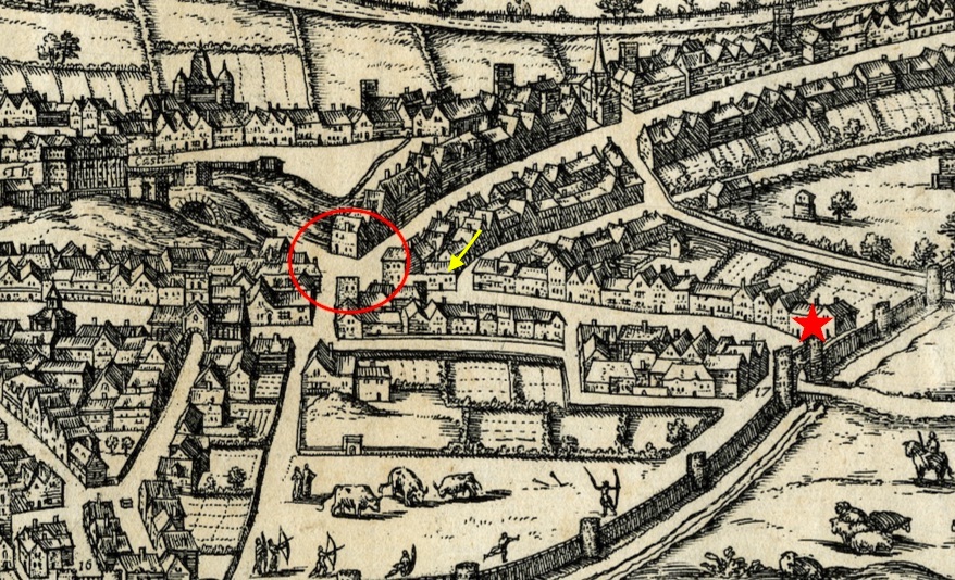
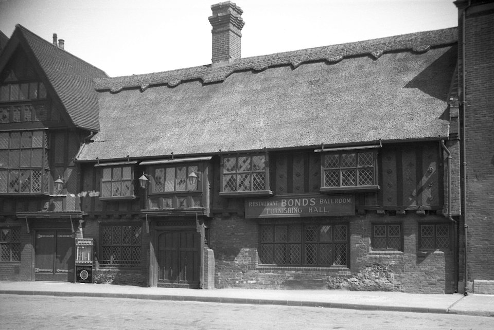
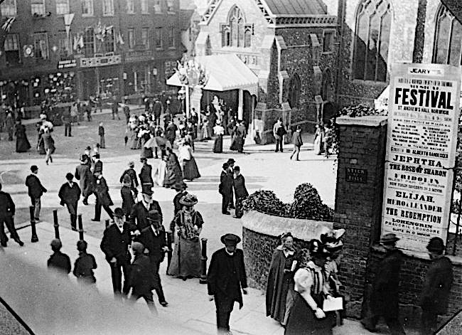
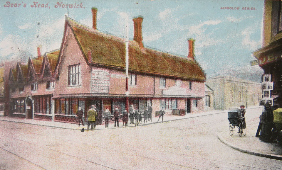
When Queen Elizabeth I came to Norwich on one of her royal progresses she entered at St Stephens Gates. Here she was met by the Mayor and a demonstration of Norwich weaving featuring religious refugees from the Low Countries whose immigration had been supported by the queen. The area was badly damaged in the bombing of WWII. Some buildings survived but the opportunity was taken to demolish the entire south side of St Stephens Street – including The Boar’s Head –  in order to widen the road.

Old Boar Inn.jpg
At the corner of St Stephens and Surrey Streets, The Boar’s Head, a C15 thatched inn, was badly damaged by bombs in 1942. Its location is marked on the map above.

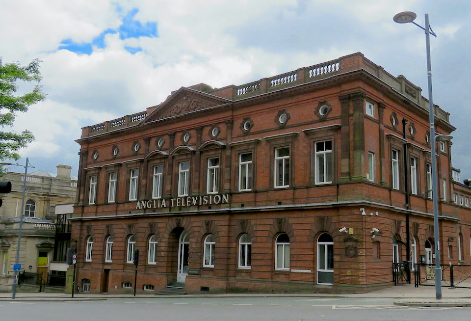
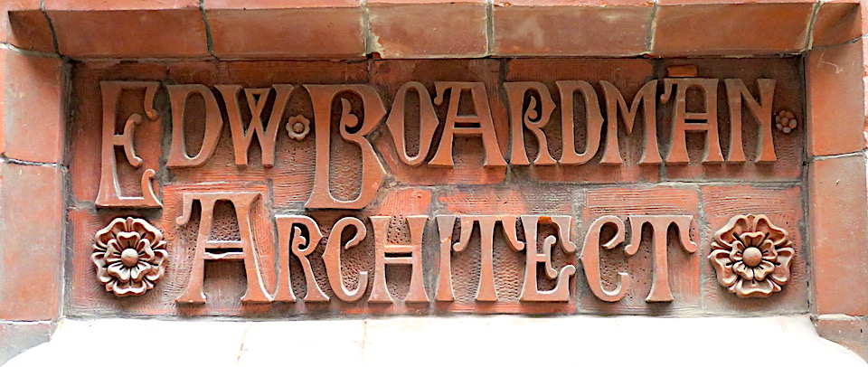
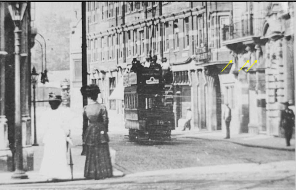
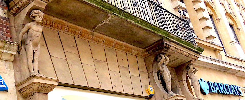
Red Lion Street, the road on the north side of St Stephens Plain, had already been widened at the very end of the nineteenth century in order to accommodate the new electric trams, whose city hub was in Orford Place. Built in 1900, the south side of Red Lion Street was comprised of buildings designed by Edward Boardman and Son or by George Skipper.

Red Lion Street, widened in 1899 for the electric trams. The women stand at the corner now occupied by Curls (later Debenhams) department store. Opposite, the child caryatids on Skipper’s Commercial Chambers are arrowed. ©Norfolk County Council at Picture Norfolk
The child caryatids (probably by Doulton Lambeth) supporting the balcony of George Skipper’s Commercial Chambers. He also designed the adjacent Barclays Bank in 1905

Looking down Westlegate towards St Stephens Plain we come to Marks and Spencer, a department store built for Buntings in 1912 by local architect AF Scott [4]. It was badly damaged in WWII but, probably due to its steel-framed construction, it survived and was rebuilt without its attic storey and corner cupola. Opposite is Debenhams department store and one wonders about the fate of purpose-built department stores now that the occupiers are in receivership.

St Stephens Plain from Westlegate. M&S to the left, Debenhams to the right

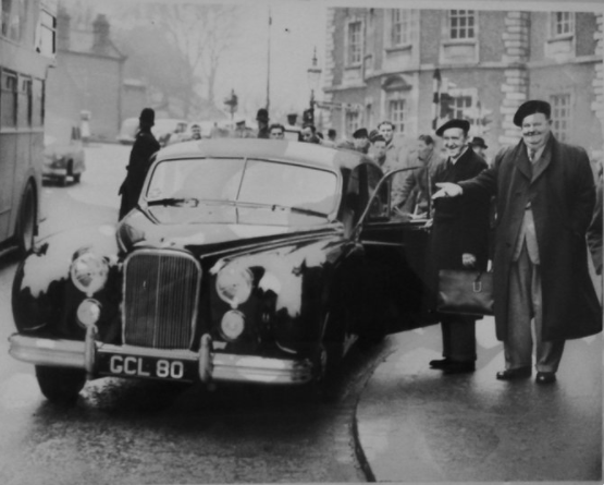
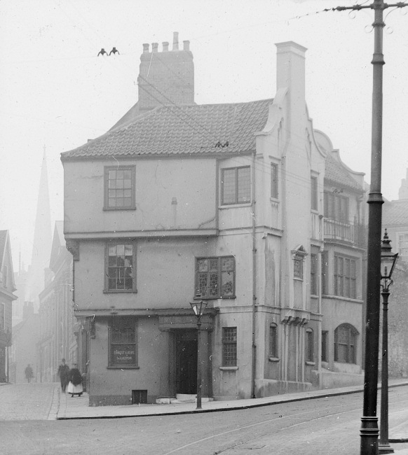
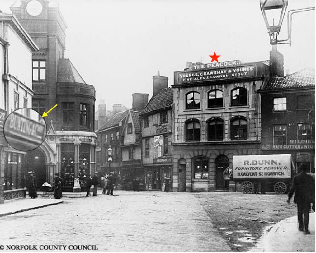
To see what the plain looked like at the end of the nineteenth century we rotate ourselves 90 degrees clockwise so that, below, we walk down St Stephens Street with Buntings (now Marks and Spencer) on our left. The red star marks The Peacock pub at 1 St Stephens Plain. The narrow street straight ahead is Red Lion Street before it was widened to take the new electric trams.

Pre-1899. Buntings/M&S is on the left (arrowed). A narrow Red Lion St is straight ahead and Westlegate is right. ©Norfolk County Council at Picture Norfolk

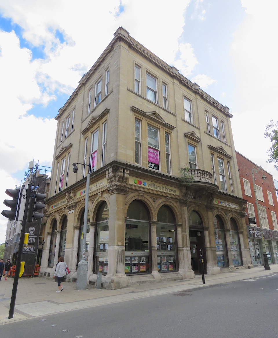
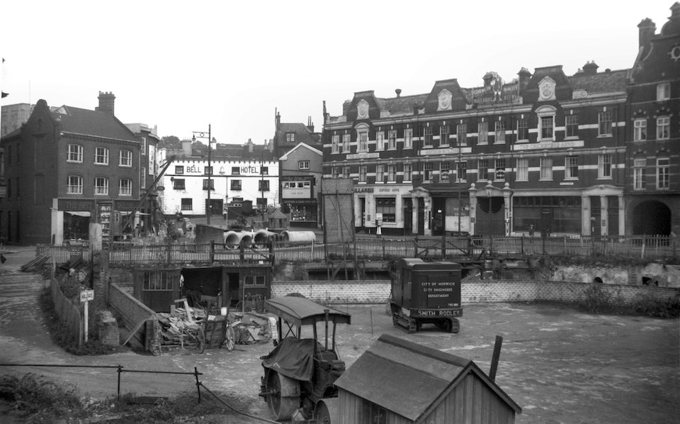
The ‘Debenhams’ site was originally occupied by a collection of buildings that became the Curl brothers’ department store. As the 1884 OS map shows (above), the site once contained The Rampant Horse Inn, which gave name to the street.

Rampant Horse mosaic in the doorway of Debenhams – a reminder of the ancient inn

Curls was badly damaged in the 1942 air raids and was rebuilt from 1953 to 1956. In the 1960s the store was bought by Debenhams but still traded as ‘Curls’ until the 1970s. Below, we look across the building site to the south side of Red Lion Street designed by Boardman and Skipper in the early 1900s.

Rebuilding the corner of Red Lion and Rampant Horse streets. ©georgeplunkett.co.uk

Walking westwards, Rampant Horse Street merges into Theatre Street, the site of Theatre Plain. An advertisement placed by Francis Noverre gives the address of his first annual ball as being in the Assembly Rooms on Playhouse Plain. Neither Playhouse Plain nor Theatre Plain seem to refer to the theatre immediately west of the Assembly House.

Theatre Street. The red arrow points to the Assembly House; the yellow arrow to the Theatre Royal

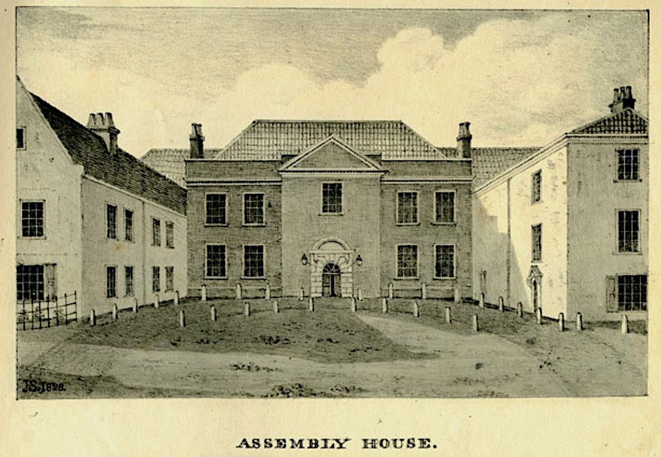
Millard and Manning’s map of 1830 shows Theatre Plain occupying the forecourt of the Assembly House.

Theatre Plain off Chapel Field Lane (now Theatre Street). Millard and Manning (1830).

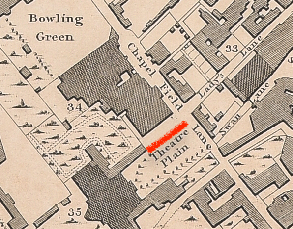
Somewhat ironically for a city claiming to have plains instead of squares, White’s Directory of 1845 refers to the space as Theatre Square [3]. This may be because we were now in an age when squares – unlike the irregular medieval spaces where streets collided – had been made fashionable by the development of polite Georgian London.

The Assembly House

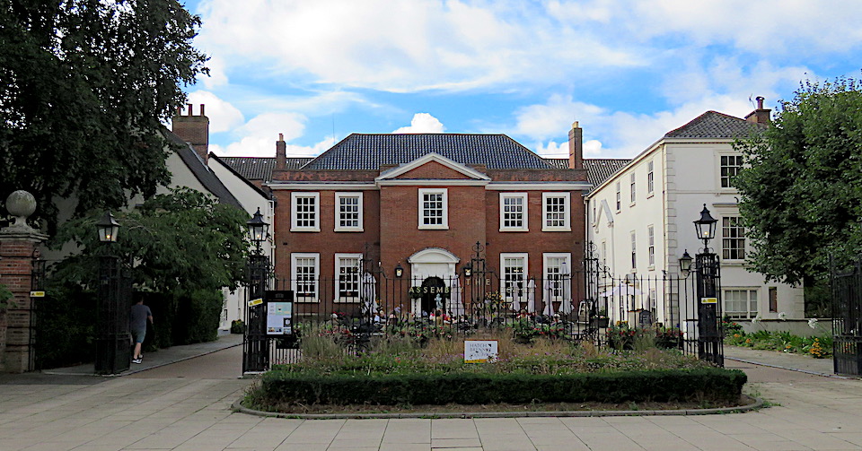
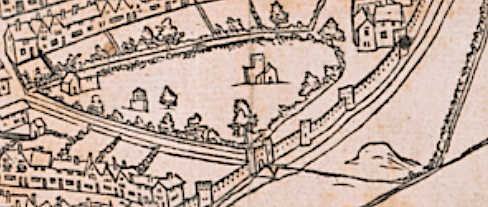
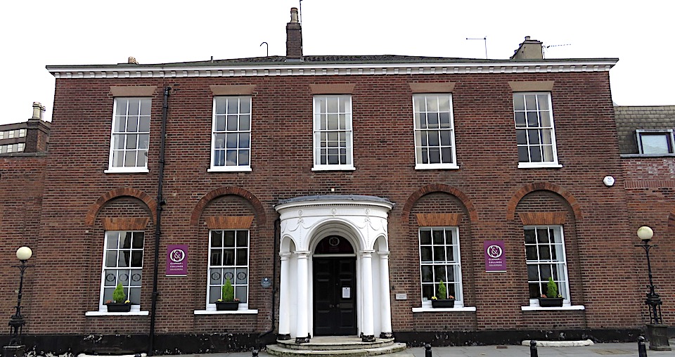
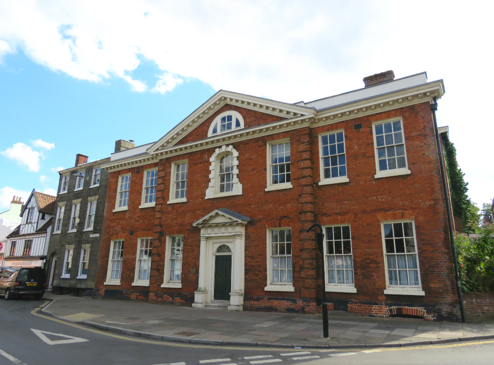
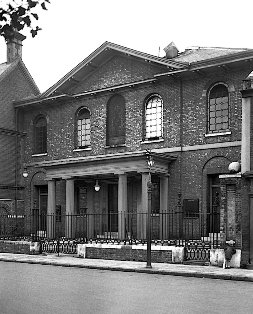
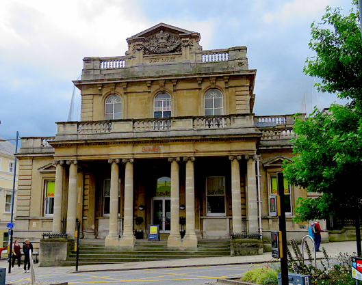
The Assembly House occupies a site established around 1250 as the College of St Mary-in-the-Fields. After the Dissolution, the church itself was demolished and in 1573 the remaining buildings converted by Sir Thomas Cornwallis into a town house, second only in size to the Duke of Norfolk’s Palace [3]. In 1609 the mansion was bought by the Hobart family who, in 1753, leased the building for public assemblies, for which purpose it was converted the following year by Thomas Ivory, the architect of Georgian Norwich. Rather than demolishing the old house, as once thought, it appears that he used a significant part – its central part and wings – in remodelling the ‘House of Assemblies’ [5].

The Assembly House by James Sillett 1828. ©Norfolk County Council at Picture Norfolk

In contrast to the popular entertainment offered in some of the larger inns around the marketplace, the Assembly House was where the gentry could come for a game of cards, a glass of wine and sometimes dance the minuet in polite surroundings. However, in Assize Week ‘the double doors between ballroom, card-room and tea-room were opened up, and country dances danced along the lengths of all three rooms’ [6]. Some scorned country dances as half an hour of standing still as long lines of paired dancers took their turn to run the gauntlet. But imagine the fun of galumphing the whole 143 feet beneath candle-lit chandeliers.

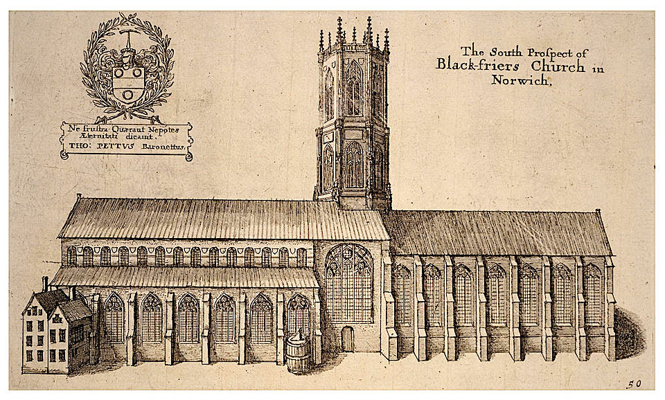
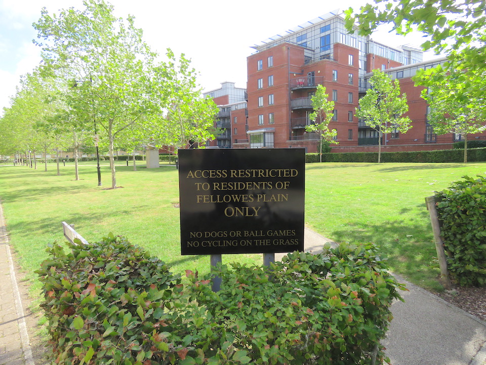
St Paul’s Plain no longer exists; it could have been restored after being damaged in the Blitz but was marked for destruction by the City Engineer’s 1944 plan for the inner and outer ring roads. The church was founded in the twelfth century as a hospital for poor strangers. It was  also recorded in the sixteenth century being used as a bridewell (prison) before William Appleyard’s house took over that function in what is now Bridewell Alley [7].

St Paul’s church in 1937 ©georgeplunkett.co.uk

The octagonal top of the tower, rebuilt with white bricks around 1819, survived the incendiary bombs in 1942. Had it been been saved it would be the largest of the city’s five round towers (just as St Benedict’s tower stands alone) but it stood in the way of post-war improvement and the site was cleared in preparation for the St Crispin’s Road flyover and the Barrack Street roundabout.

The 1970 flyover (left) and the Barrack Street roundabout superimposed approximately upon the 1884 OS map. St Paul’s at the left edge of the roundabout was demolished, leaving St Paul’s Square. St James’ church (right) survives as the Norwich Puppet Theatre.

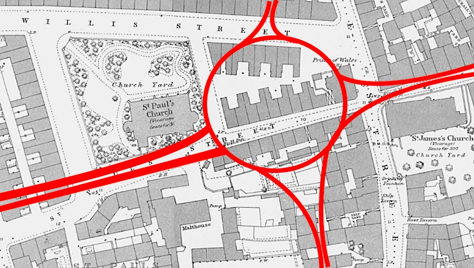
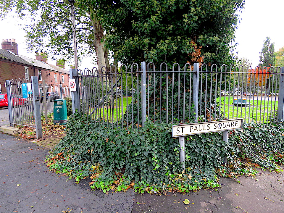
The site is now a small public garden and children’s play area. The evidence, though, for calling the space ‘St Paul’s Plain’ is slim. White’s Directory of 1845 describes it as ’the square called St Paul’s plain’ [3] and – surrounded by streets on four sides – it does look on Samuel King’s map of 1766 more like a square, albeit somewhat on the huh. ‘Square’ may work in this instance but is a poor definition of the other variously irregular open spaces we have seen. George Nobbs’ explanation comes closer: ‘In Norwich the term Plain is usually used to describe the area of a meeting of streets’ [8].

The playground in St Paul’s Square

In his short book on Norwich Plains, Richard Lane [3] generally found White’s Directory of 1845 to be a useful source of addresses as supplied by trade subscribers but he found no mention of St Benedict’s Plain. He wrote that one unnamed author mentioned it as the square where Pottergate, Willow Lane, Cow Hill and Ten Bell Lane met; ‘others’ defining it as the widening of Pottergate from Ten Bell Lane westwards. These two spaces are conjoined in the map below.

The general area of St Benedict’s Plain. Only the tower of St Benedict’s church (red star) survived the war. Ten Bell Lane is marked in yellow. The green star marks St Giles’ church standing high on Cow Hill. OS map 1899.

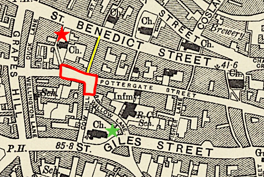
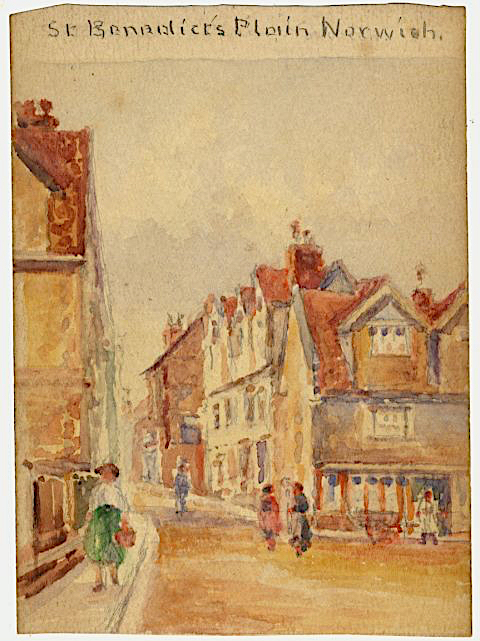
However, the National Archives records that the Norfolk and Norwich Eye Infirmary stood on St Benedict’s Plain from 1823-1854 [9]. And there is an early C20 watercolour entitled ‘St Benedict’s Plain’ by a local painter [10].

‘St Benedict’s Plain Norwich’ by Robert J Gedge, early C20. The artist looks eastwards down Pottergate with Cow Hill to the right ©somersetandwood.com

The Norfolk County Council’s Picture Norfolk site has a photograph labelled ‘St Benedict’s Plain/Pottergate’.

Photographer George Swain labelled this ‘St Benedict’s Plain/Pottergate’, 1937. The timber frame house does not survive and only the tower of St Benedict’s church, seen through the gap, remains. ©Norfolk County Council at Picture Norfolk

This photograph looks down to the plain from the junction of Cow Hill and Willow Lane …

Looking northwards down Cow Hill. Pottergate runs left-right at the bottom of the hill

… while this shows where Pottergate widens to the west of Cow Hill.

Yellow-painted Kinghorn House, named after a local Baptist minister ca 1800.

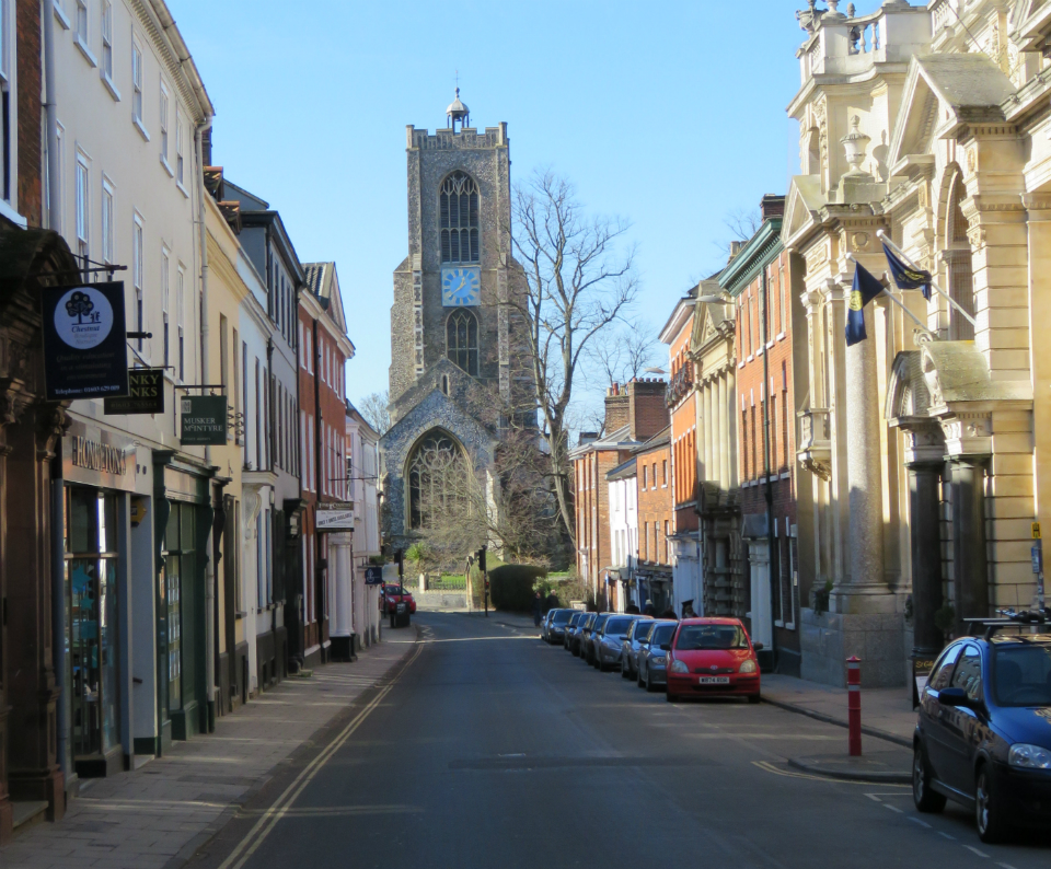
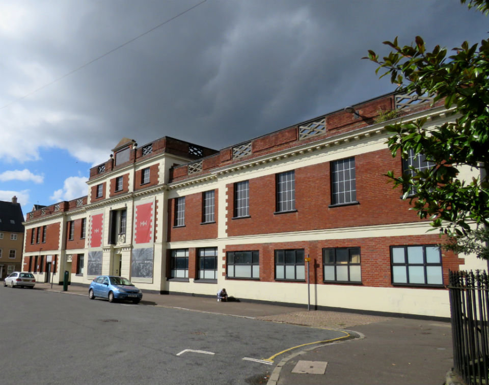
The legitimacy of St George’s Plain is beyond question for it is enshrined in Pevsner [11]. It is a part of Colegate, on which the Late Medieval and Georgian houses of the rich wool merchants still stand. On the 1886 OS map the plain appears as a widening of the road between a block labelled ‘Boot and Shoe Manufactory’ and the churchyard of St George’s Colegate.

St George’s Plain ringed in red. St George’s Colegate, red star. The green arrow points down St George’s Street, over the river to the present-day Norwich University of the Arts. OS map 1886.

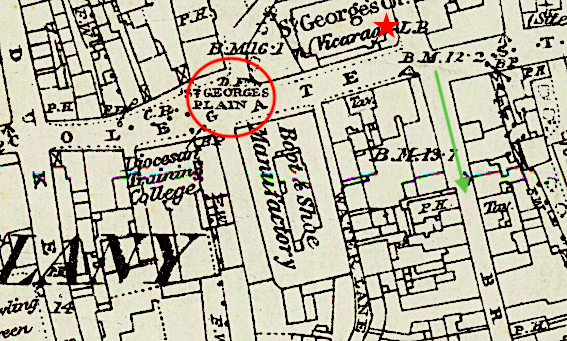
The ‘Boot and Shoe Manufactory’ was Howlett and White’s factory, once the country’s largest producer of footwear under one roof. Viewed from the west end of Colegate, the seven bays up to the tower were built by Edward Boardman in 1876; left of the tower is Boardman’s extension of 1894, making a facade of 200 feet [11]. In 1909 the company introduced the brand name Norvic and in 1935 the business itself was renamed the Norvic Shoe Company Ltd [12]. Norvic, short for Norvicensis, is the address adopted by each Bishop of Norwich but it can be traced back to a time before the Normans raised the cathedral. In the preceding Anglo-Scandinvian period, this defended trading settlement, or wic, on the north bank of the river was sufficiently stable to mint its own coins and to stamp them Norvic. Colegate is part of that north wic.

Howlett & White’s Norvic factory on St George’ Plain, facing St George’s Colegate. Below the factory tower, which separates two phases of expansion, is a carved brick canopy (red arrow)

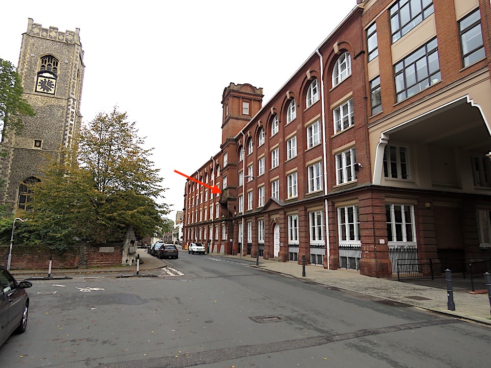
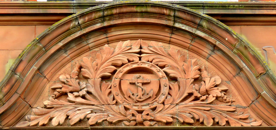
That carved brick canopy, probably by Guntons of Costessey, contains an upright anchor not to be confused with the tilted anchor of Bullards Brewery across the river. The expansion of the factory absorbed two lanes that had led down to the riverside; the upright anchor commemorates Water Lane, marked on the OS map above.

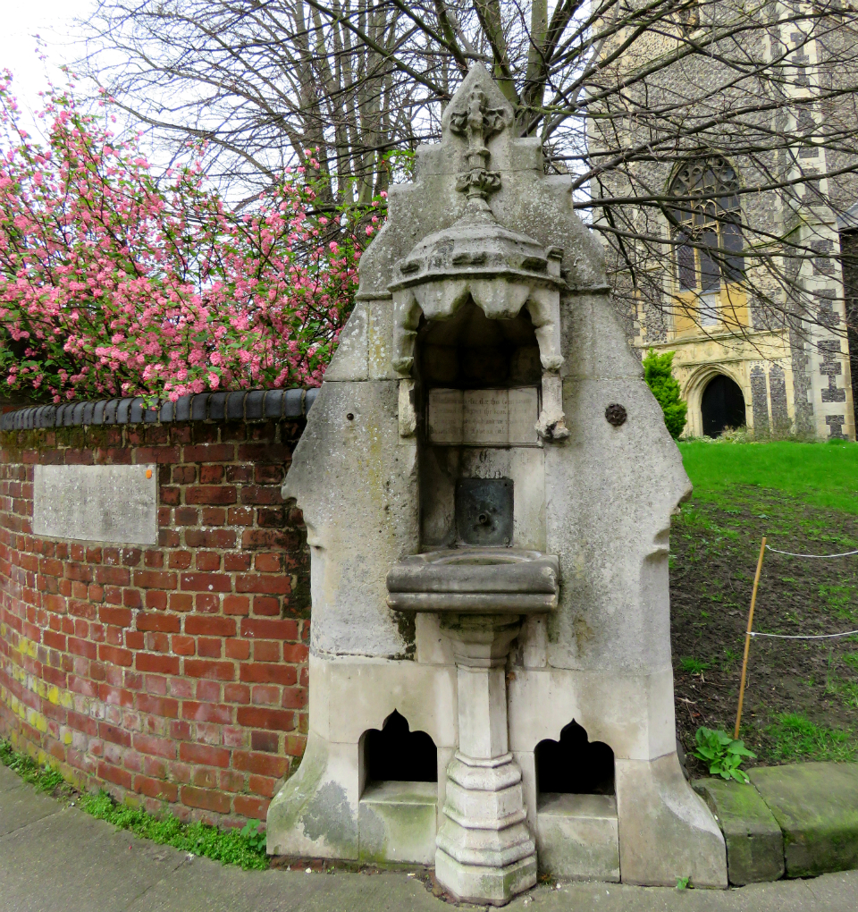
On the north-east corner of this expanded area of Colegate, adjacent to St George’s churchyard, is a piece of street furniture that we’ve seen before – a public water fountain with a marble basin for people and troughs below for dogs [13].

ColegateFountain.jpg
Fountain sculpted by J Stanley of Norwich, installed in 1860

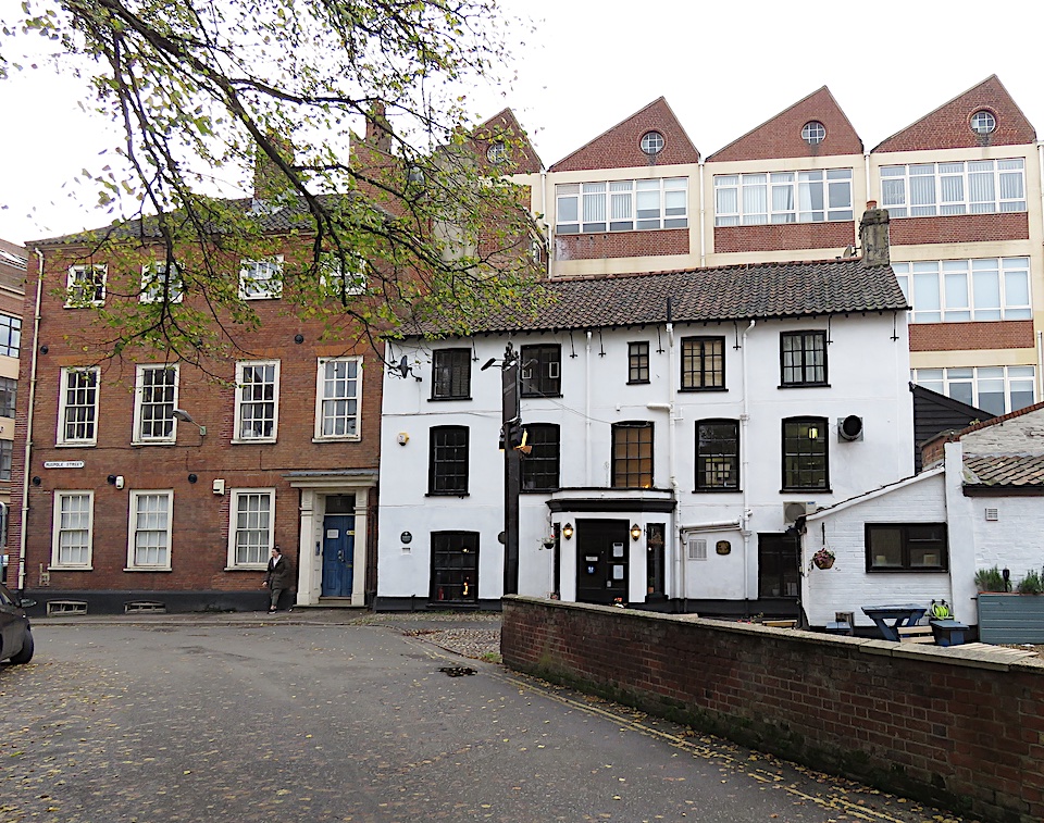
The red brick wall to the left of the fountain marks the junction between Muspole Street and St George’s Plain. A little way up Muspole Street, on the opposite side, is a pub whose various names relate to the wool that made Norwich wealthy: Crown and Woolpack (1740s); Wool Packet (1760s); Old Woolpack (2016) and The Gatherers (opened 2020). This was once the site of the town house of the Augustinian Priory of Our Lady of Walsingham, conveyed to John the Prior in 1298. The present building is Georgian with a nineteenth century pub front [14].

From the late nineteenth century, the employment provided by factory-based shoe-making took over from the more fragmented weaving industry that had sustained the city for centuries but by the early 1800s our textile trade was being outcompeted by the power mills of the north. Below, the two trades are represented by the pub and its association with wool, and by the saw-tooth roofline of the Norvic-Kiltie shoe factory that overlooks it. Howlett & White had bought the business from local shoe manufacturer SL Witton Ltd. [12], completing their domination of this part of Norwich-over- the-Water.

The Gatherers on Muspole Street with the Norvic-Kiltie factory to the rear. St George’s Plain is to the left.

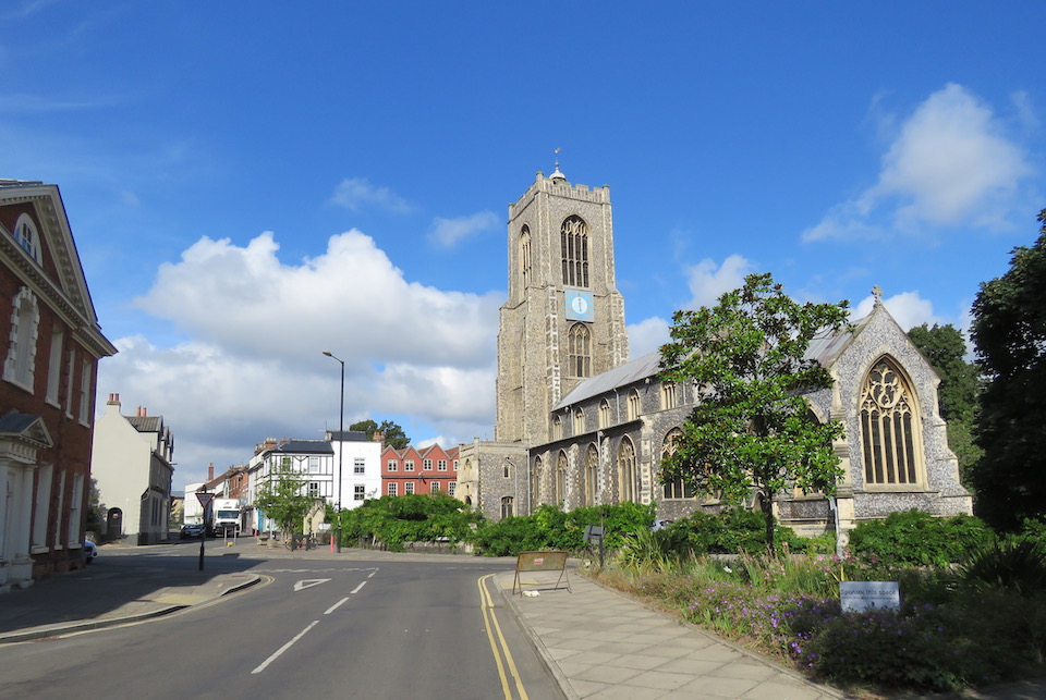
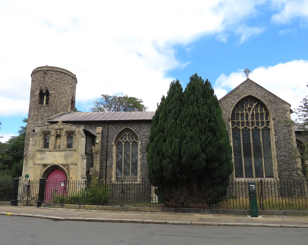
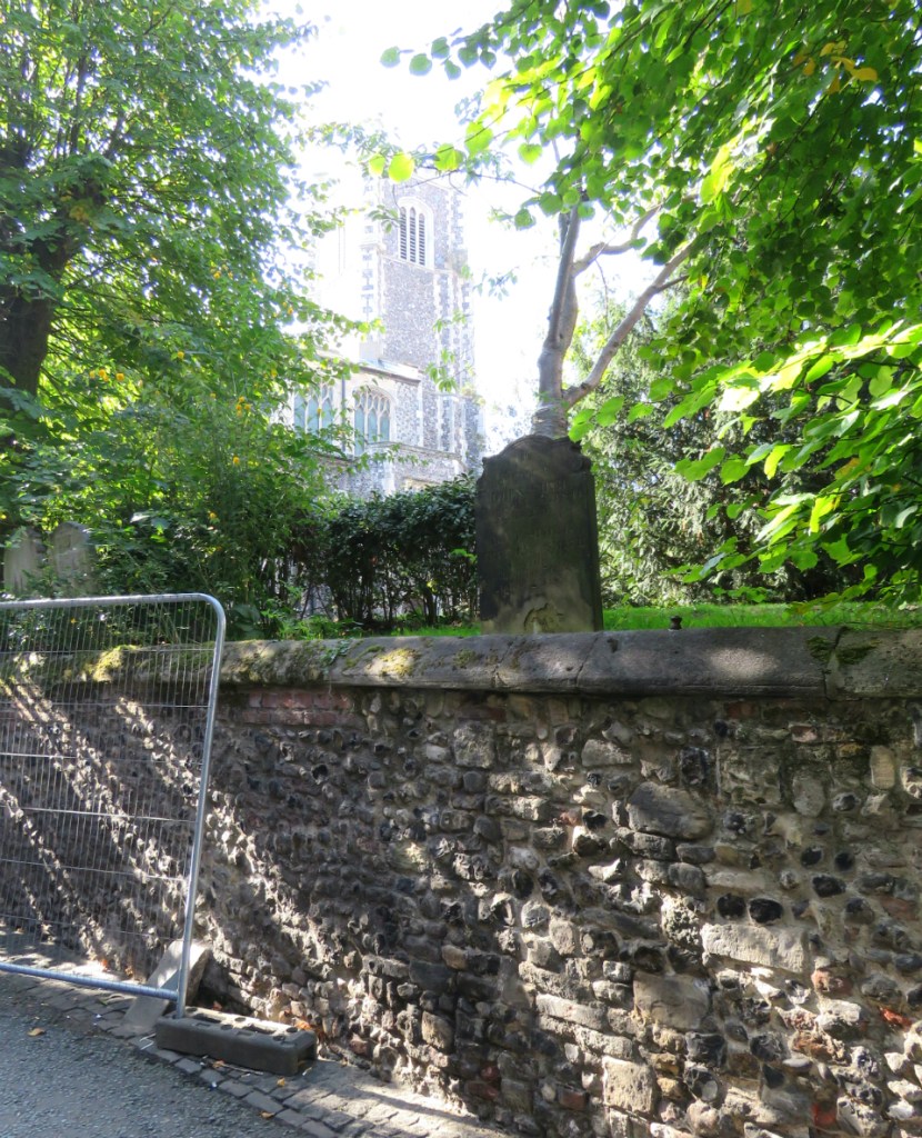
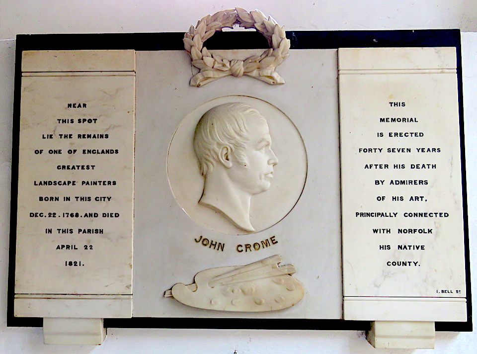
St George Colegate (c1459) is a fine church with austere Georgian furnishings. It was one of the few things in the city that architectural commentator Ian Nairn could persuade himself to like. John Crome, co-founder of the Norwich School of Artists, is buried here.

IMG_1472.jpg

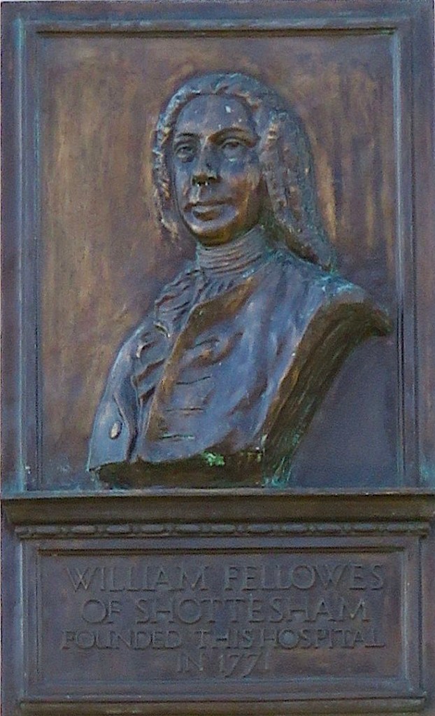
Postscript After this was published, a reader informed me that the space outside The Forum in the city centre is named Millennium Plain – a latter-day plain to add to University Plain and the three on the old Norfolk and Norwich Hospital site.

©Reggie Unthank 2020

Something for the Christmas stocking? ‘Colonel Unthank and the Golden Triangle’, which describes the development of south Norwich by the Unthank family, has been recently reprinted and can be ordered by mail by clicking these links: Jarrold’s Book Department (bookorders@jarrold.co.uk) and City Bookshop (citybookshopnorwich.co.uk).

Colonel Unthank AD.jpg

Sources

  1. https://colonelunthanksnorwich.com/2020/09/15/the-plains-of-norwich/
  2. https://colonelunthanksnorwich.com/2020/10/15/norwich-city-of-the-plains/
  3. Richard Lane (1999). The Plains of Norwich. The Larks Press, Dereham.
  4. https://colonelunthanksnorwich.com/2020/08/15/twentieth-century-norwich-buildings/
  5. https://colonelunthanksnorwichdotcom.files.wordpress.com/2020/12/d9567-ahtbooklet.pdf
  6. Marc Girouard (1990). The English Town. Pub: Yale University Press.
  7. http://www.georgeplunkett.co.uk/Norwich/mediaevalcitychurches.htm
  8. George Nobbs (1978). Norwich: City of Centuries. Pub: George Nobbs Publishing, Norwich.
  9. https://www.nationalarchives.gov.uk/hospitalrecords/details.asp?id=472
  10. https://somersetandwood.com/robert-j-gedge-st-benedicts-plain-norwich-early-20th-century-watercolour-jn-601
  11. Nikolaus Pevsner and Bill Wilson (1997). The Buildings of England: Norfolk 1: Norwich and North-East. Pub: Yale University Press.
  12. Frances and Michael Holmes (2013). The Story of the Norwich Boot and Shoe Trade. Pub: Norwich Heritage Projects.
  13. https://colonelunthanksnorwich.com/tag/street-furniture/
  14. http://www.norfolkpubs.co.uk/norwich/wnorwich/ncwpk1.htm

Share this:

  • Facebook
  • Twitter
  • Pinterest
  • Email
  • Print

Like this:

Like Loading...

Norwich, City of the Plains

15 Thursday Oct 2020

Posted by reggie unthank in Norwich buildings, Norwich history

≈ 13 Comments

Tags

Baedeker Raids on Norwich, Norwich Plains

London has its famous residential squares, built to enclose green space and clean air against the awfulness outside. These enclaves mainly arose during the Georgian and Victorian periods and from the outset were part of the designed urban landscape.

Bloomsbury Square 1787. Image: English Heritage

Norwich, on the other hand, has very few formal, rectangular spaces. In this second post on Norwich Plains we try to define these irregular spaces by contrasting them with more formal squares.

The Anglo-Scandinavian marketplace, Tombland (meaning empty space), and the Norman marketplace that superseded it, are both rectangular but neither of these was called a ‘plain’ for they pre-dated the arrival of the Dutch who gave the name to our open spaces. And although we can point to several isolated Georgian gems there was never sufficient development within the confines of a medieval street plan (if ‘plan’ is the word) to add up to an eighteenth century square. The nearest thing to a London-like square is the Cathedral Close.

The Lower Close, looking east.
Georgian terrace on south side of the Lower Close

Before the word ‘close’ was appropriated by twentieth-century developers for their suburban cul-de-sacs, the name related more specifically to the area around an ecclesiastical building enclosed – cloistered – behind the precinct gates. It may never have been an appropriate name for the more casual, un-green places outside the cathedral walls. Norwich plains are irregular, rather tentative spaces that seem to have arisen where several medieval streets collide. Some plains have been so eroded by tramways, traffic-bearing roads, World War II and general ‘improvement’, that we may wonder whether they existed at all.

St Catherine’s Plain is one such open space. It was the land surrounding the pre-Conquest church of St Catherine that was given to the nuns at Carrow by King Stephen. Now it is one of Norwich’s lost churches and its demise can be traced to the plague that almost depopulated the parish; by the time of the historian Blomefield (1705-1752) it consisted of just one house [1].

Cuningham’s map of Norwich, 1558, showing the lost church of St Catherine, at centre

At the southern end of Queen’s Road, between the twentieth century junction with Surrey Street (formerly St Catherine’s Lane) and the following junction with Finkelgate, is a treed area still marked with an older-style cast-iron sign.

Finkelgate connects with the south end of Ber Street, which was once called St. Catherine’s Street [1]. The map below also shows a St Catherine’s Lane and a St Catherine’s Hill, emphasising that the district of St Catherine’s was at one time more extensive than we may now realise.

St Catherine’s Close, enclosing the church (purple star). Red line marks St Catherine’s Lane (now the continuation of Surrey Street); blue line marks St Catherine’s Hill. Green star = St Catherine’s Plain. Blue Star = St Catherine’s Close. Yellow star = All Saints’ Plain. Ber St runs along the right edge; modern-day Queen’s Rd to the left. Millard & Manning’s 1830 Plan of Norwich. Courtesy of Norfolk County Council
St Catherine’s Plain from the junction of Surrey Street with the widened Queen’s Road, which has absorbed some of the plain [2]

Walking down Surrey Street to the junction with All Saints’ Green we come to a fine building designed by local architect Thomas Ivory who is responsible for several of the high points of Georgian Norwich. This is his St Catherine’s Close (1780) – a name once given to the place where the parsonage had stood [1] . The Adam-style porch was damaged when the area was bombed during World War II and is a replacement [3].

St Catherine’s Close (or House) by Thomas Ivory, completed by his son William. Marked with blue star on the map above. Now the offices of solicitors Clapham & Collinge

Just east of this house is All Saints Green that, as marked by the yellow star in the 1830 map above, was once known as All Saints Plain. On Samuel King’s map of 1766 this open space is labelled All Saints Green – a name by which it is known today. It appears there was a fluidity in naming places. King’s map also gives the space the alternative name of ‘Old Swine Market’ but by 1806, when Blomefield’s History of Norwich was published, the hog market had moved to the castle ditches.

All Saints Green/Old Swine Market. Samuel King’s Plan of Norwich 1766

Born 1844 in Ludham, Robert Herne Bond owned a shop in Ber Street and bought adjoining properties that allowed him to extend through to All Saints’ Green [4]. One of these buildings started life as the Thatched Assembly Rooms before being converted to a ballroom then a cinema. Bond converted it back to a ballroom for his staff and it was also used as a restaurant and furnishing hall. The ‘Thatched’ was destroyed by incendiary bombs in 1942. Immediately the war ended, Bond’s son, the architect J Owen Bond, replaced this collection of vernacular buildings with a Streamline Moderne department store. In 1982, Bonds of Norwich was taken over by John Lewis [5].

Bonds at 21 All Saints’ Green, photographed in 1935. ©georgeplunkett.co.uk

St Giles’ Plain. The provisional nature of some of the Norwich plains is apparent from Richard Lane’s book The Plains of Norwich. White’s Directory of 1845 does not, he writes, list St Giles’ Plain in the street guide despite several traders giving their address there [2]. Nor could I find it on the 1884 OS map, the Millard & Manning 1830 map, Cole’s 1807 and King’s 1766. This is not to say that the plain didn’t exist but that locals were more ready than mapmakers to use the local name for these open spaces.

St Giles-on-the-Hill with Upper St Giles ahead, Churchman House left. Cleveland Street cuts left-right across the plain.

The church stands at the intersection of Upper St Giles and St Giles Streets, Cow Hill and Bethel Street, with Willow Lane to the rear. The area outside the church would have looked more tranquil before the 1970s when Cleveland Street joined the plain, bringing traffic off the Grapes Hill roundabout and the Inner Link Road.

St Giles church, red star. Cleveland Road (yellow) was built in the C20. Samuel King’s map 1766

Until the Conquest, the settlement’s main axis ran north-south, from Magdalen Street, through Tombland, to King Street. The Normans changed this by developing the ‘French Borough’ westwards from their Castle and Marketplace. Two Norman streets from the market converged at St Giles: Lower Newport (now St Giles Street) and Upper Newport (now Bethel, formerly Bedlam, Street).

The church is situated on a hill, 85 feet above sea level. If you were to stand on top of the magnificent tower you would be 205 feet above the sea; not as tall as the county’s high point, Beeston Bump (344 feet), but still dizzyingly elevated for Norfolk. Two thirds up the tower the single clock-face points down St Giles’ Street to the Guildhall, next to the marketplace. With a diameter of ten feet the dial should have been easy to see although visibility was improved in the mid-C19 by the addition of a six and half feet minute hand.

StGiles.jpg
St Giles’s single clock-face, from St Giles Street

Facing the south side of the church, across the plain, is Churchman House built in 1727 for Alderman Thomas Churchman and remodelled in 1751 by his son Sir Thomas. According to Pevsner &Wilson this is ‘the very best Georgian house in Norwich’ [3].

ChurchmanHse.jpg

For two years (1875-7), Churchman House was the first home of the Norwich School for Girls before it moved to the Assembly House and then to its present location on Newmarket Road in 1933 [2]. After the girls moved out in 1877, Churchman House was bought by Dr Peter Eade, sheriff and three times mayor. Dr Eade was an eminent citizen, being Chief Physician at the Norfolk and Norwich Hospital, on St Stephen’s Road. He was also first President of the Norwich Medico-Chirurgical Society at a time when meetings would be held on the night of a full moon to help members return home safely.

Sir Peter Eade. Courtesy: Jarrold & Sons Ltd

Dr Eade was also embroiled in the affair of Sir Thomas Browne’s skull, that I recently wrote about [6]. Physician and philosopher Thomas Browne, the city’s most famous citizen of the seventeenth century, was buried in the chancel of St Peter Mancroft. In 1840 his skull was stolen when his coffin was broken open during the burial of the vicar’s wife. After some years the skull was bequeathed to the Norfolk and Norwich Hospital Museum where, despite numerous requests for its return, it stayed until 1922. Peter Eade ‘must have been one of the leading figures behind the hospital’s refusal to return the skull’ [7]. At the time, skulls of the famous were used for phrenology, the pseudo-scientific name for ‘reading the bumps’ – the dubious procedure for deducing personal characteristics from the shape of the cranium. Yet while Eade the Physician fought against the restoration of the skull, Eade the Mayor championed the commission for Browne’s statue, which was installed in the Haymarket in 1905 [7].

St Mary’s Plain feels more of an open space than others in Norwich-over-the-Water, possibly because of the borrowed elbow room provided by the large churchyard.

St Mary’s Plain, off the north end of present-day Duke Street. Millard & Manning’s 1830 Plan of Norwich. Courtesy of Norfolk County Council

The plain takes its name from St Mary-at-Coslany, Coslany (or island with reeds) being one of the four original Anglo-Saxon settlements on which the city is based. On the belfry, the double openings with the recessed shaft reveal the church’s Anglo-Saxon origins. It is probably the oldest in Norwich [3].

St Mary-at-Coslany where John Sell Cotman was baptised in 1782

Until the late C19 the area consisted of ‘noxious courts and alleys’ [2] but all this was to change dramatically in the following century. Norwich-over-the-Water housed many light-industrial factories and was bombed several times during the Baedeker Raids. In 1942 the church was badly damaged by incendiaries.

From far left: St Mary’s Baptist Church; the thatched Pykerell’s House adjacent to Zoar Strict and Particular Baptist Chapel; the red-brick St Mary’s Works; and hidden by the tree, the tower of St Mary-at-Coslany.

Above, just visible to the left, is St Mary’s Baptist Chapel. It dates from 1951 although various versions had stood on this site since 1745. Below, is the chapel on the 12th of September 1939.

St Mary’s Baptist chapel, 12th September 1939 ©georgeplunkett.co.uk

War had been declared against Germany on the 3rd September 1939. A week later, fire swept through the Baptist church but this was not caused by enemy action – a hint of the damage can be seen on the roof. Rebuilt to the original design, the church was opened again a year later but in June 1942 was completely gutted, this time as a result of the Baedeker bombing campaign. The church we see today was opened in July 1951 (see [8] for the detailed history of this area and of wartime bomb damage).

The Baedeker raids of 1942 also claimed medieval Pykerell’s House, named after an early C16 Sheriff and three-times mayor. Extensively restored, it is one of only six thatched houses left in Norwich. Surprisingly, I can find no reports that its conjoined but unthatched neighbour – Zoar Strict and Particular Chapel – suffered any damage in the blaze. In evading the Luftwaffe’s incendiary bombs the church was echoing its biblical namesake, Zoar, one of the five cities of the plain (the Dead Sea Plain) to escape the fire and brimstone that destroyed Sodom and Gomorrah.

It is intriguing that Zoar, a small Baptist chapel, should be sited so close to the large, general Baptist Chapel further along the plain. This break-away branch of the Baptist faith is ‘strict and particular’ in allowing only those baptised by immersion to receive communion.

The shape of the plain as we saw it on King’s map of 1766 was further changed in the 1920s. Then, old slum dwellings were demolished to make way for St Mary’s Works, home to Sexton, Son and Everard, one of the city’s large shoe-making factories. But it, too, was extensively damaged in 1942 by the summer bombing campaign. The building was restored but the business closed in 1976 and now it awaits redevelopment.

StMarysWorks.jpg

Postscript

In researching the city’s open spaces I came across an article that gave insight into the extent to which the cathedral’s brethren fulfilled their moral obligation to feed the poor [9].

Cathedral precinct. Upper Close outlined in red. Erpingham Gate (purple) and St Ethelbert Gate (yellow). Almary House leading onto Almary Green (blue star). 1885 OS map

Almary Green is not named for the Virgin Mary but because of its proximity to the Almonry. The Almoner’s House and Almonry Green are situated in the south-west corner of The Close conveniently near the paupers soliciting alms at St Ethelbert’s Gate. Here, the almoner had his own granary, distinct from the priory’s Great Granary. This separation ensured that the needy were fed mainly rye or ‘horse’ bread to accompany their soup or pottage based on pulses while wheat from the other store was used to make the white bread eaten by the brethren. From the accounts, the monks appeared to have eaten and drunk in ‘truly heroic quantities’. Bread and ale comprised about half their diet while fish and meat (but little dairy and no fruit and vegetables) made up the other half. Modern nutritional guidelines suggest the paupers had the better deal.

Almary Green and 1-4 The Close, Norwich Cathedral

In 1422, on Maundy Thursday, sufficient supplies were distributed to feed 5,688 poor. And on the anniversary of the death of the founder, Herbert de Losinga, around 10% of the annual allocation of rye, peas and barley was doled out in one day. It is not clear how the remainder was distributed throughout the rest of the year. In 1310-11, 33,000 loaves, 28,500 portions of pottage and 216,000 gallons of weak ale were given to the poor. If no food was distributed outside the charity season then the soup kitchen could have catered for around 1350 persons, possibly served by the monks. If, however, food was provided throughout the year then the almoner could have fed around 500 paupers a day [9]. Despite the fact that Norwich was a relatively wealthy city it is clear that a large part of the population required social care and it was the church that provided it before the Elizabethan Poor Laws.

Sources

  1. https://www.british-history.ac.uk/topographical-hist-norfolk/vol4/pp120-145
  2. Richard Lane (1999). The Plains of Norwich. Pub: The Larks Press, Dereham.
  3. Nikolaus Pevsner and Bill Wilson (1997). The Buildings of England. Norfolk I: Norwich and the North-East. Yale University Press.
  4. http://www.georgeplunkett.co.uk/Norwich/agr.htm#Allsg
  5. https://colonelunthanksnorwich.com/2020/08/15/twentieth-century-norwich-buildings/
  6. https://colonelunthanksnorwich.com/2020/07/15/thomas-brownes-world/
  7. http://www.racns.co.uk/sculptures.asp?action=getsurvey&id=307
  8. http://www.georgeplunkett.co.uk/Norwich/stj.htm#Stmap
  9. Philip Slavin (2012). Bread and Ale for the Brethren. In, Studies in Regional and Local History vol 11. Pub: University of Hertfordshire. https://www.academia.edu/3346435/Bread_and_Ale_for_the_Brethren_The_Provisioning_of_Norwich_Cathedral_Priory_1260_1536

Thanks

The main source for this post has been Richard Wilson’s excellent book on Norwich Plains. As ever, I am grateful to Jonathan Plunkett for generously allowing access to his father’s collection of C20 photographs of Norwich.

Share this:

  • Facebook
  • Twitter
  • Pinterest
  • Email
  • Print

Like this:

Like Loading...

The Plains of Norwich

15 Tuesday Sep 2020

Posted by reggie unthank in Norwich buildings, Norwich history

≈ 11 Comments

Tags

Kett's Rebellion, Norwich Plains

I recently came across that quotation by Dorothy Parker about members of the Bloomsbury Group living in squares, painting in circles and loving in triangles. They couldn’t have done that in Norwich for although we have circles and triangles we don’t have squares. Instead, we have plains, an import from the Low Countries. 

In modern Amsterdam, a ‘plein’ is an open rectangular space surrounded by buildings

Plains aren’t restricted to Norwich for you’ll stumble across them in Norfolk and Suffolk; I came across this one in Great Yarmouth.

Hall Plain, just off the Quayside in Great Yarmouth

It was in 1566 that the Fourth Duke of Norfolk requested Queen Elizabeth’s permission to invite ‘thirty Douchemen’ to help revive Norwich’s flagging textile trade. The following year this trickle became a flood when Protestants from the Spanish Netherlands escaped the religious intolerance of Philip II of Spain [1]. But the word ‘plain’ for an open space predated these arrivals: Nicholas Sotherton’s eye-witness account of Kett’s 1549 rebellion refers to ‘the playne before the pallace gate’ [2] so the word was an earlier introduction, part of the city’s already long association with the Low Countries.

‘The playne before the pallace gate’. Looking out from the gate of the Bishop’s Palace towards St Martin at Palace Plain. Cotman’s house is the tallest of the red brick buildings, the churchyard of St Martin at Palace is to the right

St Martin at Palace Plain – now the site of the Wig & Pen pub and John Sell Cotman’s house – was the site of a pitched battle between the King’s forces and Robert Kett’s men.

St Martin at Palace Plain. The church of St Martin at Palace is marked with a cross. The gate to the Bishop’s Palace is marked with a star and a plaque marking the death of Lord Sheffield is further along the Cathedral wall (arrow). 1884 OS map courtesy of [3]

Lord Sheffield fell from his horse and, as was the custom, he removed his helmet expecting to be ransomed. Instead, he was bludgeoned to death by a butcher named Fulke. Sheffield and 35 others were buried in the adjacent church. 

In his book The Plains of Norwich, Richard Lane wrote that only five of the fifteen Norwich plains are officially marked by a street sign; St Martin’s at Palace Plain is one of them as is Agricultural Hall Plain, at the east end of Castle Meadow [4].IMG_2805

At one time the castle was ringed by various livestock markets for which the Agricultural Hall of 1882 provided formal focus. The sloping plain outside the Hall stands at the top of Prince of Wales Road, a wide, curving street.  It was built in 1865 to connect Norwich Thorpe Railway Station to the city; it was never finished as planned and is only graceful in parts.  However, the buildings on the plain at the top of the road ‘dignify the new entry to the city’ [5].  From the left (below) we see: part of Barclays Bank – a huge banking hall designed like a Roman palazzo by the local firm of E Boardman & Son with Brierley & Rutherford of York (1929); next, a monument to the Boer War – the statue of Peace sculpted by George and Fairfax Wade (1904); then the Royal Hotel, another local masterpiece by the Boardmans (1896-7), decorated in  moulded red brick from Gunton’s Costessey Brickworks [6]. To the right we get a glimpse of the Agricultural Hall itself. It was built in 1882 in local red brick and alien red Cumberland sandstone, again relieved with decorative Cosseyware.

The Agricultural Hall was inaugurated in 1882 by the Prince of Wales, the future King Edward VII, who was Patron of the Norwich Fat Cattle Show Association. This was the year that Oscar Wilde started his lecture tour of America where one of his topics was ‘The House Beautiful’. Two years later he came to the Agricultural Hall to deliver the same lecture, no doubt well received by cattlemen on both sides of the Atlantic.

The Agricultural Hall

Just visible to the left is the former Crown Bank of 1866 built by Sir Robert Harvey. As we saw in The Norwich Banking Circle, Harvey named his Crown Bank after the Crown Point estate, just outside the city at Whitlingham. The estate was bought from the aptly named Major Money – intrepid balloonist and someone who had served in the army at Crown Point fort in North America.

Harvey shot himself after his dubious investments discredited the bank. The crown carved into the pediment of the Crown Bank then doubled as an appropriate symbol for the Post Office until 1970

Before we leave Agricultural Hall Plain we should take some cheer from knowing that Laurel and Hardy stayed in the Royal Hotel in 1954.

Looking out from the Hall (now Anglia TV), across Agricultural Hall Plain, is its conjoined twin – Bank Plain.

Bank Plain, with the balcony of a Boardman building to the immediate left, the turreted Royal Hotel in the distant left, the Agricultural Hall ahead and the former Barclays Bank to the right.

On the site now occupied by the former Barclays Bank stood its predecessor, Gurney’s Norwich Bank, established in the late C18.

Gurney’s Bank and the adjacent Bank Plain. Courtesy of the Library at Friends’ House

At the time, the open space was called Redwell Plain but after Gurney’s opened it became known as Bank Plain. The well is still commemorated in Redwell Street, which runs between Bank Plain and St Andrew’s Street.

img_2728
In 1899, E Boardman & Son designed this Classical building for the Royal Insurance Company. It stands at the junction of Bank Plain and Queen Street, where the Boardmans’ own offices were situated in Old Bank of England Court.
Edward Boardman’s sign, carved from Costessey clay. Old Bank of England Court, Queen Street

Today, it is possible to travel to St Andrew’s (Hall) Plain by following the bend in the road down the hill to Suckling House/Cinema City. But, as the map shows, this extension of St Andrew’s Street did not exist in 1884; it was created so that the new electric trams, which ushered in the twentieth century, could avoid the tight corner where Redwell Street meets Princes Street.

The curved line shows the approximate route of the new tramway constructed in 1900, joining Bank Plain to the plain outside St Andrew’s Hall. 1884 OS map courtesy of [3]

Garsett House – also known as Armada House since it was reputedly built from the timbers of a ship wrecked during the Spanish Armada – was bisected in the process.

The right-hand side of Armada House, also known as Garsett House (Sir Robert Garsett d.1611), was demolished to make way for the electric trams. Note the overhead wires.
St Andrew’s Hall Plain. This scene was prior to 1892 when a public lavatory was built in the curved piece of wall. ©Norfolk County Council at Picture Norfolk

St Andrew’s Hall is the nave of what was the Blackfriar’s or Domican church of Norwich – the most complete surviving medieval friary in England. Present-day Blackfriars Hall was formerly the friars’ chancel and, as the map above indicates, was also once the church of the Dutch-speaking community [1].

The engraving by Wenceslas Holler (1607-1677) shows the nave and chancel meeting beneath an octagonal tower that collapsed in 1712. Home to the ‘Order of Preachers’, as the Dominican Friars are known, the large internal volume of St Andrew’s Hall was designed for spreading the word [7]. Outside, St Andrew’s Plain was also used as a preaching yard but during Kett’s Rebellion it witnessed less peaceable activity for it was on the plains, rather than the tortuous medieval alleyways, that pitched battles could be fought. Sotherton saw the rebel bowmen let loose ‘a mighty force of arrowes’… ‘as flakes of snow in a tempest’ but Captain Drury’s band of arquebusiers, with their early versions of the musket, replied with ‘such a terrible volley of shot (as if there had been a storm of hayle)’, leaving about 330 dead [2]. St Andrew’s Hall was used as stables until the uprising was quelled.

Maddermarket Plain is one of the city’s smaller plains [4]. It is situated at the junction of St Andrew’s Street, Duke Street, St John Maddermarket (formerly St John’s Street) and Charing Cross. The latter two names provide a thumping clue to the history of this district. ‘Charing Cross’ is thought to be a corruption of ‘shearing’ – the process where the raised pile on woollen cloth was cut to a standard height with shears. ‘Madder’, of course, refers to the red/deep pink dye derived from madder roots and used to colour fabric the famous ‘Norwich Red’.

Maddermarket Plain at the end of the raised graveyard of St John Maddermarket. Charing Cross is circled; the red dot marks the site of Michael Stark’s dyeworks adjacent to Duke’s Palace Bridge. The church of St John’s Maddermarket is marked XIX. Millard & Manning’s Plan of the City of Norwich 1830

The Charing Cross/Westwick Street area was at the heart of the textile industry [4] and the river was where its waste products ended up. Just above Charing Cross on the map is Fuller’s Lane – fulling being a process in which cloth is cleaned. In a previous post [8] we saw that in the C19 the master dyer Michael Stark emptied his dye vats into the Wensum from his factory next to the Duke’s Palace Bridge but this kind of pollution had been happening for centuries. On his journeys through England in 1681 Thomas Baskerville noted that the duke’s great townhouse was ‘seated in a dung-hole place’, surrounded by tradesmen cleaning and dyeing cloth [9]. The palace was later abandoned.

At the beginning of the 1500s, Norwich had been devastated by two fires that destroyed over 1000 houses [10]. The extent of the damage was such that some 70 years later the mayor was discussing how to deal with unrestored plots. When Queen Elizabeth I visited Norwich in 1578 she commented on the number of derelict properties despite the steps taken to shield her from the worst. To convey her from the Marketplace to the Cathedral (centuries before Exchange Street was open) the east wall of St John’s Maddermarket was rebuilt in order to widen the street [4].

In 1671 John Evelyn noted that the city’s churchyards were filled to the tops of the walls. Today the wall, perhaps the one rebuilt for Queen Elizabeth I’s visit, awaits repair.

 In his book, Richard Lane [4] skips forward a few centuries to end with the last recorded plain of the twentieth century. This is University Plain, the site of the University of East Anglia where Sir Denys Lasdun built his 1960s paean to concrete. You might imagine the plain to be an open meeting space, such as the amphitheatre-like Central Court, but it appears to refer to the large site as a whole.

University Central Court and waterfall 1990 ©georgeplunkett.co.uk

The use of the word ‘plain’ continues into the twenty-first century. In 1771 William Fellowes, a wealthy and philanthropic squire, built in Shotesham (ca. eight miles south of Norwich) what is claimed to be the earliest cottage hospital in England. Benjamin Gooch was the first surgeon and he, together with Fellowes, went on to propose a new general hospital for the city of Norwich. Designed by local architect William Ivory, the Norfolk and Norwich Hospital was built just outside the city wall at St Stephen’s Gate on land provided by the council at a nominal rent. Fellowes laid the foundation stone in 1771 and it was completed in 1775.

Memorial plaque to William Fellowes on the former N&N Hospital in St Stephen’s Road

In 2003 a new hospital was built on the outskirts of Norwich at Colney leaving the old N&N site to be developed for housing by Persimmon Homes on the newly-coined Fellowes Plain [11].

The Norfolk and Norwich Hospital, refurbished in the C19 by Edward Boardman

The word ‘plain’, as applied to Fellowes Plain, seems to refer to the entire site although three open spaces within this are named ‘plain’ in their own right. The first is Kenneth McKee Plain, dedicated to Ken McKee CBE (1906-1991), orthopaedic surgeon at the N&N who pioneered the total hip replacement.

Kenneth McKee CBE, sculpted by his daughter in law, Gina McKee 1988. Courtesy racns website [12]

The second is Edward Jodrell Plain. Dozens of searches provide no insight beyond repeating the salient fact that he was a major benefactor. The Jodrell family of Bayfield Hall, near Holt, were known to have been benefactors to the N&N [13]. As far back as 1814 Henry Jodrell left £200 to the hospital in his will. His nephew Edward (1785-1852) and Edward’s son Captain Edward Jodrell have the necessary forename but it was Captain Jodrell’s youngest son Alfred who seems best remembered for his philanthropy. He sent baskets of fruit and vegetables each week to the hospital and at Christmas gave 40 oven-ready chickens and the same number of turkeys, underlining the Jodrells’ tradition of giving to the Norfolk and Norwich Hospital.

The third plain on the site of the old hospital is the large green known as Phillipa Flowerday Plain.

Variously spelled ‘Phillipa’ or ‘Philippa’, the former is the spelling given in the UK 1881 National Census for Phillipa Flowerday, ‘sick nurse’.

Before being employed by Colmans at their Carrow Works, Phillipa Flowerday (1846-1930) trained and worked as a nurse at the Norfolk and Norwich Hospital. According to Rod Spokes, former Colmans manager, when the company’s dispensary was founded in 1864 a man was employed to visit male employees at home and report on cases of need. In 1872, Phillipa was employed to visit the families of the workpeople as well as assisting the doctor in the dispensary. She is therefore celebrated as the first industrial nurse in the country [14].

Phillipa Flowerday far right. Image courtesy of Norfolk Record Office at www.picture.norfolk.gov.uk

To be continued …

©2020 Reggie Unthank

Sources

  1. https://colonelunthanksnorwich.com/2019/08/15/going-dutch-the-norwich-strangers/
  2. https://archive.org/stream/kettsrebellionin00russuoft/kettsrebellionin00russuoft_djvu.txt
  3. http://www.norwich-heritage.co.uk/norwich_maps/Norwich_map_1884_zoomify.htm
  4. Richard Lane (1999). The Plains of Norwich. Pub; Lanceni Press, Fakenham.
  5. Nikolaus Pevsner and Bill Wilson (1997). The Buildings of England. Norfolk I. Norwich and North-East. Pub: Yale University Press.
  6. https://colonelunthanksnorwich.com/2016/05/05/fancy-bricks/
  7.  https://historicengland.org.uk/listing/the-list/list-entry/1220456
  8. https://colonelunthanksnorwich.com/2018/07/15/the-bridges-of-norwich-1-the-blood-red-river/
  9. https://colonelunthanksnorwich.com/2018/12/15/the-absent-dukes-of-norfolk/
  10. https://colonelunthanksnorwich.com/2019/12/15/norwich-shaped-by-fire/
  11. https://en.wikipedia.org/wiki/Norfolk_and_Norwich_Hospital
  12. http://www.racns.co.uk/sculptures.asp?action=getsurvey&id=797
  13. https://en.wikipedia.org/wiki/Bayfield_Hall
  14. https://en.wikipedia.org/wiki/Philippa_Flowerday

Thanks: I was inspired to write this post by Richard Lane’s excellent book on Norwich Plains and I have drawn upon it freely. I am grateful to Clare Everitt of Picture Norfolk for permissions and the George Plunkett website for the use of photographs. I am grateful to Rod Spokes for information about the Colmans dispensary.

Share this:

  • Facebook
  • Twitter
  • Pinterest
  • Email
  • Print

Like this:

Like Loading...

Enter your email address to follow this blog and receive notifications of new posts by email. It's free, no junk.

Join 3,471 other followers

Recent Posts

  • Parson Woodforde and the Learned Pig
  • A postscript on Eaton Nurseries
  • The Nursery Fields of Eaton
  • Vanishing Plains
  • Parson Woodforde goes to market
  • Norwich, City of the Plains
  • The Plains of Norwich
  • Twentieth Century Norwich Buildings
  • Thomas Browne’s World
  • The angel’s bonnet
  • After the Norwich School
  • A few of my favourite buildings
  • James Minns, carver
  • The Norwich Banking Circle
  • Behind Mrs Opie’s medallion
  • Norwich: shaped by fire
  • Street Names #2
  • Street names
  • The Norwich School of Painters
  • Going Dutch: The Norwich Strangers
  • The Captain’s Parks
  • Norfolk’s Napoleonic Telegraph
  • Catherine Maude Nichols
  • The Norfolk Botanical Network
  • City Hall Doors # 2
  • City Hall Doors # 1
  • Late Extra: The Norwich Pantheon
  • Pleasure Gardens
  • The absent Dukes of Norfolk
  • Nairn on Norwich
  • The Norwich Way of Death
  • Norwich: City of Trees
  • The Bridges of Norwich Part 2: Around the bend
  • The Bridges of Norwich 1: The blood red river
  • Norwich knowledge (libraries)
  • Street furniture: palimpsests
  • Putting Norwich on the map
  • Clocks
  • Faces
  • The Norwich coat of arms
  • New book: Colonel Unthank and the Golden Triangle
  • The Pastons in Norwich
  • Reggie through the underpass
  • Gildencroft and Psychogeography
  • Bullards’ Brewery
  • Post-medieval Norwich churches
  • The end of the Unthank mystery?
  • Barnard Bishop and Barnards
  • Public art, private meanings
  • Colonel Unthank rides again
  • Three Norwich Women
  • The flamboyant Mr Skipper
  • When Norwich was the centre of the world*
  • Arts & Crafts pubs in the C20th
  • Entertainment Victorian style
  • Jeckyll and the Japanese wave
  • Dragons
  • Decorative tiles
  • Hands off our bollards!
  • Stained Glass: Arts & Crafts to Art Nouveau
  • Angels in tights
  • Norwich’s pre-loved buildings
  • Flint buildings
  • Entrances and Exits (Doors II)
  • Early doors: Tudor to Georgian
  • Fancy bricks
  • Thomas Jeckyll & the Boileau Family
  • Art Nouveau in Great Yarmouth
  • Skipper’s Art Nouveau Building
  • The sailing ship as an Arts & Crafts motif

Recent Comments

reggie unthank on Parson Woodforde and the Learn…
reggie unthank on Fancy bricks
Huw Sayer - Business… on Parson Woodforde and the Learn…
Barbara W. Santos on Fancy bricks
reggie unthank on Parson Woodforde and the Learn…
Don Watson on Parson Woodforde and the Learn…
reggie unthank on Parson Woodforde and the Learn…
John Fielding on Parson Woodforde and the Learn…
reggie unthank on Parson Woodforde and the Learn…

Archives

  • February 2021
  • January 2021
  • December 2020
  • November 2020
  • October 2020
  • September 2020
  • August 2020
  • July 2020
  • June 2020
  • May 2020
  • April 2020
  • March 2020
  • February 2020
  • January 2020
  • December 2019
  • November 2019
  • October 2019
  • September 2019
  • August 2019
  • July 2019
  • June 2019
  • May 2019
  • April 2019
  • March 2019
  • February 2019
  • January 2019
  • December 2018
  • November 2018
  • October 2018
  • September 2018
  • August 2018
  • July 2018
  • June 2018
  • May 2018
  • April 2018
  • March 2018
  • February 2018
  • January 2018
  • December 2017
  • November 2017
  • October 2017
  • September 2017
  • August 2017
  • July 2017
  • June 2017
  • May 2017
  • April 2017
  • March 2017
  • February 2017
  • January 2017
  • December 2016
  • November 2016
  • October 2016
  • September 2016
  • August 2016
  • July 2016
  • June 2016
  • May 2016
  • April 2016
  • March 2016
  • February 2016
  • January 2016
  • December 2015

Follow me on Twitter

My Tweets

previous posts

  • About
  • Contact
  • Posts
  • Unthank Book
Follow COLONEL UNTHANK'S NORWICH on WordPress.com

Enter your email address to follow this blog and receive notifications of new posts by email. Your details remain private.

Join 3,471 other followers

Blog at WordPress.com.

Cancel

 
Loading Comments...
Comment
    ×
    loading Cancel
    Post was not sent - check your email addresses!
    Email check failed, please try again
    Sorry, your blog cannot share posts by email.
    %d bloggers like this: