The Norwich coat of arms

Tags

, , ,

Coats of arms designed to identify groups of soldiers in the heat of battle were also used  by towns and cities to identify themselves and the source of their authority.

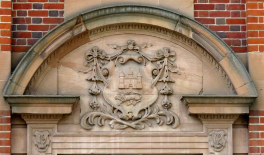
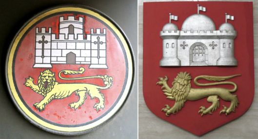
Both symbols on the Norwich coat of arms are martial and point to a long relationship with the crown that conferred certain privileges upon the city. This civic coat of arms is described as: Gules, a castle triple-towered and domed argent; in base a lion passant guardant Or”. Simply put: red shield, domed silver castle, gold lion. There are, however, many stylistic variations: as often as not the castle towers aren’t domed.
lions2.jpg

Undomed or domed. The Norwich City coat of arm in the City Hall (1938). Left, on the Bethel Street door to the Treasurer’s Department and right, inside the ‘Rates Hall’

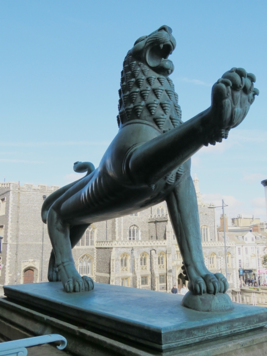
The castle, of course, is Norman but it was about a century after the Conquest that the city’s lion appeared during the reign of the Plantagenets. The association between the lion and the English crown seems to have begun during the reign of King John but it was John’s older brother, Richard the Lionheart, who is particularly associated with the lion passant guardant  [1]; that is, walking with forepaw raised (passant) and head turned to the left, full face (guardant). This is the version of the animal that figures on all of the city’s heraldic devices. Except … guarding the entrance to the City Hall, Alfred Hardiman’s Assyrian-influenced bronze lions are two of our finest civic sculptures but they are at odds with other Norwich lions in not looking looking towards us. This may be because the architects saw an Assyrian lion exhibited at the British Empire Exhibition of 1936 before they commissioned its twin [2].
lion.jpg

Staring straight ahead, one of Alfred Hardiman’s lions (1938) outside the City Hall [3]

The connection with Richard I relates to the charter of 1194 in which he allowed citizens to elect their own Reeve – equivalent to the ‘president’ of the borough [4]. The foundation of self-government is usually dated to Richard’s charter even though there may have been a degree of municipal independence before this [5].

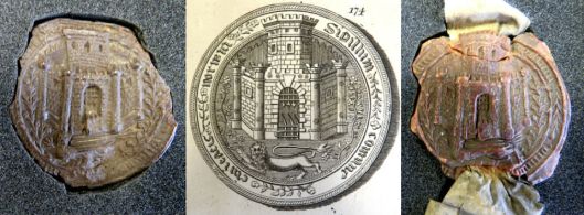
The Guildhall, which is the largest medieval civic building outside London, was built 1407-1412 in order to administer the self-governing powers conferred upon the city by Henry IV. The king’s charter of 1404 granted county status to the city and, like London, allowed the citizens to elect a mayor [6]. Documents issued by the council were authenticated with the city’s coat of arms in the form of a wax seal applied either directly or pendent.
seal trio.jpg

Left and right: early C15 wax seals from Colman’s Collection Norfolk Record Office COL5/1. Centre: “The Common, or City Seal, now in use” Blomefield 1806 [6]
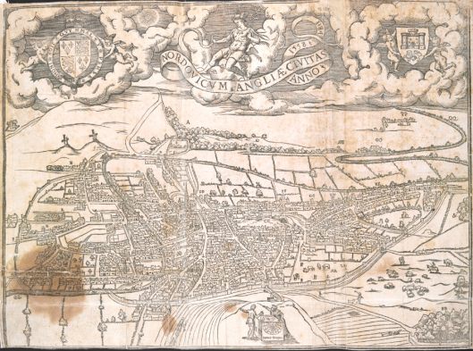
The city’s proud status as ‘civitas‘, a form of city state, is acknowledged in Cuningham’s 1558 map of Norwich, which is probably the earliest surviving printed map of any English town or city.

Map of Norwich1.jpg

Map of Norwich by citizen William Cuningham, ‘Doctor in Physicke’ 1558 (British Library)

In the top right corner we can see the castle and lion augmented by two supporters who, as we will see, appear in various guises through the city’s history.

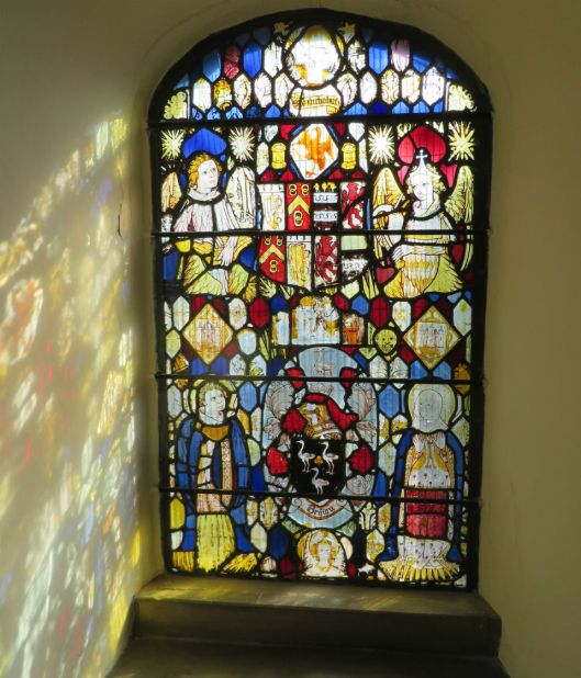
Map of Norwich Small.jpgA century prior to this, around 1450, the alderman John Wighton – whose stained glass workshop made the great east window of St Peter Mancroft – glazed the window of the council chamber in the Guildhall. He did this for the mayor and wealthy wool merchant Robert Toppes who ran his business from Dragon Hall in King Street [see 7 for a fuller account of the Norwich School painted glass].
Toppes window.jpg

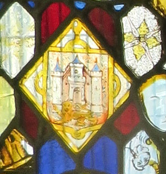
Between the two angels is Toppes’ own coat of arms, dwarfing the city coat of arms in the lozenges beneath each angel.
Toppes small.jpg

City coat of arms mid C15, from the Toppes window in the Guildhall

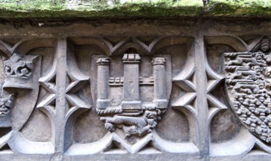
Opposite the rear entrance to Cinema City, the city arms can be seen amongst a series of 13 shields carved at the east end of St Andrew’s church and dated to the rebuilding of the church 1500-1506.
StAndrews.jpg

Norwich arms on St Andrew’ Church ca 1505. Note the simplified castle and the contrary lion

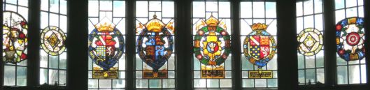
A fine C16 example of the city coat of arms can be seen in Surrey House, the early C20 building designed for Norwich Union by George Skipper. The stained glass is a relic from the Earl of Surrey’s house that previously stood on this site in what is now Surrey Street.

MarbleHall2.jpg

From the Earl of Surrey’s C16 house in Surrey Street, Norwich

The Earl of Surrey, Henry Howard, son of the Duke of Norfolk, was called “the most foolish proud boy that is in England” and it was pride that led to his downfall. Surrey was brought up in Windsor Castle with Henry VIII’s illegitimate son Henry Fitzroy. The king came to believe that Surrey – a staunch anti-Protestant – was planning to usurp Henry VIII’s legitimate son, Edward VI, when he inherited the crown. The trigger, though, appeared to be when Surrey flaunted his descent from English royalty by attaching (quartering) the arms of Edward the Confessor to his own. He was executed for treason in his thirtieth year but his father, who was to have shared that fate, was saved when Henry VIII died the day before the planned execution [8].

Against this background of excessive pride associated with coats of arms, the other armorial glass in the Ante Room of Surrey House [9] takes on an extra layer of meaning.
surrey arms.jpg

Around 1900, three marble mosaics of the city arms were installed in the entrances to civic buildings: the Guildhall, Norwich Castle and the Technical Institute (now Norwich University of the Arts). But I can find no record of the Italian craftsmen living around Ber Street who were reported to have made them.

three coats of arms.jpg

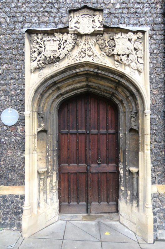
On the south side of the Guildhall is the Bassingham Gateway, originally from the London Street house of John Bassingham, a goldsmith in the reign of Henry VIII. When London Street was widened in 1855-7 the gateway was bought by William Wilde for £10 and inserted in the Magistrate’s Entrance of the Guildhall [10].
BasshmGate.jpg

By comparing this with George Plunkett’s 1934 photograph of the doorway [10], the crisp carving would appear to be part of a postwar renovation. The lion is now decidedly oriental with the castle’s crenellations resembling lotus leaves.

BasshmLion.jpg

Although there are minor variations in the way they are depicted, the castle and the lion are constants in the city’s arms. More variable are the supporters – the flanking figures that appear on some versions of the arms. In Cuningham’s map of 1558 (above) they appeared as cherubs.

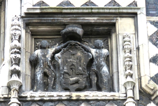
In 1511 the roof of the mayor’s chamber in the Guildhall collapsed and in the rebuilding of 1535-7 the chequerboard of the eastern façade received coats of arms; the city arms of castle and lion were now protected by armed angels with an indeterminate shape hovering over the shield [3].
Guildhall A.jpg

The city arms; one of three coats of arms on the east end of the Guildhall. (The central arms [not shown] were those of Henry VIII but are no longer legible)
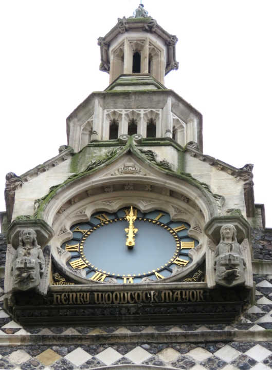
Above this coat of arms on the east wall is a clock turret dated 1850, dedicated to mayor Henry Woodcock.  Flanking the clock face are two unarmed angels, each clasping the city arms.

GldhlAngel.jpg

Curiously, the gilded inscription at the lower edge of the clock gives the motto of the Dukes of Norfolk (Sola Virtus Invicta, Only Virtue is Invincible) who, for a long time, had had no connection with the city or county [3]
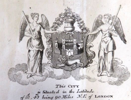
An illustration in Blomefield’s authoritative book on the history of Norwich [6] also has two angels as supporters, this time armed, but the object above the shield is difficult to read in this form.

Arms plus angels.jpg

The Arms of the City of Norwich. From Blomefield [7] 1806

Hudson and Tingey’s 1906 book on Norwich history [4] also shows the shield flanked by two guardian angels and in this case the object above the arms resolves as a hat. One source describes this as a warden yeoman’s hat (yeoman warder’s?) [2], another as a fur cap [12]. After posting this article, former Sheriff Beryl Blower told me this may be the mayor’s ceremonial Cap of Maintenance and I see that Blomefield says that the cap of maintenance is worn by the sword-bearer on all public occasions.

CoA Angels.jpg

The Norwich City Arms embossed on the cover of Hudson and Tingey, 1906 [4] 
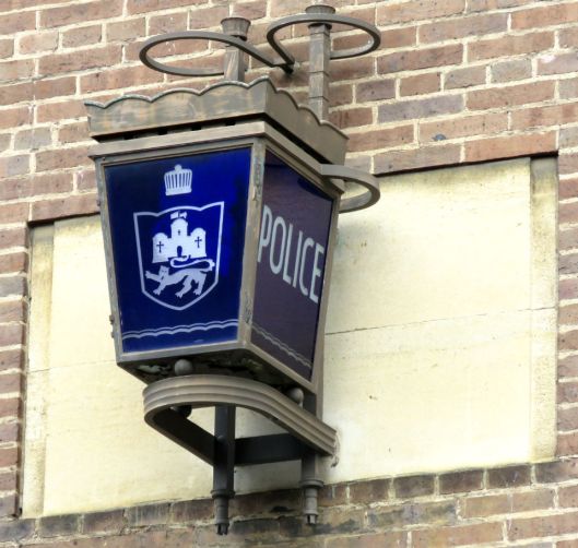
The hat also appears on the blue lamp on the police station, which is attached to the west side of the City Hall, but no guardian angels.

blue lamp2.jpg

Police Station, Bethel Street 1938

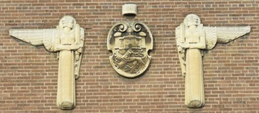
The City Hall itself is Coat-of-Arms Central; there were even plans for the tower to be topped with an angel before it was cut for reasons of cost [3]. The city arms appears above the entrance to the City Treasurer’s Department in Bethel Street with all its accoutrements: the hat and Art Deco angels flanking a traditional coat of arms.
Norwich Arms.jpg

By Eric Aumonier who also designed Art Deco sculpture for the London Underground

Examples of the ‘full set’ can also be seen on the engraved glass window above the stairs leading up from the ground floor of the City Hall…

CityHallGlass1.jpg

Designed by Eric Clarke and painted by James Michie [13]

… above the mayor’s chair in the council chamber…

AboveMayorsChair1.jpg

… and on Lutyens’ war memorial, facing the City Hall on St Peter’s Street.
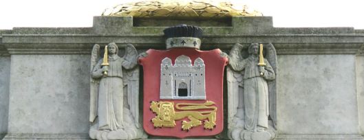
LutyensMemorialNorwich1.jpg

The additional elements (hat and angels) that appeared  some time after the original granting of the lion-and-castle arms do complicate what was once a simple and effective design. The College of Arms does not recognise the the flanking angels; by dispensing with the supporters the cartoon-like arms on these two mid-C20 projects marked a return to simplicity (although the question of whether or not to dome the castle is still not solved).

Lion Duo.jpg

Domed or undomed? Left, Hewitt School; right, Alderson Place, Finkelgate. These two civic projects were supervised by City Architect David Percival ca 1958

The right-hand version of the city arms also appears on Percival’s 1960 redevelopment on Rosary Road.

IMG_9626.jpg

Added 5/10/18

© 2018 Reggie Unthank

Colonel Unthank Ad jpeg.jpg

Sources

  1. https://en.wikipedia.org/wiki/Lion_(heraldry)
  2. Nobbs, G. Norwich City Hall (a booklet from the City Hall, private imprint and undated but published for the 50th anniversary of the 1938 opening).
  3. Cocke, R. (2013). Public Sculpture of Norfolk and Suffolk (photography by Sarah Cocke). Pub: Liverpool University Press.
  4. Hudson, W. and Tingey, J.C. (1906). The Records of the City of Norwich vol 1. Pub: Jarrolds.
  5. Meeres, F. (2011). The Story of Norwich. Pub: Phillimore & Co Ltd.
  6. https://en.wikipedia.org/wiki/Norwich_Guildhall
  7. Blomefield, F. (1806). An essay towards a topographical history of the County of Norfolk. Vol III Containing the History of Norwich. Pub: W Miller, London.
  8. https://colonelunthanksnorwich.com/2015/12/19/norfolks-stained-glass-angels/
  9. https://en.wikipedia.org/wiki/Henry_Howard,_Earl_of_Surrey
  10. http://www.norfolkstainedglass.co.uk/Norwich_Union/ante_room.shtm
  11. http://www.georgeplunkett.co.uk/Norwich/guildhall.htm
  12. http://www.ngw.nl/heraldrywiki/index.php?title=Norwich
  13. https://historicengland.org.uk/listing/the-list/list-entry/1210484

Thanks to Clive Cheesman, Richmond Herald of the College of Arms for information about the Norwich coat of arms. 
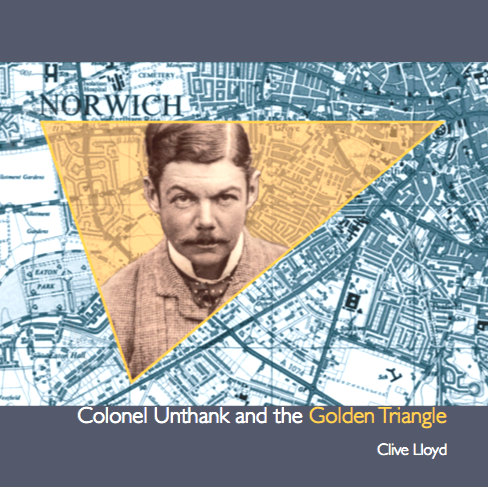
New book: Colonel Unthank and the Golden Triangle

Tags

, , ,

Cover Ping.png

Running through  a triangular district of Norwich’s Victorian terraced housing is Unthank Road; it took its name from the family who owned a large estate there in the nineteenth century. When I moved to the road I was intrigued by the urban myth that a nearby stretch of very tall wall was the last remnant of the Unthank estate. In researching this story (and finding an unexpected answer) I uncovered more about the history of the Golden Triangle. This book describes how the Triangle developed and how many of the street names originated. Newly discovered photographs of the Unthanks bring to life the founding fathers of this neighbourhood. Published December 15th 2017. 56 pages £10.

Stockists

City Books, Davey Place Norwich.  PRESS HERE to Order online

Jarrold’s book department, Exchange Street, Norwich  https://www.jarrold.co.uk/departments/books

The Pastons in Norwich

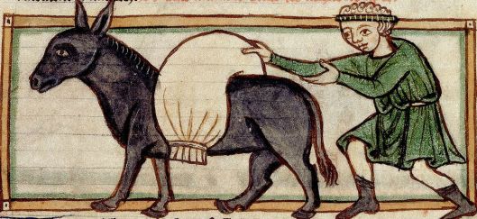
The story starts with Clement Paston (d1419), from the village of Paston about 20 miles north-east of Norwich. He was “a good, plain husband” whose lowly station in life was illustrated by the fact that he had to ride, “to mill on the bare horseback with his corn under him” [1]. Clement’s humble origins, probably as a bondman not entitled under feudal law to own land, were to be used against his descendants as they rose to prominence.

Man and horse.jpg

Courtesy BL Harley 3244

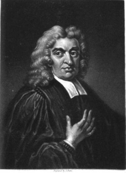
We know much about the rise of Norfolk’s Paston family from the cache of letters left in the C18 by the last of the line, William Paston 2nd Duke of Yarmouth. This correspondence gives unique insight into one family’s life (1422 to 1509), illustrating how – in the long period following the halving of the population by the Black Death – the descendants of a feudal serf could become elevated to the aristocracy. But it was probably the weakness of this foundation that led to the later Pastons being assailed by the Dukes of Norfolk and Suffolk who disputed their title to land.

Francis Blomefield.jpg

In the C18 the Norfolk antiquarian Francis Blomefield acquired part of the Paston Letters from the estate of William Paston 2nd Duke of Yarmouth

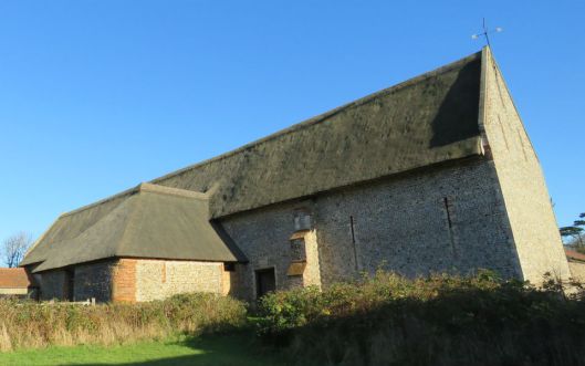
With the assistance of his brother-in-law, Clement was able to provide a grammar school education for his son William who then studied law in London and eventually became a Judge of Common Pleas [1, 2]. In addition to purchasing land in the village of Paston,  William bought his favourite manor Oxnead in 1419 and Gresham Castle in 1427 [1, 3]. Eventually, the successors of a man troubled by transporting his own corn would be able to build one of the largest barns in the county.

PastonBarn.JPG

The 70m long Paston Barn in the village of Paston, Norfolk

paston barn.jpg

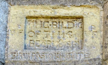
“The Bildg of this Bearn 1581 Sir W Pasto(n) Knighte”

William married Agnes Barry and they had four sons and a daughter. The first was John Paston I (1421-1466), another lawyer, who married the redoubtable Margaret Mautby. They named two of their sons John: John II (1442-1479) and John III (1444-1504), not just to flummox future antiquarians but probably in honour of Margaret’s father, John, and possibly of a relative of hers who would play an unwitting part in the Paston’s troubled history – Sir John Fastolf.

Although much of the story revealed in the Paston Letters was set in the county, the Pastons had a significant presence in the city of Norwich. A green plaque announces that John Paston lived in a house on King Street after 1478 (presumably, therefore, John III). This was in what is now the oldest dwelling house in the city – Jurnet’s House, named after the Jewish trader who arrived here in the C12th [4]. It was rare at the time for being built of stone.

JurnetsHouse.JPG

Jurnet’s House or Music House, King Street, where John  Paston lived in the C15. Now it is Wensum Lodge Adult Education Centre

John I and Margaret had a house on Elm Hill where some of the Paston Letters were probably written.

“There is not a single house in Elm Hill which could be disturbing” [5]

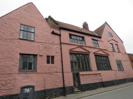
However, this house was destroyed in 1507 by a fire that raged in the street for four days [6]. The present house on the site, the Strangers Club, was built after the fire by Sheriff of Norwich and three-times mayor, Augustine Steward. [For a fuller account of Elm Hill read the excellent Norwich Trails PDF].

Paston House Norwich.JPG

Paston House, now the Strangers’ Club on Elm Hill

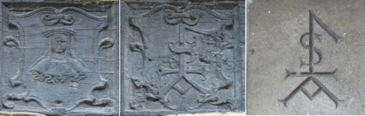
The beam above the alleyway into Crown Court Yard (to the left, above) has crisp carvings at either end relating to the cloth merchant (mercer) Steward.

steward trio.jpg

Left: the Mercers’ Maiden, the mark of the Mercers’ Company [7]; centre: Augustine Steward’s personal insignia; right: Steward’s mark on modern tablet in nearby Tombland Alley, on the side of Augustine Steward’s House

Augustine Stewards House.JPG

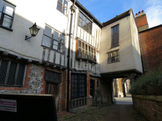
Augustine Steward’s House (1549) from Tombland Alley, a short distance from his re-built ‘Paston House’ in Elm Hill. The Erpingham Gate to the cathedral can be glimpsed through the entry.

Adjacent to Steward’s House, facing Tombland, is Samson and Hercules House. The eponymous heroes holding up the porch are now thankfully painted white after their years of humiliation while painted red to advertise a lobster restaurant. This house, with four Norwich lucams, was built in 1656 on the site of a house owned by the Pastons’ relative, Sir John Fastolf. In yet another of those coincidences so frequent in this densely historic city, Fastolf could have looked across the road to the effigy of another soldier mentioned in Shakespeare, Sir Thomas Erpingham, as he knelt in his niche above the cathedral’s Erpingham Gate (see previous post [8]). Erpingham’s posture at prayer might have been to counter the claim that he was a Lollard (pre-Reformation objector to practices of the Catholic Church) – a claim also levelled at Sir John Fastolf [9].

Tombland Norwich.JPG

The Erpingham family contributed large sums of money to the lengthy restoration of the Blackfriars’ church in nearby St Andrew’s Plain, which was damaged by fire in 1413 [10]. John and Margaret Paston’s Norwich house was closer to the damaged church and they paid for the roof beams and for the hammer beams in St Andrews Hall. The nave of the old friary church is now known as St Andrew’s Hall and the chancel, Blackfriar’s Hall. During the Reformation Augustine Steward purchased the buildings on behalf of the city, “to make the church a fayer and large hall” [6]; ‘The Halls’ are still used as public spaces.

The Halls norwich.JPG

St Andrew’s Hall under the green roof with Blackfriars’ Hall beyond

A permanent reminder of the Pastons’ generosity can be seen in the form of the Paston and Mautby coats of arms on the C15 doors they installed, to the south side of St Andrew’s Hall.

StANdrewsDoor 2.JPG

On the doors of St Andrew’s Hall, a shield bearing the Paston arms impaled with Mautby. The hammer beam roof funded by the family can be seen in the background.

John and Margaret Paston also funded the rebuilding of the nave and transepts of St Peter Hungate between 1458-60 [6]. This small church is at the top of Elm Hill at the junction with Princes Street, formerly known as ‘Hungate’. (I fondly recall Saturday mornings at the Hungate Bookshop where my children would sit and read).

Hungate. ‘Gate’, which means street or opening, derives from the Old English ‘geat’ or the Old Norse ‘gat’. ‘Hun’ may refer to the place where the bishop kept his hounds [11].

St Peter Hungate.jpg

St Peter Hungate with Briton’s Arms on Elm Hill to the left and Princes Street/Hungate to the right. The cathedral spire just tips over the tower to St George Tombland

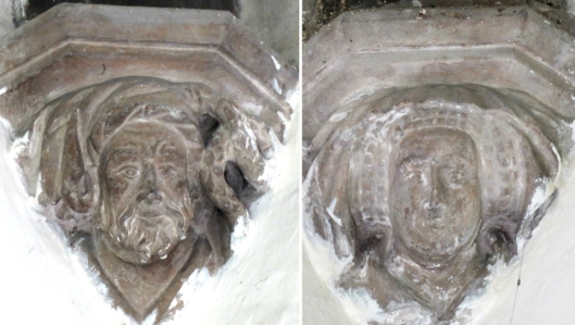
Two decorative corbels in the corners of the south transept record the Pastons’ generosity.

Paston Duo.jpg

John and Margaret Paston ca 1460

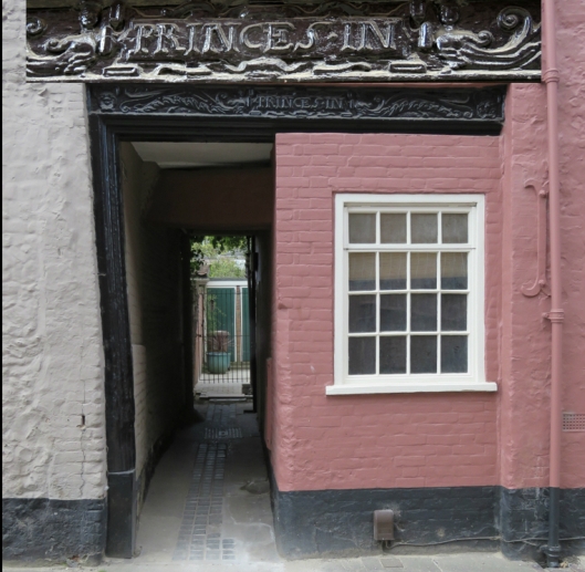
In addition to their house on Elm Hill, The Pastons had a property on Princes Street that may have provided overspill accommodation. Coincidentally, opposite Paston’s House in King Street (now Wensum Lodge), a beam bearing the name ‘Princes In’ survives on what was – until the 1970s – the old Ship Inn. This lintel is thought to have been transferred from the inn on Princes Street, which was first mentioned in 1391 [12].

Princes In Duo.jpg

168 King Street, entrance to Ship Yard with ‘Princes In’ (enlarged) on the lintel

This has been an intentionally Norwich-centric look at the Pastons but the great dramas surrounding this family were played out in the county, against a broader backdrop of national instability during the Wars of the Roses. The Pastons were to be besieged in three of their houses. First, in 1448 Lord Moleyns laid claim to Gresham Castle, which William Paston had bought from Thomas, the son of poet Geoffrey Chaucer. With the support of the powerful Duke of Suffolk, Moleyns sent 1000 armed [13] men to expel Margaret who famously wrote to her husband in London to send crossbows and poleaxes. In the event, Moleyns’ men mined the walls of Margaret’s  chamber, she was plukkyd out of here howse” then her mansion destroyed.

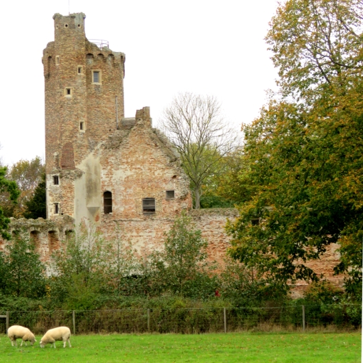
The greatest upturn in the Pastons’ fortunes came at the death of their kinsman, the fabulously wealthy soldier Sir John Fastolf, to whom John had become legal adviser. John claimed that two days before he died (1459) the old soldier had made a verbal will agreeing to sell him all his Suffolk and Norfolk lands for the bargain price of 4000 marks provided that John oversaw the foundation of a chantry at Caister to pray for Fastolf’s soul. It was perhaps inevitable that disinherited heirs and local noblemen would contest a deathbed will dictated in the presence of  the main beneficiary. In 1461 [2], a month after the coronation of the new king (Edward IV), the Duke of Norfolk felt able to take direct action by besieging Caister Castle with 3,000 men [14]. There were further altercations but the castle was not to be returned to John Paston II until after the restoration of Henry VI in 1470.

caister castle.jpg

Fastolf’s Caister Castle, reduced by the Duke of Norfolk’s guns; between Mautby (birthplace of Margaret Paston) and the east Norfolk coast

The Pastons also inherited Fastolf’s manors in Hellesdon and Drayton but in 1466 the powerful Duke of Suffolk seized Drayton, just across the Wensum from his own stronghold in Costessey. He then attacked their manor at Hellesdon, not only destroying what had been Margaret’s home for the last six years, but ransacking their tenant’s houses and even the church. Suffolk evidently felt that as the king’s brother-in-law, and with the Mayor of Norwich in his pocket [13], he could act with impunity.

Drayton Lodge.jpg

Drayton Old Lodge. It was once a manor house owned by Sir John Fastolf, built as a ‘plaisance’ overlooking the Wensum valley.

In 1466 John Paston died in London and over six days his body was conveyed back to Norfolk, accompanied by a priest and twelve torchbearers. The cost of the funeral exceeded £250, more than a year’s income from the Paston estates [13]. The extravagance and extraordinary pomp surrounding the occasion were perhaps a final riposte to those who had dragged his family through years of turbulence. The hearse cost more than £30; cloth for the mourners, £20; alms and doles to be distributed to the poor, more than £60. John Paston’s body rested for one night at St Peter Hungate before completing the journey to Bromholm Priory, near Bacton, where his father had been buried.

Bromholm.jpg

John Paston’s hearse would have passed through this gatehouse to Bromholm Priory

Bromholm Priory near Bacton had become a major site of medieval pilgrimage after a large piece of the true cross – brought from Constantinople – was incorporated into its Holy Rood. Twenty two pounds worth of candles illuminated the hearse and such was the stench of burning tallow that a glazier had to be paid 20 pence to remove two panes of glass ‘to late out the reke of the torches’. The mourners at John Paston’s funeral feasted on 49 pigs, 49 calves, 10 cows, 34 lambs and 22 sheep that had taken two men more than three days to flay [13].

Margaret Paston died in 1484 and is buried in her home church of Mautby, not far from Caister.

mautby church.jpg

SS Peter and Paul, Mautby. Following the demolition of an aisle during the Reformation, Margaret Paston’s grave is now on the outside of the south wall. 

Margaret Paston Ave.jpg

A modern reminder of Margaret Paston, steadfast and brave. NR3 2LH

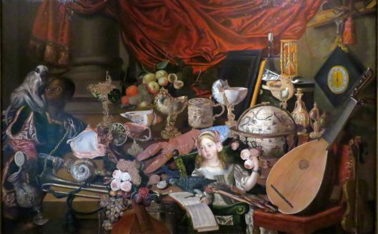
Margaret and John’s descendants  – like the second Earl of Yarmouth – lived in less turbulent times, but when he died in 1732 his titles died with him. Amongst his possessions was the Paston Treasure, a painting of the Paston collections once held at Oxnead Hall. Painted around the middle of the C17, in the manner of Dutch vanity paintings [15], it depicts some of the objects amassed by William Paston (1610-62) and his son Robert (1631-83), both of whom had travelled through Europe to the Middle East. Robert was a founding member of the Royal Society and so the collection might be thought to come from his cabinet of curiosities. However, there are so many symbols of the transience and futility of life (hourglass, watch, guttering candle, lute with broken string, the falling flagon) that it is more vanitas painting than a curiositas [15]. The most heart-breaking counterbalance to all these vanities is the image of a pretty young girl; whether Mary Paston or her older sister Margaret she holds roses in full bloom, a poignant reminder that all things must pass. Exciting new research on the Paston Treasure, by Norwich Castle Museum and the Yale Center for British Art, will be revealed in an exhibition opening at the Castle Museum in summer 2018.

The Paston Treasure1.jpg

The Paston Treasure, Dutch School (approx 1650) at Norwich Castle Museum and Art Gallery. Courtesy of Norfolk Museums Collections. NWHCM:1947.170

©2017 Reggie Unthank  

Thanks to Mathew White, Events Manager of St Andrews Hall for opening doors and to Dr Francesca Vanke, Keeper of Art & Curator of Decorative Art at the Castle Museum for information on the Paston Treasure.

Sources

  1. Gairdner, James (1904). The Paston Letters vol 1. Pub: Chatto and Windus, London. (Available online at http://www.gutenberg.org/files/43348/43348-h/43348-h.htm).
  2. Richmond, Colin (1990). The Paston family in the fifteenth century. The first phase. Pub: Cambridge University Press.
  3. https://en.wikipedia.org/wiki/Paston_Letters
  4. http://www.edp24.co.uk/17-jurnet-s-house-1-214362
  5. Pevsner, Nikolaus and Wilson, Bill (1997). The Buildings of England I. Norfolk, Norwich and North-East. Pub: Yale University Press.
  6. http://friendsofelmhill.cromegallery.co.uk/pageID_7964924.html
  7. http://www.mercers.co.uk/mercers-maiden-london
  8. https://colonelunthanksnorwich.com/2017/10/15/gildencroft-and-psychogeography/
  9. https://en.wikisource.org/wiki/Fastolf,_John_(DNB00)
  10. http://www.norwichblackfriars.co.uk/history/background-information/
  11. History, Gazetteer & Directory of Norfolk (1883). Pub: William White. See online at: https://archive.org/stream/historygazetteer00whit/historygazetteer00whit_djvu.txt
  12. http://www.georgeplunkett.co.uk/Norwich/kin.htm (King St 168 Ship Inn).
  13. Castor, Helen (2004). Blood and Roses.  Pub: Faber and Faber. For a readable account of the fascinating Paston story, look no further.
  14. Rye, Walter (1885). A History of Norfolk. Available online at:  https://archive.org/stream/historyofnorfolk00ryewrich/historyofnorfolk00ryewrich_djvu.txt
  15. Schneider, Norbert (1994). Still Life Pub: Taschen, Cologne


Reggie through the underpass

Tags

, , ,

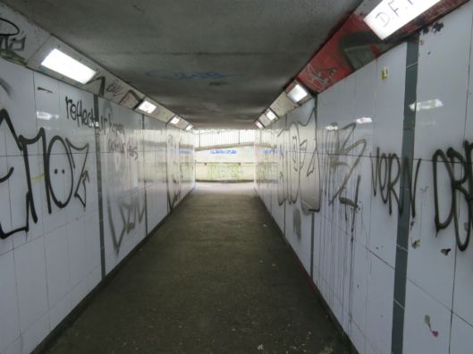
Previously [1] …  I spent so much time exploring Norwich’s medieval St Augustine’s that I never made it to the marketplace. Unless you fancy playing chicken on the inner ring road there is only one way to continue directly to the city centre and that is to walk beneath the flyover as it struggles to clear poor old Magdalen Street. So I escape to the former industrial area via St Crispin’s underpass.

underpass.JPG

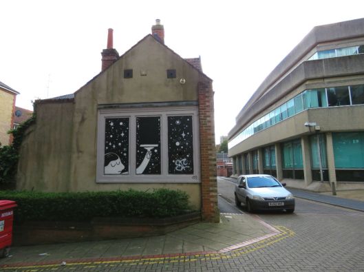
On the other side everything is sweetness and light. We are still in Norwich-over-the-Water but at least we are away from the lowering presence of the Anglia Square development, modern buildings are in scale, the old street pattern has largely survived and there is a better class of graffiti.

graffiti.jpg

The more sympathetic renovation of the former industrial quarter may be part of what Pevsner and Wilson [2] have called the  “welcome softening of approach since the late 1980s“. Around the corner on St Georges Street is a pair of houses that were renovated rather than demolished – the one on the right bearing a plaque dating it to “1670 renewed in 1986“. The larger building used to be the King’s Head pub and gained two dormers/lucams in the restoration [3]. The postmodern office block forming a backcloth is Cavell House.

StGeorgeSt.JPG

C17 house with Cavell House in the background. Note its different window styles

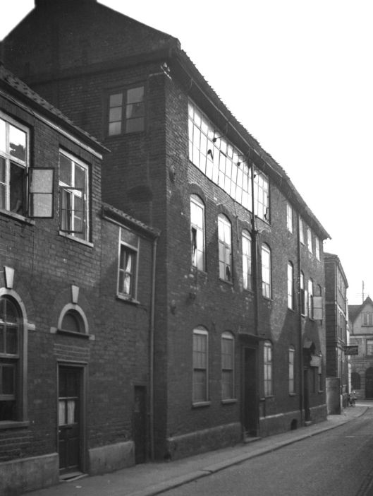
As a postmodern building Cavell House kicks against the uniformity of modernism by including a variety of references, some of them playful. For instance, the horizontal run of windows on the upper floor resembles the long ‘throughlight’ windows once common in the heart of the Norwich weaving industry.

Calvert St 3 to 5 west side 1936.jpg

Nos 3-5 Calvert Street 1936, destroyed by enemy firebombs in 1942. Note the weaver’s window in the upper floor. Courtesy http://www.georgeplunkett.co.uk

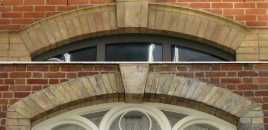
The brick arches above the lower windows in Cavell House are borrowed from the next building along St Georges Street, Sherwyn House.

Two windows1.jpg

Window arches on Cavell House (above) and Sherwyn House (below)

The style of Sherwyn House is reminiscent of Edward Boardman’s 1876 shoe factory for Haldinstein’s in Queen Street and his design for Howlett & White’s ‘Norvic’ shoe factory a few hundred metres away in Colegate [4]. However, the 1885 map of Norwich clearly shows a ‘brush manufactory’ on this site, not a shoe factory [5] and Kelly’s Directory for 1883 confirms the owner to have been Henry Mullett.

St George St 61a 1983-07-12.jpg

St Georges St, derelict brush factory 1983 built 1867. Courtesy http://www.georgeplunkett.co.uk

By 1983 the brush factory was derelict and became part of the 1992 Calvergate development by Feilden and Mawson [6].

CavellHse.JPG

Sherwyn House, St George’s Street, now retirement apartments

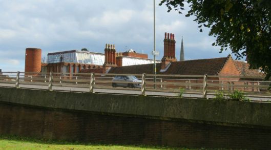
Just beyond Sherwyn House, a U-turn up Cross Lane then a right into Golden Dog Lane brought me to a building I had previously seen from the other side of the flyover.

flyover2.jpg

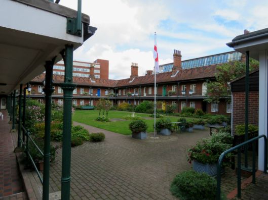
The defiant Tudor-style chimneys and crow-step gable belong to Doughty’s Hospital, an alms house founded in 1687 by William Doughty for 24 poor men and eight poor women. By the mid C19 only a sparse outline of the original building remained and it was rebuilt in 1869 [7]. Now it provides 57 sheltered flats for the elderly.

Doughtys.JPG

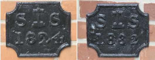
On a wall are two parish plates. In the Georgian era, in the absence of detailed maps, such plates were the way of defining the boundaries of the parish and its social and legal responsibilities [8]. The letters S stand for C14/15 Saint Saviour’s Magdalen Street – the church with the truncated tower now literally overshadowed by the flyover. The insignia between these letters represents the stone cross that stood at the former junction of Magdalen and St Botolph’s Streets [9].

SS.jpg

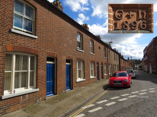
Retracing my steps into Cross Lane I looked down Calvert Street towards Colegate and the castle beyond. On the left side are two fine rows of red brick Victorian houses: one recording ‘GH 1896′ in Guntons’ tiles, the other with a stone inscribed ‘Thompson’s Buildings 1859’. A resident told me these were once council houses, sold under the Right-to-Buy scheme.

Calvert:Gunton.001.jpeg

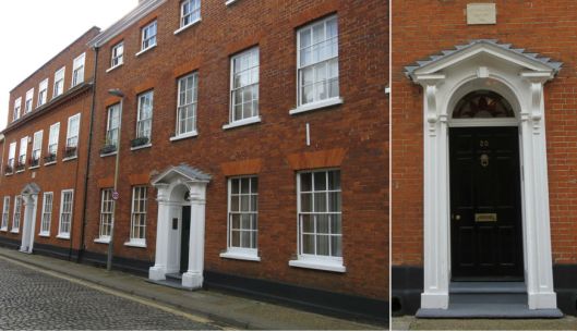
Across the cobbled street is a grander prospect – a reminder of the area’s former prosperity.

Calvert 2 B.jpg

20 and 22 Calvert Street. Above the doorway to No20 a plaque reads ‘Snaylgate House 1802’

The street was named for a former Sheriff of Norwich John Calvert (1741) who owned a house here. Before Calvert the street was Snaylgate and before that Snackegate [10]. The linguist Peter Trudgill says that ‘snek’ is an old Dutch dialect word for snail [11], underlining the historical connection between this weaving city and the immigrants from the Low Countries. ‘Gate’ comes from the old Danish word for street and is encountered in towns, like York and Norwich, once part of the Danelaw. This link is celebrated in a ‘Viking Norwich’ wall plaque stating that the street runs along an Anglo-Scandinavian defensive bank and ditch.

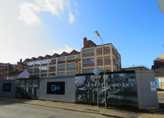
Retracing my steps down Cross Lane I enter Muspole Street via Alms Lane. It is from here that I see the St George’s Works building site with Howlett and White’s Norvic-Kiltie shoe factory (1926) in the background. This was an adjunct to their huge Norvic shoe factory on St Georges Street and whose roof can just be glimpsed to the left. In 1909 the firm employed 1200 workers [12].

IMG_6735.JPG

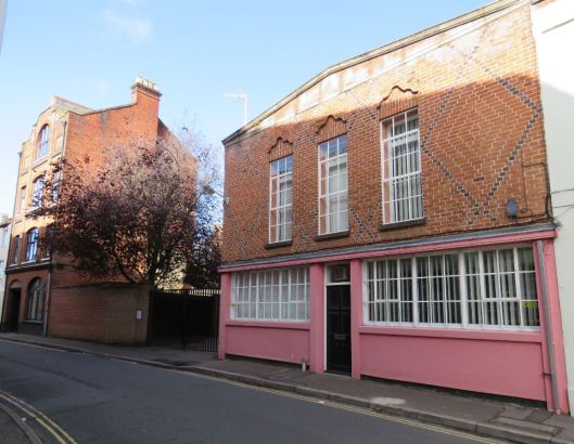
To the right, there is an interesting parade of resurrected industrial buildings along Muspole Street; I am particularly taken with a building faced with mathematical tiles. The Crittall windows on the jettied first floor, with eyebrows made from ridge and pantiles, suggest the house was renovated between the wars.

IMG_6737.JPG

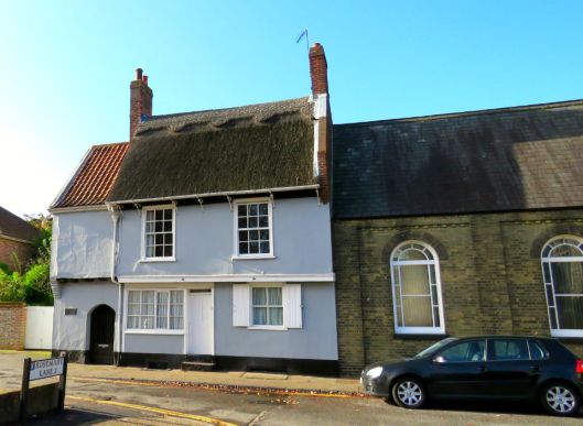
Walking straight over Duke Street I enter one of the city’s 15 open spaces – St Mary’s Plain. Where other cities have squares Norwich has plains [13]. ‘Plein’ is another borrowing from the C16 Dutch and Flemish Protestant refugees who, fleeing Spanish Catholic persecution, settled here and reinvigorated our weaving trade. Next to Zoar Strict and Particular Baptist Chapel, is the former home of Thomas Pykerell, cloth merchant, sheriff and three times Mayor of Norwich in the C15. Pykerell’s House is one of only a handful of thatched buildings in the city. It was gutted by incendiary bombs in the 1940s and we are fortunate to have it in its restored state.

IMG_6701.JPG

The square is dominated by another former shoe factory, now being redeveloped as part of St Mary’s Works. The name of Sexton Son and Everard Ltd, which is over-painted, sits on top of the building – the blacked-out lettering an unwitting reminder of the damage inflicted in the Blitz. The business that started in 1876 folded in 1976.

StMarysWorks.jpg

This aerial photo of the factory in 1946 gives an idea of the extent to which  Norwich-over-the-Water was dominated by industry.

EAW002889.jpg

Now for Duke Street, widened in 1972 to become the main feeder for the inner ring road. Duke St is named for the Duke of Norfolk’s C16 palace that once stood roughly on the site of present-day St Andrews Street car park [14]. I have previously mentioned the 1888 Norwich Board School on Duke St that is now part of the Norwich University of the Arts [4] but I can’t pass it without showing one of my favourite architectural folderols: this roof lantern with its lead cockade.

Belvedere.JPG

I exit Norwich-over-the-Water via the Duke Street bridge. The original Duke’s Palace Bridge of 1822, made entirely out of cast iron, was moved as part of the 1972 road widening scheme and re-erected over the entrance to the Castle Mall car park [2].

IMG_6757.JPG

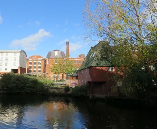
A riverside gangway to the left of the present bridge provides a vantage point over the river, across to the site of Howlett and White’s factory on St George’s Plain and one of the last remaining chimney stacks in an area that once bristled with them (there is another behind the Brush Factory, now Sherwyn House (above).

IMG_6744 2.JPG

To the right of the bridge the mostly derelict complex, between river and Charing Cross, was once devoted to the generation of electricity.

IMG_6761.JPG

In 1892 Boardman and Son designed the conversion of the old Duke’s Palace Ironworks for the Norwich Electric Light Company who supplied the city’s street lamps. But by the 1920s this was superseded by the power station at Thorpe and the Duke Street site was converted to offices [4].

IMG_6657.JPG

The city coat of arms on the former offices of the Norwich Electric Light Company, Duke Street [4].

Left into St Andrews Street then right into one of the very few post-medieval streets in the city: Exchange Street. Originally called Museum Street then Post Office Street it was renamed once more after the opening of the Corn Exchange (1828). In 1832 Exchange Street finally connected through to St Andrews Street, allowing traffic to flow over the recently opened Duke Street Bridge then to points north via St Augustine’s Gate [2, 15].

In 1861 the original corn exchange was replaced by a larger one that functioned well into the C20.

norwich corn exchange.jpg

The ‘new’ Corn Exchange in 1960. © Copyright Historic England Archive ref: AA98/12867

But a century later (1963) this larger corn exchange (seen below) was in turn demolished to make way for the extension to Jarrolds Department Store at the corner of Exchange and Bedford Streets.

Exchange St Corn Exchange west side [2513] 1938-06-26.jpg

The 1861 Corn Exchange seen in 1938 from the market end. http://www.georgeplunkett.co.uk

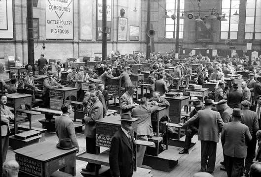
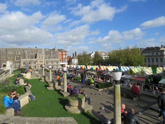
At last, the marketplace. The Anglo-Saxon market was based in Tombland but the entire axis of the city changed when the Normans built the castle in the late C11 and installed a market in its present position, outside the motte in the Mancroft district [16]. Over recent years there had been too many unoccupied stalls in the 900+ year–old market but there seems to be a revival of its fortunes due the city council’s introduction of a ‘Global Market’ – pop-ups selling street food from around the world. Hybrid vigour comes to the rescue, as it has done throughout the long history of this city [17].

IMG_6749.JPG


New Walk.jpg

  ©OpenStreetMapscontributors

©2017 Reggie Unthank

Thanks to Frances Holmes, Martin Shaw and John Fuller for their assistance. I am also grateful to the www.georgeplunkett.co.uk website run by Jonathan Plunkett.

References

  1.  https://colonelunthanksnorwich.com/2017/10/15/gildencroft-and-psychogeography/ ‎
  2. Nikolaus Pevsner and Bill Wilson (2002). The Buildings of England. Norfolk I, Norwich and North-East. Pub: Yale University Press.
  3. http://www.georgeplunkett.co.uk/Norwich/stc.htm#Stgeo
  4. https://colonelunthanksnorwich.com/2016/07/28/norwichs-pre-loved-buildings/ ‎
  5. http://www.norwich-yards.co.uk/norwich_map_1885/norwich_map_15600.asp?ID=2210
  6. http://www.mbp-uk.com/projects/fscalvergate.html
  7. https://historicengland.org.uk/listing/the-list/list-entry/1187193
  8. David A Berwick (2007). Beating the Bounds in Georgian Norwich. Pub: davidaberwick@gmail.com
  9. http://www.heritage.norfolk.gov.uk/record-details?MNF597-St-Saviour%27s-Church-Magdalen-Street-Norwich&Index=593&RecordCount=56542&SessionID=6df6bab1-16b0-4b3f-9ba9-746ca0e3740d
  10. www.georgeplunkett.co.uk Calvert St 20 to 22 [2676] 1938-08-03
  11. http://www.edp24.co.uk/news/how-snailgate-became-calvert-street-1-4805457
  12. Frances and Michael Holmes (2013). The Story of the Norwich Boot and Shoe Trade. Pub: Norwich Heritage Projects (www.norwich-heritage.co.uk).
  13. Richard Lane (1999). The Plains of Norwich. Pub: The Larks Press.
  14. http://www.eveningnews24.co.uk/news/politics/dig-could-reveal-secrets-of-norwich-s-lost-16th-century-palace-1-4015633
  15. http://www.racns.co.uk/sculptures.asp?action=getsurvey&id=915
  16. https://en.wikipedia.org/wiki/Norwich_Market
  17. http://www.edp24.co.uk/news/street-food-and-pop-up-stalls-give-norwich-market-remarkable-boost-1-5166418


Gildencroft and Psychogeography

Tags

, , , , , , ,

On the map it was meant to be a straight enough radial walk from a city gate into the city centre but I’m easily distracted. I got lost around Gildencroft where – as the psychogeographers among you will know – an historic area clings on among the after effects of postwar modernisation.

StAugustinesCastleMus.jpg

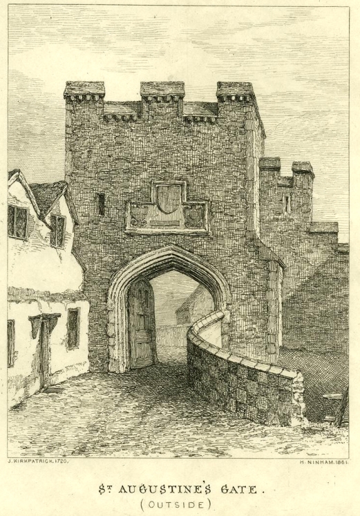
Henry Ninham’s 1861 engraving, based on John Kirkpatrick’s 1720 drawing. Norfolk Museums Service. NWHCM : 1953.31.FAP33

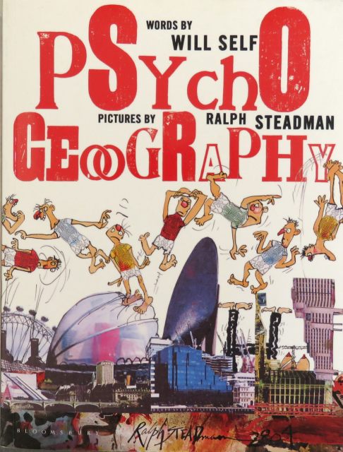
There was a time you were free to imagine yourself a nineteenth century flâneur like Baudelaire, strolling along the boulevards without a care [1]. But midcentury psychogeographers like Guy Debord, with their socio-political ideas about the effects of environment on the pedestrian’s psyche, put a stop to that, making a new wave of urban explorers more conscious about the impact of urban development [2]. In Psychogeography [3], Will Self wrote about walking to Manhattan from his house in south London (not over the watery bit, obvs) in order to regain “the Empty Quarters“: the hinterlands around airports.

Psychogeog.JPG

Psychogeography ©Will Self (words) and Ralph Steadman (artist). Bloomsbury Publishing 2007

And in his ‘alternative cartography’ around the M25 London Orbital, Iain Sinclair famously wrote about walking through urban no-man’s land. Other twenty-first century urban walkers (the new psychogeographers) suggest taking a playful approach to the exploration of the built environment, employing a variety of tricks to nudge the pedestrian off the beaten path to make them more aware of the urban landscape. Rob Macfarlane recommends following the path drawn on a map by an upturned tumbler; others throw dice at each intersection or perform ‘ambulant signmaking’ by following a letter traced on a map; and one urban runner even used the GPS in his running shoe to geotrack the shape of his privy member on the map. Hmm. This may be why Lauren Elkin (“walking is mapping with your feet”) [4] writes about the need for female flâneuses to reclaim the streets. There’s a lot of hoo-ha around psychogeography but, at heart, it’s about the way that urban development affects our lives.

Keynote map1gateA.jpg

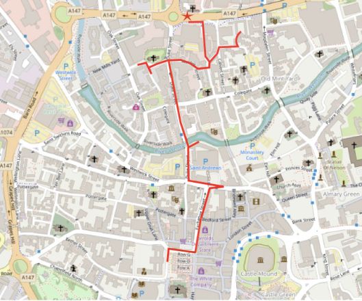
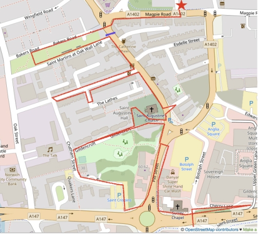
The Gildencroft area of St Augustine’s parish is over the A147 inner ring road. St Augustine’s Gate (lost in the C18) is marked very approximately with the blue bar. ©OpenStreetMapcontributors

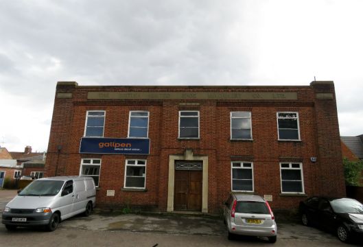
I started my walk, not at the old city gate, but by taking a closer look at a building I’d glimpsed from my car. So at the outset I travelled contrariwise. This was on Starling Road, just off Magpie Road (red star), which runs parallel to the old city wall. The building is a relic of the once thriving Norwich shoe industry that, like much of the city’s trade, took place here in Norwich-over-the-water (Ultra Aquam). The concrete lettering on the parapet reads: The British United Shoe Machinery Co Ltd 1925 [5].

IMG_6504.JPG

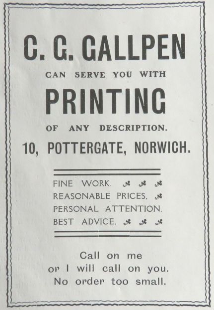
Once, this Leicester firm made equipment for the Norwich shoemakers but collapsed in 2000. Now the building is occupied by Gallpen who – in a nice example of nominative determinism – are printers (ink used to be made by adding iron salts to tannic acid extracted from oak galls). In a 1910 trade book the founder, Charles Gaunt Gallpen (b 1859), advertised himself as a printer with the unintentionally ominous slogan: “Call on me or I will call on you” [6].

gallpenprinters.JPG

From [6]

Crossing busy Magpie Road, I passed a segment of the city wall and part of a tower revealed by the demolition of Magpie Printers in 2013.

wall.jpg

The medieval city wall would have continued beyond the houses to the right, passing across St Augustine’s Street to emerge on a tract of land between Bakers Road to the right and St Martin’s at Oak Wall Lane to the left.

IMG_6517.JPG

What we are looking at is the external ditch and on the inner side of the wall was a tract of land once known as the Jousting Acre [7]. Here, men-at-arms practiced jousting with lances and – as was compulsory in the medieval period – young men would have performed their archery practice with bows or crossbows. The antiquary Francis Blomefield mentions that King Edward III came to a tournament that local historian Stuart McLaren suggests is likely to have been held at this Jousting Acre [7].

In the 15th year of his reign, the King appointed a turnament to be held at Norwich … this exercise was much in use in ancient times, and is otherwise called jousting or tilting; the knights that used this martial sport were armed, and so encountered one another on horseback, with spears or lances, by which they made themselves fit for war, according to the manner of that age, which made use of such weapons … this turnament began in February 1340, and the King … was at Norwich on Wednesday February 14, being St. Valentine’s day.  (Francis Blomefield 1806 [8])

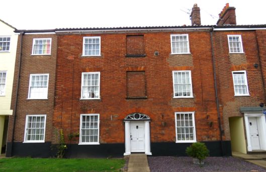
Sussex Street is one of the most attractive streets in this part of the city, containing rows of Georgian terraced housing dated mainly to 1821-1824 [9].

14-16Sussex.JPG

14 & 16 Sussex Street (south side)

These were probably houses for the respectable working/lower middle class; Number 22 (below) is more genteel.

IMG_6526.JPG

22 Sussex Street. Doorway with Greek Doric columns and segmental arch with fanlight

There is a similar doorcase on No 21  on the opposite side of the street. This house forms part of a terrace of three-storeyed houses. To the left can just be seen part of the 1971 conversion to flats by Edward Skipper and Associates. As we know, George Skipper [10] built the architectural fireworks of late Victorian Norwich and laid out much of the Golden Triangle in the early C20. The family name lives on in St Augustines.

SussexSt.JPG

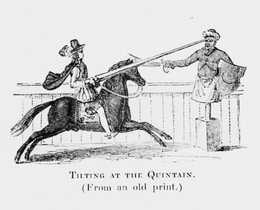
Behind, and to the left, is the modern development, Quintain Mews – the name commemorating medieval jousting.

IMG_6533.JPG

The quintain was a revolving target that would, when struck with lance or sword, swing around to sandbag the combatant.

Tilting_at_the_Quintain.jpg

Wikimedia Commons

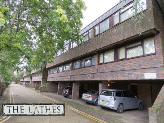
On the opposite side of Sussex Street is the entry to 42 modern, split-level dwellings – The Lathes – owned by Broadland Housing Association. This development was built in 1976 by the architects Teather and Walls, described as ‘Associate for Edward Skipper and Associates” [11].

LathesDuo.jpg

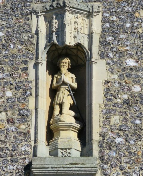
The word ‘lathes’ is dialect for a grain barn [7], commemorating the farm that once stood in this area. According to Blomefield [8] the farm belonged at various times to Sir John Paston, and two Shakespearean heroes: Sir John Fastolff of Caister (Falstaff is mentioned in five plays) and “brave Sir Thomas Erpingham” (Henry V) whose statue is above the Erpingham Gate of Norwich Cathedral. One suggestion is that Erpingham installed this pious statue to assert his religious orthodoxy at a time when the Lollards were asserting themselves [12]

Erpingham.JPG

Sir Thomas kneels in a niche above the Erpingham Gate 

Historically and architecturally St Augustine’s is a fascinating street but the temptation to flit from one side of the road to the other is inhibited by the volume of traffic flowing out of the city.  Still, this hasn’t put off the young artists who are adopting the street.

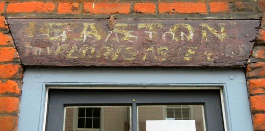
On the west side of the street a ghost sign was recently uncovered when No. 22 became Easton Pottery [13]. I can pick out ‘Easton’, ‘Florists’ and perhaps ‘Newsagents’. Trade directories show that from the 1930s to the 1960s a Miss E Easton ran a florist’s shop here. Before that she, and her father before her, ran a greengrocer’s. But the current owner, the potter Rachel Kurdynowska, found that T Easton traded here in 1873 as an earthenware dealer and it is in honour of this serendipitous connection that Rachel named her business.

Eastons.jpg

Ghost sign for the Easton family businesses, now Easton Pottery #22 St Augustine’s Street

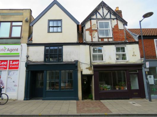
The oversized roof gables known locally as lucams are a prominent feature of the east side of the street. ‘Lucam’ may be a corruption of ‘lucarne’, a French word for skylight donated by immigrant ‘Strangers’ – C16-17 Dutch and French-speaking Walloons who could have used the term for the windows at which they reinvigorated the city’s weaving trade [14]. The owner of No 33 (left), who is just coming into view, told me that he had recently repaired his lucam.

StAug1.JPG

Lucams at 33 and 31 St Augustine’s Street

NunnsYard.JPG

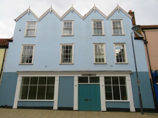
Nunn’s Yard, a fine range of five upper gables on 23-25 St Augustine’s Street

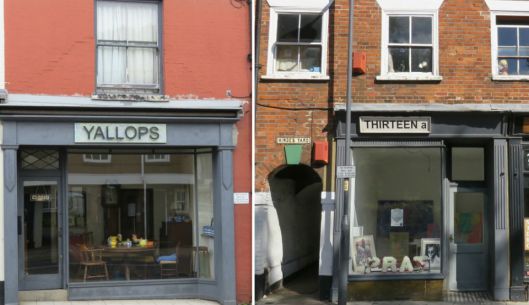
The recently renovated numbers 23 and 25 announce themselves as ‘Nunn’s Yard’, which is actually further up the road between numbers 31 and 33. Instead, Nunn’s Yard Gallery is now the name of an enterprise whose two other contemporary exhibition spaces are doing much to enliven this street: Yallop’s and Thirteen A [15].

YallopsDuo.jpg

Yallop’s and Thirteen a.

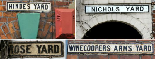
The entry to Hinde’s Yard can be seen to the left of Thirteen A and the cast-iron signs for other yards are encountered along the street.

Yard four.jpg

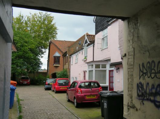
The influx of Strangers in the Elizabethan era created a demand for housing within the confines of the city walls; this was met by squeezing poorly-built, insanitary ‘yards’ or ‘courts’ into the courtyards of larger properties fronting the streets [16]. Before WWII there were 70 houses in Rose Yard. The only source of water for 50 of them was the public pump in St Augustine’s churchyard. An 1851 report mentions, “at the bottom is a large pool of nightsoil 15 feet by 25 feet from about 40 houses”[16]. Most of the city’s several hundred yards were cleared as slums in the 1950s. All that remains of Rose Yard is the entrance and a few houses. (See Nick Stone’s brilliant rephotography of this area [17]).

IMG_6556.JPG

Rose Yard #7 St Augustine’s Street

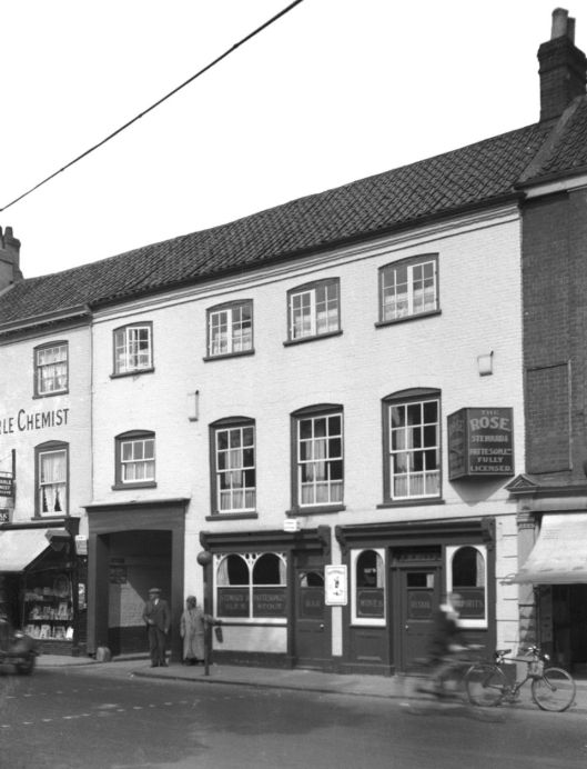
This entrance to Rose Yard can be seen (below) to the left of The Rose Inn as it was in 1938. An inn is known to have been on this site since the C14 when it refreshed those attending the jousting tournaments in Gildencroft.

Rose 1938.jpg

The Rose Inn in 1938, with the entrance to Rose Yard on the left  [www.georgeplunkett.co.uk]

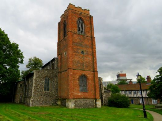
Opposite Rose Yard is St Augustine’s Church whose parishioners are known as Red Steeplers on account of the only (late 1600s) red brick tower in the city [18].

StAugustines.JPG

St Augustine’s. In the background, a medieval terrace and a looming presence.

In the churchyard is the tomb of Thomas Clabburn (d.1858) who employed upwards of six hundred Norwich weavers [19].

IMG_6566.JPG

The Clabburn family tomb. Inside the church is a tablet commemorating Thomas’s ‘many virtues as an employer and a kind, good man’

In the background (above) is Church Alley (1580), believed to be the longest row of Tudor houses in England [7]. It leads to the wonderfully named street, Gildencroft, which commemorates an area that once roughly overlapped St Augustine’s parish [20].

gildencroft.JPG

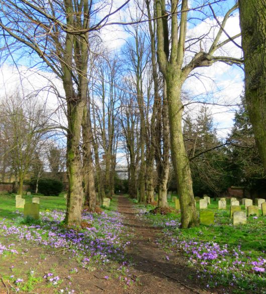
Gildencroft is also the name of a small park I circumnavigated as I tried to find the Quaker Burial Ground. I passed a small building, now a nursery, that was built by the Society of Friends at the end of the C17 then rebuilt after the original was destroyed in the 1942 Baedeker air raids. Nearby are the gates to the burial ground, which were open when I visited it this spring in search of Amelia Opie’s grave [20], but are now sadly locked. Reasons for closure include drink, drugs and dog poo (wasn’t that an album by The Pogues?).

IMG_4274.JPG

The Quaker Burial Ground, Spring 2017

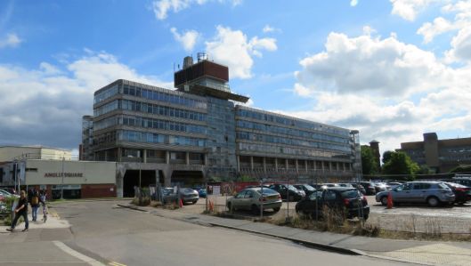
I completed my anticlockwise stroll around Gildencroft by walking through St Crispin’s Car Park and hopping up a bank to St Crispin’s Road (aka the ring road) with its busy roundabout. Due to the volume of traffic I had to trek back up Pitt Street (commemorating not Prime Minister Pitt but a rubbish pit [7]) to find a safe crossing. And it was here, now facing towards Sovereign House, that I was confronted by the source of my irritation – Anglia Square and all it stands for: postwar dereliction, the ring road, the Magadalen Street flyover, disregard of the pedestrian, insensitivity to the past …  [22].

AngliaSquare.JPG

The derelict Sovereign House (formerly Her Majesty’s Stationery Office), part of the 1960s/70s Anglia Square development

In the decades after the war it must have seemed a good thing to replace a bomb-damaged area of insanitary medieval housing with Brutalist modernity. But modernity barely survived 50 years in the case of Her Majesty’s Stationery Office, and the shopping centre fails to thrive. This can’t be blamed on a dislike of Brutalism in the provinces: see how well concrete works in Lasdun’s greenfield site at UEA. More likely the problem stemmed from the imposition of an out-of-scale development on an historic site. Now, in a frightening example of history repeating itself, it is proposed to replace Anglia Square with a tower block 25 storeys high [23].

The isolation of St Augustine’s from the city centre by the river had already established its marginal identity but then, in the 1960s and 70s, the severing of old routes by the inner ring road released this area into an even more distant orbit: Norwich-over-the-ring-road (Ultra Via Anulum). [See 24 for a critical view of ‘The Norwich Magdalen Street Massacre’].

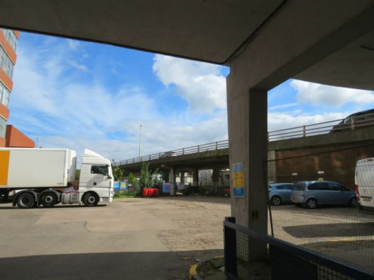
I tried to get back to the city centre by walking under the flyover that goes on to blight the next radial road – medieval Magdalen Street – but found my way blocked by a private trailer depot …

flyover.jpg

… so I doubled back and left via the only route available to pedestrians going up or down Duke Street – an underpass. Flâneurs and flâneuses wanting to enter an historic area are unlikely to find a less welcoming entrance but do it, explore St Augustine’s and help reconnect it to the city centre.

underpass.JPG


©2017 ReggieUnthank

Sources

  1. https://en.wikipedia.org/wiki/Fl%C3%A2neur
  2. https://en.wikipedia.org/wiki/Psychogeography
  3. Will Self and Ralph Steadman (2007). Psychogeography Pub: Bloomsbury.
  4. Laura Elkin (2017). Flâneuse. Pub: Vintage
  5. Frances Holmes and Michael Holmes (2013). The Story of the Norwich Boot and Shoe Trade. Pub: Norwich Heritage Projects
  6. Citizens of no Mean City (1910). A trade book published by Jarrold and Sons.
  7. http://www.staugustinesnorwich.org.uk/history_-_the_gildencroft.html. Do read this excellent account of the history of this area By S J McLaren. The website (http://www.staugustinesnorwich.org.uk/index.html) describes a proud community working hard to maintain its identity.
  8. Francis Blomefield, ‘The City of Norwich, chapter 15: Of the city in Edward III’s time’, in An Essay Towards A Topographical History of the County of Norfolk: Volume 3, the History of the City and County of Norwich, Part I (London, 1806), pp. 79-101. British History Onlinehttp://www.british-history.ac.uk/topographical-hist-norfolk/vol3/pp79-101#p27
  9. Nikolaus Pevsner and Bill Wilson (2002). The Buildings of England. Norfolk I, Norwich and North-East. Pub: Yale University Press.
  10. https://colonelunthanksnorwich.com/2017/02/15/the-flamboyant-mr-skipper/
  11. http://www.twa.co.uk/projects/the_lathes_norwich
  12. http://users.trytel.com/tristan/towns/florilegium/popdth04.html
  13. https://www.eastonpottery.com/about
  14. Peter Trudgill (2003). The Norfolk dialect. Pub: Poppyland, Cromer.
  15. http://www.nunnsyard.co.uk/exhibitions.html
  16. Frances Holmes and MichaelHolmes (2015). The Old Courts and Yards of Norwich. Pub: Norwich Heritage Projects. (The definitive book on the Norwich yards).
  17. http://www.invisibleworks.co.uk/lost-city-ghosts-st-augustines-the-rose-tavern/
  18. Mortlock, D.P. and Roberts, C.V. (1985). The Popular Guide to Norfolk Churches. No2 Norwich, Central and South Norfolk. Pub: Acorn Editions.
  19. https://en.wikipedia.org/wiki/St_Augustine%27s_Church,_Norwich
  20. Personal communication, Stuart McLaren
  21. https://colonelunthanksnorwich.com/2017/03/15/three-norwich-women/
  22. https://en.wikipedia.org/wiki/Anglia_Square_Shopping_Centre,_Norwich
  23. http://www.edp24.co.uk/news/environment/25-storey-tower-block-planned-in-new-anglia-square-development-for-up-to-1-350-homes-1-4929377
  24. http://nr23.net/govt/unfinished_mag_st.htm

Thanks. I am indebted to: local historian Stuart McLaren for sharing his deep knowledge of the area; to Rachel Kurdynowska for information about Easton Pottery; to The Bookhive (http://www.thebookhive.co.uk/) for suggesting Lauren Elkins’ Flâneuse; and Jonathan Plunkett for access to the website based on his father’s largely pre-war photographs (www.georgeplunkett.co.uk). I thank my daughter Susie for the many conversations about psychogeography and urban walking .

The Norwich Society helps people enjoy and appreciate the history and character of Norwich.   Visit: www.thenorwichsociety.org.uk

NorwichSocLogo.jpg

Bullards’ Brewery

Tags

,

In the previous post on churches [1] I mentioned the saying that Norwich had ‘a church for every Sunday‘, tactfully stopping short of saying, ‘and a pub for every day of the year‘. But, as we saw for churches, not every pub managed to stay open for they were subject to the same Darwinian struggle we see in the history of Bullards’ Brewery.

BullardsNew.jpg

Bullards’ Fat Man logo by Alfred Munnings 1909

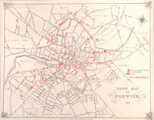
Calculating the number of Norwich’s pubs is not an exact science since the definition of a pub varies. In 1681 a Dean of Norwich Cathedral complained that “the town swarms with alehouses” at a time when there were about 250 [2]. By the early C19 there was indeed a pub for every day of the year, with about 378, plus 30 to 40 beer-houses that were licensed to brew beer. By 1878 Ratcliffe’s Drink Map listed 655 licensed houses (including refreshment houses and beer houses) but, with various licensing acts designed to curb drunkenness, the number continued to decline throughout the C20. The 1892 Drink Map by the Norwich and Norfolk Gospel Temperance Union gives an idea of the density of licensed premises at its peak.

Drink Map.jpg

1892 Drink Map of Norwich. Courtesy of Picture Norfolk (www.picture.norfolk.gov.uk)

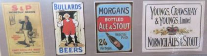
Matching the decline in the number of pubs was the reduction in the number of breweries, from 27 in the early 1800s to just four in the 1920s: Stewart and Patteson; Bullards; Morgans; and Youngs Crawshay and Youngs [2].

4 breweries.jpg

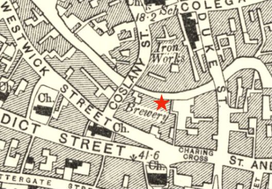
In 1837 Richard Bullard and James Watt entered a short-lasting partnership to start the Anchor Brewery at St Miles Bridge in Coslany – forming a major part of industrial Norwich. It was just over the water from Barnard Bishop and Barnards’ Norfolk Iron Works.

coslany map.jpg

Bullards’ Brewery. OS 6 inch map 1888-1913. ©Ordnance Survey. Reproduced with permission of the National Library of Scotland. maps.nls.uk

Bullards.jpg

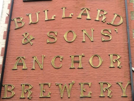
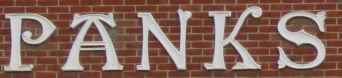
[Incidentally, this is the same lettering that Panks Engineering used on their Victorian cast-iron showroom in Rose Lane and now in Heigham Street].

Panks2.jpg

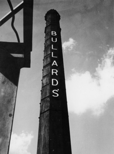
Bullards’ chimney, with its conspicuous lettering, was an inescapable feature of the city’s industrial landscape.

Bullards chimney lettering.jpg

Courtesy of Picture Norfolk http://www.picture.norfolk.gov.uk

The brewery was well-situated, drawing high quality water from a deep artesian well and receiving grain and hops by wherry along the River Wensum. The large fermentation hall survives as Anchor Quay apartments.

Coslany St Bullard's fermentation hall [5342] 1973-01-05.jpg

Bullards’ fermentation hall in 1973, at the junction of Westwick and Coslany Streets. http://www.georgeplunkett.co.uk

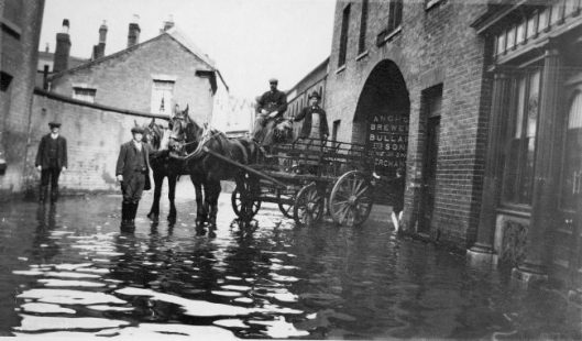
However, proximity to the river meant that the brewery did not escape the 1912 floods.

Bullards floods.jpg

The Anchor Brewery in the 1912 floods. Courtesy of Picture Norfolk (www.picture.norfolk.gov.uk)

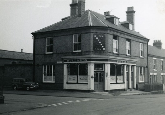
The company was to employ several hundred workers to supply the company’s ca 500 pubs [3]. The Unthank Arms in Bury Street, near the Heigham home of the Unthank family [4], was one of Bullards’ pubs …

Unthank Arms.jpg

The Unthank Arms. Courtesy of Picture Norfolk (www.picture.norfolk.gov.uk)
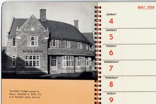
… as was The Barn Tavern at the foot of Grapes’Hill, built for Bullards’ by RG Carter [see 5 for Arts and Crafts pubs].

Barn Public House Barn Road 1950s.jpg

The Barn at St Benedict’s Gates, from a 1958 trade calendar by the builders RG Carter (Courtesy RG Carter Archive)

Barn ANchor1.jpg

Bullards’ tipsy anchor in the gable end of The Barn Tavern

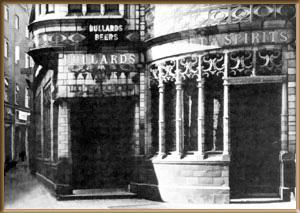
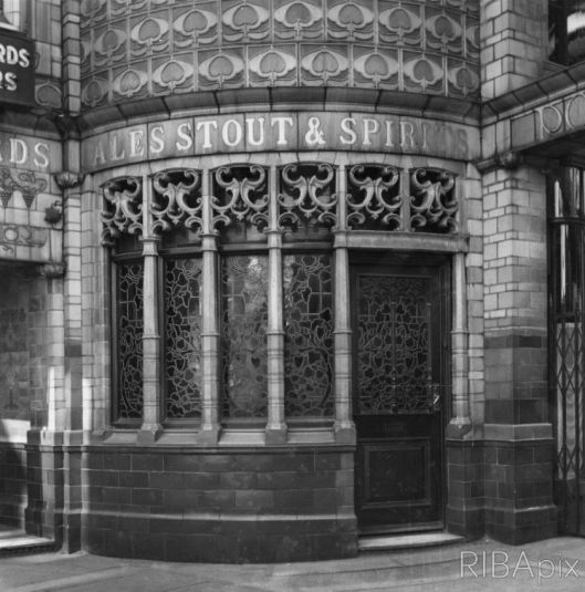
I make no apologies for revisiting The Arcade Stores, which was originally a Bullards’ pub selling beer, wines and spirits [6]. It was at the left-hand entrance (castle end) of George Skipper’s Royal Arcade, with which it was integrated by WJ Neatby’s magnificent Doulton tiles. Art Nouveau buildings in this country are scarce: Nikolaus Pevsner only reckoned Norwich’s Royal Arcade and Edward Everard’s  printing works in Bristol. The Arcade is therefore of national importance so it is hard to comprehend why the ground floor of the pub, with its Doulton tiles, was allowed to be remodelled in the 1960s to make way for a plate-glass-fronted butcher’s shop.

arcade5a.jpg

Norwich’s lost art nouveau pub, from [7]

ArcadeStoresNorwich_1.jpg

The Arcade Stores 1956 © RIBA

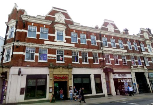
Red Lion Street – a fine post-1900 development with designs by Edward Boardman and George Skipper – contains the Anchor Building …


AnchorBldgs.JPG

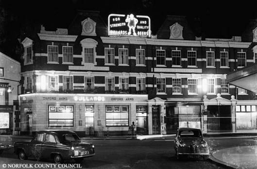
… which at one time contained Bullards’ Orford Arms, now occupied by Nando’s. Beneath the pub was the Orford Cellar where Jimi Hendrix and David Bowie played in the 1960s.

orford arms.jpg

“For Strength and Quality”. Bullards’ Orford Arms and Anchor Buildings ca 1960s, Red Lion Street, Norwich. Courtesy of Picture Norfolk (www.picture.norfolk.gov.uk)

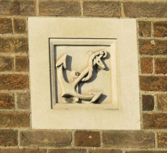
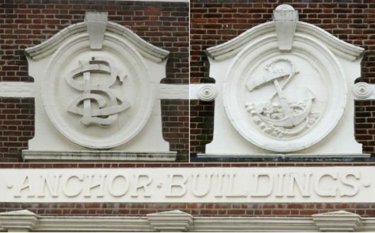
Two of the pediments on Anchor Buildings contain the initials BS for Bullard and Sons; the central pediment contains the brewery’s tilting anchor emblem. This strangely prescient version of ‘anchor on the rocks’ was a variation of the Bullards’ emblem used from 1869 [8]. The later version from The Barn (above) is simpler, has no rocks and tilts in the opposite direction.

Bullards3 clipped.jpg

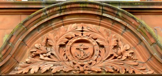
Although not far from the Anchor Brewery, the upright anchor below seems to have nothing to do with Bullards’. Instead, architect Edward Boardman appears to have placed this cartouche over Water Lane that passed through Howlett and White’s shoe factory (later Norvic) on Colegate, down to the River Wensum. The lane did, however, go down to a staithe opposite the Anchor Brewery.

upright anchor.jpg

Carved brick insignia above Water Lane, Colegate. Similar leaf-work was carved by James Minns for Guntons of Costessey [9]

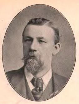
After Richard Bullard died in 1864 the brewery was renamed Bullard and Sons, continuing under the management of Richard’s sons Harry, Charley and Fred. Harry was a well-known figure in the city; he was sheriff, justice of the peace, three times mayor and knighted by Queen Victoria in 1886 [10].

Harry_Bullard.jpg

Sir Harry Bullard 1895. Courtesy Wikipedia [11]

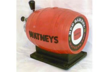
The amalgamation of the remaining Norwich breweries began in the 1950s when Bullards took over Youngs Crawshay and Youngs in King Street. In 1961, competitors Morgans went into voluntary liquidation and the chairmen of Bullards and Steward & Pattesons – not wanting the brewery itself – reportedly drew cards to decide who would take which of the 400-plus tied houses [12]. Morgans’ Brewery was sold to Watney Mann on the understanding that Watney’s keg beers would be sold in Bullards’ and Steward & Patteson’s pubs. This was when the Bullards’ enterprise finally hit the rocks for Watney’s filtered, pasteurised and carbonated keg beers were soon outselling the traditional beers drawn on long-handled pumps [13].

red barrel.jpg

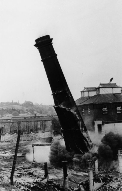
In 1982, Bullards’ chimney – so long a landmark of the city’s industrial quarter – was demolished.

Bullards chimney demolition.jpg

Courtesy of Picture Norfolk (www.picture.norfolk.gov.uk)

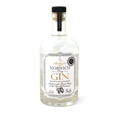
Postscript The name ‘Bullards’ is undergoing a revival, for cask beers bearing their name are being produced in collaboration with local brewers Redwell [14]. In addition, Bullards’ Gin, which is now being distilled in The Ten Bells on St Benedict’s Street, has been voted Best London Dry Gin in the World [15]. On your behalf I bought some and tasted it. It was good and, as promised by Kingsley Amis’ slogan, ‘Makes You Drunk’.

bullards_gin.jpg

© 2017 Reggie Unthank 

Sources

  1. Young, John Riddington (1975). The Inns and Old Taverns of Old Norwich. Wensum Books (Norwich) Ltd.
  2. http://www.norridge.me.uk/pubs/beertalk/nos.htm
  3. http://www.bullardsbeers.co.uk/
  4. https://colonelunthanksnorwich.com/2016/01/30/colonel-unthank-…-golden-triangle/ 
  5. https://colonelunthanksnorwich.com/2016/12/22/arts-crafts-pubs-in-the-c20th/
  6. https://colonelunthanksnorwich.com/2016/03/12/the-art-nouveau-…ers-royal-arcade/
  7. http://www.oldcity.org.uk/norwich/tours/arcade/arcade4.php
  8. http://www.racns.co.uk/sculptures.asp?action=getsurvey&id=121
  9. https://colonelunthanksnorwich.com/2017/02/15/the-flamboyant-mr-skipper/
  10. http://www.norfolkpubs.co.uk/norwich/bnorwich/ncbulla.htm
  11. https://en.wikipedia.org/wiki/Harry_Bullard
  12. http://www.norfolkpubs.co.uk/norwich/mnorwich/ncmorg.htm
  13. http://www.norwich-pubs-breweries.co.uk/Bullards/Bullards.shtm
  14. http://www.bullardsbeers.co.uk/
  15. https://www.bullardsspirits.co.uk/

For a really fascinating account of Norwich pubs and breweries see Frances and Michael Holmes’ Norwich Pubs and Breweries: Past and Present (2011) http://www.norfolkpubs.co.uk/publications/books6.htm

Thanks to Clare Everitt of Picture Norfolk for permission to reproduce images from this wonderful archive. I am grateful to the archivist of RG Carter for her assistance.


Post-medieval Norwich churches

Tags

, , , ,

Once, the walled city of Norwich had 58 churches within its confines. After the break from Rome these Anglican churches were supplemented by new kinds of building to accommodate the varying shades of non-conformism.

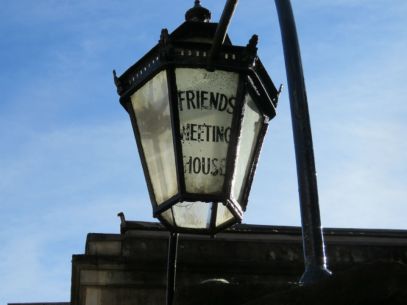
FriendsMtgHouse.JPG

The term nonconformist can be traced to the licensing of clergy who – during the reign of Elizabethan I – subscribed to the Act of Uniformity and were therefore ‘conformable’ to the rules of the established Protestant church [1]. But, as we know, Norwich citizens have always taken pride in their nonconformability [2] and this was expressed in the Dissenting or Nonconformist chapels built from the C17 onwards.

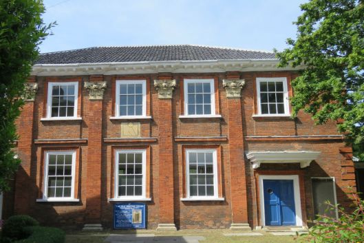
By 1580 nearly half of Norwich’s population were Protestant ‘Strangers’ from the Low Countries who had come seeking religious tolerance not granted by their Spanish overlords. These separatists from the Catholic church worshipped in ‘eglises libres‘ and The Old Meeting House off Colegate (1693) is an important architectural example of this Free Church Movement [3]. This square-plan building shows Classical rather than Gothic influences and we will see the four large brick pilasters capped by Corinthian capitals, used again. The sash windows are thought to be the first  in the city.

The invention of sash windows is uncertainly attributed to Robert Hooke who helped Christopher Wren survey and rebuild the City of London after the Great Fire (1666). The ability to set back sash windows helps prevent the spread of fire and they were specified in subsequent building acts.

old mtg house.JPG

The Old Meeting House Congregationalist Church

By the C19, Norwich was not a healthy place for the city’s poor living in the crowded and unsanitary ‘courts’ vacated by the wealthy merchant-class [4]. The rising population in the second half of the C19 created a demand for new, well-built, sanitary homes [5] that was met by the terraces built on land freed by the break-up of the Steward and Unthank estates in Heigham [6].

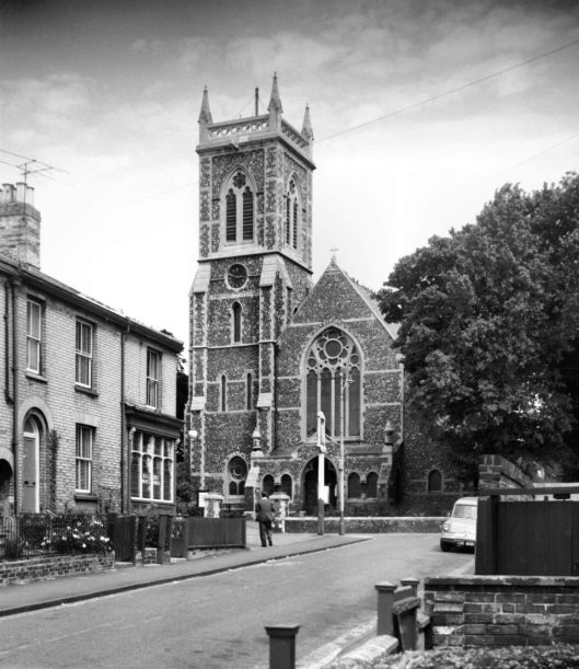
From 1801 to 1861 the population of Heigham had risen from 854 to 13,894 – too large to be served by the old parish church of St Bartholomew (bombed in WWII). Four new parishes were therefore formed: Holy Trinity in Trinity Street (built on one of the first blocks of land released by CW Unthank [5]); St Barnabas’ (at the junction of Heigham and Northumberland Streets); St Thomas’ Earlham Road (damaged in WWII and rebuilt in the 1950s and 60s) and St Philip’s (at the junction of Stafford Street and Heigham Road).

St Philip's 2.jpg

St Philip’s church 1962, looking up Stafford Street towards Heigham Road. ©www.georgeplunkett.co.uk

In late 1944 a US bomber, in difficulty and trying to find its way back to base, clipped a pinnacle on the tower of St Philip’s [7]. The pilot courageously steered the plane towards waste ground near the station but none of the crew survived the crash.

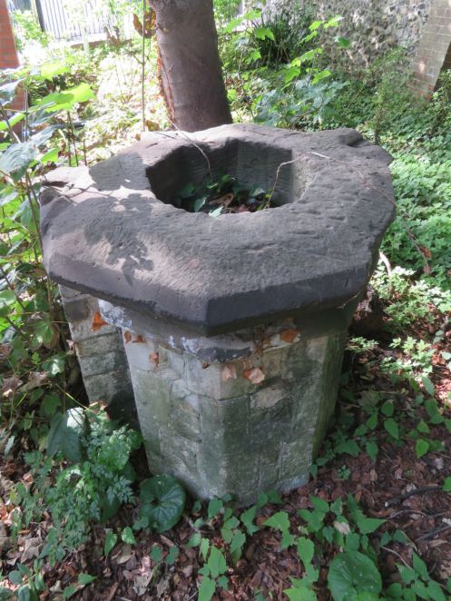
This increase in the number of churches continued into the C20. Pevsner notes that around a dozen churches were built in the new suburbs between 1900 and the start of WWI [8]. However, after WWII the next generation’s churchgoing declined and St Philip’s became redundant and was demolished in 1977. On a recent visit I was told that the stone basin in the garden of the adjacent care home had been the church’s font.

StPhilipsFont.jpg

Suggested to be the font from St Philip’s Church

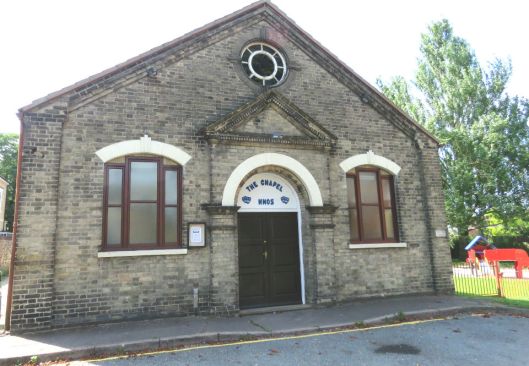
St Philip’s church rooms, at the rear of the site, survive as the Douro Place chapel.

Douro place chapel.jpg

Only the tower of the original parish church of Heigham – old St Bartholomew’s – survived WWII and so its congregation met instead in the disused Primitive Methodist church (1879) in Nelson Street.

Reflecting an era of public philanthropy, the Nelson Street church has a foundation stone laid by mustard manufacturer JP Colman with a commemorative stone dedicated to printer and Sunday school supporter Thomas Jarrold.

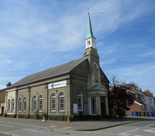
The church’s roofline does seem rather alien, more suited to New England than the flatlands of East Anglia. This can be attributed to the narrow spire that was added in 1956 when St Bartholomew’s North Heigham was adopted as the parish church [9]. It is now Gateway Vineyard Church.

nelson st.jpg

Built in Nelson Street as a Primitive Methodist in 1878-9, spire added by JP Chaplin in 1956. Now the evangelical Vineyard Centre

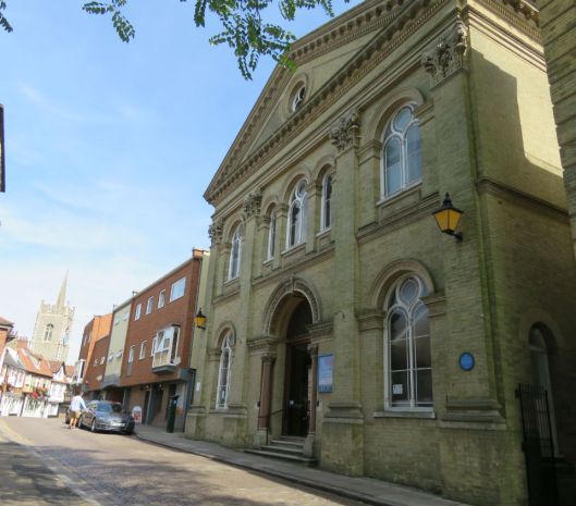
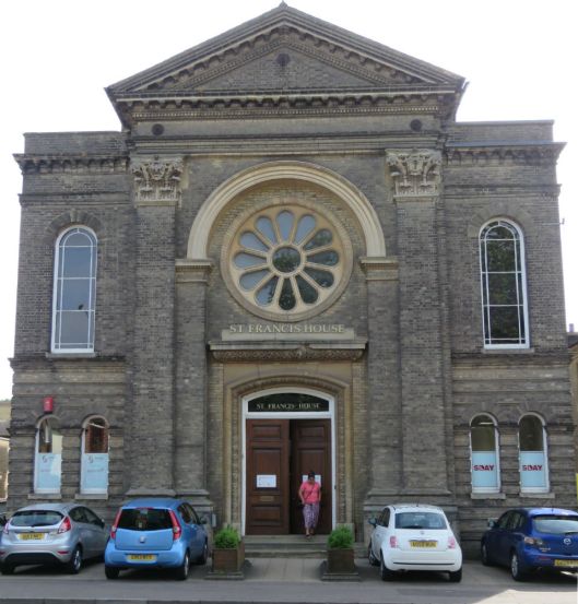
Nonconformist chapels like this sprang up across the expanding city during the latter part of the C19. While the Anglican Church (and perhaps the Wesleyan Methodists) tended to favour the Gothic other nonconformists built rectangular temples in Graeco-Roman form. In modernising his own Congregational Church in Princes Street (1869) Edward Boardman added a Classical facade with a triangular pediment, using white brick from Gunton’s Costessey brickworks (see previous post [10]). The ornate facade has four large Corinthian pilasters that Boardman may well have borrowed from the Old Meeting House across the river.

princes st.jpg

Below, Boardman repeated the use of giant Classical pilasters on the Primitive Methodist Chapel on Queen’s Road (1872).

Queens Rd.jpg

The Gothic Revival Baptist Chapel at the city end of Unthank Road was built (1874) during the city’s expansion southwards but – like other contemporaries – did not reach its century (1874-1954). Below, it is shown with the Catholic Church (now cathedral) of St John the Baptist in the background.

Unthank Rd Baptist church.jpg

Photographed in 1939, the original Baptist chapel on Unthank Road with St John the Baptist Catholic church to the right. ©www.georgeplunkett.co.uk

The original Unthank Road Baptist Chapel (above), designed by Edward Boardman in 1874, was demolished in 1954 to be superseded by a Presbyterian church – a replacement for the church in Theatre Street that was destroyed in the Blitz. The new Modernist church incorporates the original foundation stone from Theatre Street. In 1972 the Presbyterians and Congregationalists came together to form the United Reformed Church [11]. In 1956 a former member of the Boardman practice – Bernard Melchior Feilden –  designed what Pevsner thought the best postwar church in Norwich.

st peters.jpg

Trinity United Reformed Church, Unthank Road. Designed by Sir Bernard Feilden

On the eve of WWII (1939), the practice of Edward Boardman and Son replaced a Gothic-style Methodist chapel (1894) with the much larger St Peter’s Methodist that still stands – just about – at the junction of Park Lane and Avenue Road. It was a neighbour of mine for several years so it is sad to see it empty and in a state of disrepair.

st peters.jpg

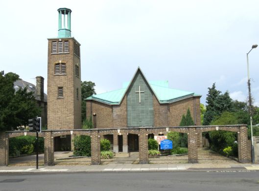
Fewer churches were built between the wars [8]; the following come from the 1930s archives of local builder RG Carter.

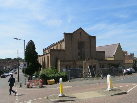
This photograph taken by George Plunkett shows the Belvoir Street Wesleyan Methodist Church (1869) up for sale in 1989. It was demolished to make way for a block of flats but is survived by the adjoining twin-bayed Memorial Sunday School (seen on the far left) that Carters built in the 30s.

Belvoir St Wesleyan Reform Methodist church [6585] 1989-09-18.jpg

Courtesy RG Carter archive ©www.georgeplunkett.com

Screen Shot 2017-07-25 at 17.05.07.png

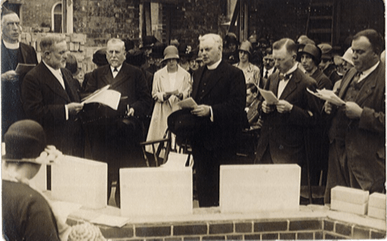
Blessing the foundations of the Belvoir St Sunday school in the 1930s. ©RG Carter Archive

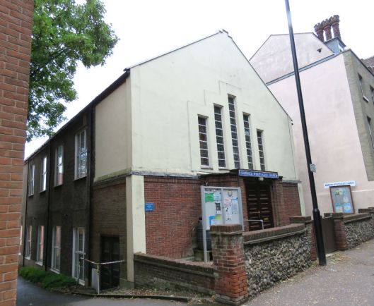
The simplicity of the Norwich Christian Spiritualist Church, built in 1936 by Carter’s, contrasts with Gunton’s chimneys peeping out from the Victorian St Mary’s Croft further along Chapel Field North (see previous post [10]). This steel-framed one-storey building was funded in part by a large Spiritualist meeting held in Norwich after WWI, which was addressed by the faith’s most famous member, Sir Arthur Conan Doyle.

spiritual Ch.jpg

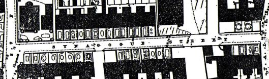
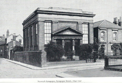
Incidentally, the Spiritualist Church was a temporary home for the city’s Jewish community after their synagogue was destroyed in the German Baedeker raids of 1942. The original building was in Synagogue Street – the only street of this name in the country. It was on the opposite side of the river to the Riverside complex alongside Thorpe Station.

1885 OS (query)_99.jpg

©Ordnance Survey 1885

norwich-old-synagogue.jpg

Synagogue in Synagogue St Norwich 1848-1942 [12]

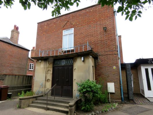
In 1948 the Jewish congregation moved to a prefabricated building on Earlham Road, opposite St John’s Catholic cathedral. The present synagogue below was built (though not by Carters) on the site in 1968/9 and is now on a 999 year lease [13].

synagogue.JPG

Carters also built: the United Congregational School, Jessop Road (opened 1931); Dereham Road Baptist Sunday School in Goldsmiths Street; the Anglican shrine at Walsingham; and a garden house at the back of the Old Meeting House. The garden house was named for Reverend REF Peill who died in the pulpit on Easter Day 1930.

In Recorder Road, just off Prince of Wales Road, Carters built a Christian Scientist church (1934) to hold 300. It is now a Greek Orthodox church. The chequer of flint and brick on the boundary wall and the main north wall are reminiscent of the turret on The Gatehouse pub on Dereham Road, also built by Carters (see previous post [14]).

Greek church.jpg

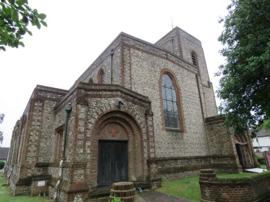
Of Carters’ inter-war churches a personal favourite is St Alban’s Lakenham (1932-1937). It was designed by local architect Cecil Upcher who lived and worked in Pull’s Ferry [15]. The detailing is especially pleasing. Externally, the vernacular whole-flint walls are outlined in red brick and tile …

Grove Rd.jpg

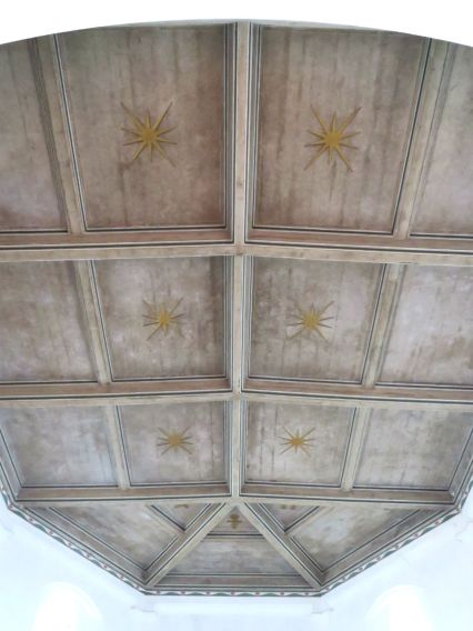
… internally there are several attractive features including the painted concrete ceiling.

Grove Road 2.jpg

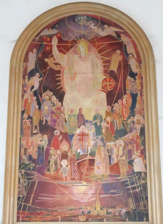
In 1955, in response to a competition by the Eastern Daily Press to provide a work of art above the altar, Jeffery Camp  painted a reredos of an androgynous Christ in Majesty above Norwich. Camp is a founding member of the Norwich Twenty group of artists and a Royal Academician.

christ in majesty.jpg

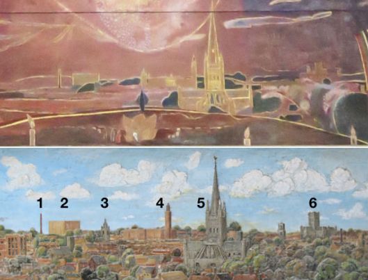
The cityscape at the bottom of the reredos shares the same viewpoint – St James’ Hill – that John Moray-Smith used for The Norwich Panorama (ca. 1947), recently restored by the Norwich Society [16].

panorama final.jpg

1, Caley’s chocolate factory; 2, Norwich Castle; 3, St Peter Mancroft; 4, City Hall; 5, Norwich Cathedral; 6, St John’s Catholic Cathedral.

A thread that runs throughout this post is that the city’s churches have been reused and adapted over a very long time. But despite Norwich being famed for its medieval churches (‘one church for every week of the year’) many of these older buildings are empty and still to find a new purpose. With such cultural treasure it should be possible to find imaginative uses to attract those who come to cities for something other than shopping.

An important start is being made by the Norwich Churches Project [17] who are looking into the relationship between the city, community and architecture. Its downloadable churches trail and guide is available HERE [18]. I can also recommend their free exhibition in the Archive Centre behind Norfolk County Hall, Norwich: ‘Drawing in the Archive: the Visual Record of Norwich’s Medieval Churches 1700-2017‘. Monday 21 August – Friday 17 November 2017.

©2017 Reggie Unthank. Archived by the British Library’s UK Web Archive

Thanks: I am grateful to the RG Carter Archives, whose list of Carter’s 1930 buildings prompted this post. I am grateful to Jonathan Plunkett for permission to reproduce images from the essential and fascinating archive of Norwich buildings photographed by his father George (www.georgeplunkett.co.uk). Thank you Shea Fiddes for the information on Synagogue Street.

Sources

  1. http://www.heritagecity.org/research-centre/churches-and-creeds/noncomformity-in-norwich.htm
  2. https://colonelunthanksnorwich.com/2017/03/15/three-norwich-women/
  3. http://www.heritagecity.org/research-centre/churches-and-creeds/the-old-meeting-house.htm
  4. Holmes, Frances and Holmes, Michael (2015). The Old Courts and Yards of Norwich: A Story of People, Poverty and Pride. Pub: Norwich Heritage Projects.
  5. O’Donoghue, Rosemary (2014). Norwich, an Expanding City 1801-1990. Pub: The Larks Press.
  6. https://colonelunthanksnorwich.com/2017/07/15/the-end-of-the-unthank-mystery/
  7. http://www.georgeplunkett.co.uk/Website/raids.htm
  8. Pevsner, Nikolaus and Wilson, Bill (2002). The Buildings of England. Norfolk 1: Norwich and North-East. Pub: Yale University Press.
  9. http://www.georgeplunkett.co.uk/Norwich/mid.htm#Nelso
  10. https://colonelunthanksnorwich.com/2016/05/05/fancy-bricks/
  11. https://historicengland.org.uk/listing/the-list/list-entry/1392268
  12. http://jscn.org.uk/small-communities/norwich-hebrew-congregation-synagogue/
  13. http://www.norwichsynagogue.org.uk/wp-content/uploads/2014/12/11th-12thcenteryjews.pdf
  14. https://colonelunthanksnorwich.com/2016/12/22/arts-crafts-pubs-in-the-c20th/
  15. http://www.norfolkchurches.co.uk/norwichalban/norwichalban.htm
  16. Burrall, Paul (2017). John Moray-Smith, a booklet published by the Norwich Society http://www.thenorwichsociety.org.uk/moray-smith-panorama (exceptional value at just £3!).
  17. https://norwichmedievalchurches.org/
  18. https://mediafiles.thedms.co.uk/Publication/ee-nor/cms/pdf/OTW_WEBChurchesWalkingTrail.pdf

The end of the Unthank mystery?

Regular readers will know that I have been chipping away at the urban myth that claims a piece of tall wall at the Unthank Road/Clarendon Road junction to be the last remnant of the Unthank’s Heigham estate. Days after my last post on this topic I was still unable to confirm or deny the story … but then I stumbled across new evidence.

The Wall 1.jpg

The double-height wall said to be the last vestige of the Unthanks’ Heigham estate

The story seems to have originated with Reverend Alfred Jonathan Nixseaman (1886-1977), vicar at Intwood Church, a field away from Intwood Hall on the southern outskirts of Norwich.

Intwood church.jpg

Intwood Hall from the churchyard

William Unthank’s son and heir, Clement William, moved to the Hall when his wife took possession of her family home in 1855.  William Unthank (1760 – 1837) was buried in St Bartholomew’s church Heigham but his descendants are buried at Intwood church. Reverend Nixseaman was the incumbent there when the last of the Norwich Unthanks (Miss Margaret Beatrice Unthank d.1995) lived in the Hall.

Unthank montage 1.jpg

Memorials in Intwood church to the Unthanks of Intwood Hall. Clement William moved from Heigham to his wife’s Intwood estate when their son, CWJ  Unthank, was a young boy.

Unthank window.jpg

The Unthank memorial window in Intwood church

Nixseaman’s familiarity with the details of the Unthanks’ lives, and deaths, lends an air of authority to his self-published book, The Intwood Story (1972) [1]. He described in quite some detail the newly-built house to which William Unthank moved in 1793; its sylvan setting in the “highest part of Heigham”; a house with 70 acres of grass and woods.

“This Heigham House became the home of the Unthanks for about 100 years, from 1793 to 1891. It stood in its own Park grounds not far from St Giles’ Gates (at the top of Upper St Giles Street). Later when the estate was sold up piece-meal a terrace of houses was built on the site … All that now remains of the premises is some walling which formed part of the stables, seen at the corner of Ampthill Street, opposite Clarendon Road.” Later, “This old wall now shelters the surgery and residence of Dr A.G.Day (38 Unthank Road) from the roadway.”

This is where the myth of The Wall began According to Reverend Nixseaman, William Unthank’s Heigham House was unambiguously situated at the corner of modern-day Clarendon Road and Unthank Road. But even if we ignore the slight niggle that Ampthill Street is not opposite Clarendon Road there are enough other inconsistencies to have sent me on a wild-goose chase around various other Heigham Houses, Halls and Lodges of Victorian Norwich, as my previous blogpost on the topic demonstrates [2]. For instance: Clement William and his wife, Mary Anne Muskett, did not live in this particular Heigham House from 1835 to 1855 for according to the 1842 tithe map they lived 1000 yards away on their estate near modern-day Onley Street; Clarendon Road, Grosvenor Road, Neville Street and Bathhurst Road were eventually built on this site, not “a terrace of houses”; and other evidence indicates that brewer Timothy Steward was living in Heigham Lodge from 1836 onwards.

stewards house 1.jpg

‘Steward’s House’ at the corner of Clarendon and Unthank Roads

S nP duo.jpg

The S in the S&P Limited refers to Timothy Steward, brewer. From the Eaton Cottage public house at the junction of Unthank Road and Mount Pleasant

In that previous blogpost on the Unthanks, when I was still contorting myself to accommodate Nixseaman’s plausible-sounding testimony, I speculated that William and Clement William might have had separate houses and that William sold his to Timothy Steward towards the end of his life. I therefore looked at the Land/Window Tax records for the parish of Heigham to check whether Steward ever lived in Unthank’s house. In every annual entry from 1790 to 1832, when the NRO’s records unfortunately stop, William Unthank is recorded as Proprietor and Occupier of House and Land. Unfortunately, the number and name of the house was never specified in these records. In 1832, Timothy Steward also makes an appearance but his entry (Proprietor and Occupier of House and Land) is the same as Unthank’s indicating that both were owner-occupiers, implicitly of separate houses.

Puzzlement about the exact site of the Unthanks’ house is not a new thing for on the 25th of May 1934 a correspondent to the Eastern Daily Press wrote:

“In reply to S.B. about 60 years ago Colonel Unthank’s House was near Mount Pleasant and, if my memory is correct, was in the space now occupied by Gloucester, Bury and Onley Streets. His grounds were enclosed by a brick wall and the house was  some distance from the road (i.e., in contrast to Timothy Steward’s House whose carriage drive was close to the road). The Unthank Arms, at the top of Newmarket Street, at one time bore, as a sign, the elaborate armorial bearings of the Unthanks, so we may, I think, assume with some confidence that the family existed in the neighbourhood. Yours faithfully, W,B.”

In the same edition, a letter from William Unthank’s grandson, Clement William John Unthank (b 1847), should have settled the argument but appears not to have been seen by Nixseaman:

“My grandfather bought Heigham House and 70 acres of land between what is now Trinity Street and Mount Pleasant about 1793.”

This location for Heigham House is consistent with Rye’s History of the Parish of Heigham [3] that states:  “Unthank’s house was on the other side of the road (to Timothy Steward’s), and was in well-wooded grounds.” It now looks as if Reverend Nixseaman, writing 100 years after the Unthanks left the parish, chose the wrong Heigham House on which to pin his imaginative account of their home.

The Unthank Estate. This estate on the east side of Unthank Road was extensive, as the 1842 tithe map shows. By 1843, six years after his father’s death, Clement William Unthank was living outside the city at Intwood Hall. Now he started selling off his father’s estate and was applying to be excused land rent charges, “since the lands have been divided into numerous building plots.” First he sold Unthank’s House and two adjacent plots, then in 1850 he sold 46 acres 2 rods and 26 perches of surrounding land, followed in 1878 by another Certificate of Redemption of Rent Charge relating to the sale of his former garden, ‘The Lawn’ and ‘The Plantation’. This all goes to show that the Unthanks’ Heigham House was on this ‘Onley Street’ estate, outlined in red below, and not on land for which they held no title further down Unthank Road. The terraces subsequently built on Unthank land account for much of the Victorian housing on the east side of Unthank Road: from Essex Street to Bury Street.

Unthanks land 2.jpg

Plots sold by CW Unthank 1843-1878. The octagonal gaol (top right) – now the site of the Catholic Cathedral – is at the city end of Unthank Road marked yellow. The Unthanks’ Heigham House is marked with a red star; Timothy Steward’s Heigham House with a purple star. The green line marks the future Essex Street and parallel to this were built Trinity, Cambridge, York, Gloucester, Onley and Bury Streets. Redrawn from the 1842 tithe map of Heigham (NRO BR276/1/0051). Courtesy of the Norfolk Record Office.

So who did own The Wall opposite Timothy Steward’s version of Heigham House further up Unthank Road? Again, the 1842 tithe map comes to our aid. The accompanying apportionment record gives the ownership of the numbered properties on the map. It shows that The Wall is on a strip of land belonging not to the Unthanks, nor to Steward, but leased to others by the Norwich Boys’ Hospital. This charity, founded by the C17 mayor Thomas Anguish, supported boys’ and girls’ hospitals by leasing their land around Norfolk.

Peddars+arrow2.jpg

The upper pink house is Steward’s, the lower is the Boys’ Hospital (occupied house in pink, outbuildings in grey). The arrowed red line marks the tall wall. From the 1842 Heigham tithe map. NRO BR2671/0051 Courtesy of the Norfolk Record Office

Account ledgers for the Trustees of the Norwich Boys’ Hospital, covering the years 1834-1897, are held in the Norfolk Record Office.

Boys hospital 1.jpg

NRO N/CCH84. Courtesy of the Norfolk Record Office

The only entry for the parish of Heigham records that a house and garden of one acre, known as Peddars Acre, had been leased to Leonard Harmer for 60 years from Michaelmas 1822. This period is from 15 years before William Unthank died to 25 years after Clement William moved to Intwood. The land and its ‘messuage’ (buildings) were not, therefore, part of the Unthank estate and the absence of Clement William’s name from the ledgers rules out the remote possibility that he rented the stables from them after his father’s death.

” (Where) every prospect pleases and only man is vile”. As to the unusual height of The Wall, Rosemary O’Donoghue [4], in her book on the C19 expansion of Norwich, mentions the steps that owners took to protect their privacy when breaking up their Heigham estates. Below, the 1842 tithe map of Heigham shows that Timothy Steward (whose house and grounds are outlined in red) owned another large plot of land,  known as Home Close (black) on the other side of Unthank Road. This plot of arable land adjoined Peddars Acre (green) on one side and plot 466, which also belonged to Steward, on the other. Steward’s plots 453, 568 and 466 were almost as big as the Unthanks’ estate.

Stewards plot final.jpg

Steward’s house and grounds in red; Peddars Acre in green. He also owned plot 568 (black) and the adjacent plot 466. (Unthank’s House is #460 lower left). Redrawn from NRO PD522/44. Courtesy of Norfolk Record Office

The Victorian terraces of Trory, Woburn, Oxford and Kimberley Streets were to be built on Steward’s Home Close, plot #568. A purchase agreement dated 12th December 1853 (NRO N/TC/D1/277, 335 x2) refers to part of this land that William Trory (a tavern owner) had recently bought from Timothy Steward. The purchaser was required to:

“… build a good and substantial nine-inch brick wall, with 14-inch piers of the height of six feet … along the whole boundary of the said piece of land adjoining the garden ground of the said William Trory...”. [Trory leased Peddars Acre from 1837 to 1864]. The covenant continues, “And that no windows or other apertures shall be made in the said houses or buildings, or any of them (including those next to Unthank’s road) on the north-east side thereof, or so as to front or overlook the garden of the said William Trory.”

But in the original sale agreement with William Trory, Timothy Steward and his wife Lucy had gone to even greater lengths to limit what could be seen from their bedroom windows.

“… that before any offices or back premises of any description … shall be built on any part of the said land … a dwelling house facing towards Unthank Road and in a line to conceal such offices [an outmoded term for lavatory] or back-premises from being seen from the windows on the first-floor or first story (sic) of the residence of the said Timothy Steward“.

That is, the Stewards made sure that even if William Trory re-sold the land, as he did, the purchaser’s first legal duty would be to build an entire house facing the Steward residence so that their gaze should not alight on lavatories or other outhouses on the other side of the road. As a consequence, Trory Street is a cul-de-sac, blocked from opening directly onto Unthank Road.

House opp.jpg

Opposite Steward’s house

Furthermore, the Stewards had specified that nothing unsavoury should be seen, not just from their garden, but from their bedroom windows! A six-foot wall of the kind that Trory had demanded around his own garden could not have met this stringent condition but the Stewards’ sensitivities provide an explanation for the twelve-foot wall that separates the building on Peddars Acre from Unthank Road.

©2017 Reggie Unthank

The book, “Colonel Unthank and the Golden Triangle”, contains much more than is included in my three posts on the Unthanks. It also contains fascinating photographs of the Unthank family, not seen online. Still available from Jarrolds Book Department, and The City Bookshop in Davey Place, Norwich. Or contact me direct.Cover Ping.png

Book available from Jarrolds Book Department and City Bookshop £10

Sources

  1. Nixseaman, A.J. (1972). The Intwood Story.ISBN 0950274208, Norwich. (Available from the Heritage Centre, Norwich Library)
  2. https://colonelunthanksnorwich.com/2017/04/15/colonel-unthank-rides-again/
  3. Rye, Walter (1917) History of the Parish of Heigham in the City of Norwich. A digitised version is on  http://welbank.net/norwich/hist.html#hhall
  4. O’Donoghue, Rosemary. (2014). Norwich, an Expanding City 1801-1900. Pub, Larks Press ISBN 9781904006718.

Thanks. I am enormously grateful to the staff of the Norfolk Record Office for their help and advice in searching the records and for giving permission to reproduce images.


Barnard Bishop and Barnards

Tags

, , ,

There is little now to suggest that Norwich had an industrial past but the parish of Coslany, around the River Wensum, was once home to iron works, shoe factories, an electricity generating works and a brewery – all providing employment after the slow decline of the city’s wool-weaving trade.

Barnards lady2.jpg

From the mid-nineteenth to the mid-twentieth century, Barnard Bishop and Barnards’ Norfolk Iron Works was a major part of the industrial landscape of Norwich-over-the-water.

30129028230002 Barnards factory.jpg

Barnard, Bishop and Barnards’ Norfolk Iron Works. Courtesy Picture Norfolk (www.picture.norfolk.gov.uk)

Barnards red.jpg

Ordnance Survey 1908. Reproduced with the permission of the National Library of Scotland (maps.nls.uk/index.html)

The son of a farmer, Charles Barnard (1804-1871) started making domestic and agricultural ironwork in Pottergate in 1842 [1]. Having lived on the land, Barnard was aware of the damage that wild animals could wreak on crops and began to experiment on a machine for weaving wire netting. Initially the netting was made on the machine below but later it was produced by a powered loom. Netting was to be remain a core activity well into the C20.

netting.JPG

Barnard’s loom for weaving wire netting at The Museum of Norwich

In 1846 Barnard went into partnership with John Bishop, then in 1859 Barnard’s sons Charles and Godfrey joined the business, becoming Barnard, Bishop and Barnards.

4 Bs.JPG

Barnard Bishop and Barnards’ ‘four Bs’ trade sign – the two smaller bees representing Charles Barnard’s sons. Courtesy of The Museum of Norwich

This ‘four Bs’ rebus marks the firm’s attachment to puns: their designer Thomas Jeckyll used his own two-butterfly signature from the time of his early collaborations with Barnard and Bishop. Jeckyll, incidentally, was a friend of Frederick Sandys who drew the portrait of Charles Barnard (unable to show): both inserted a rogue ‘y’ into their surname.

I have already written at length about Jeckyll [2-5] but it’s not possible to omit him entirely since it was his designs that brought Barnards national attention, elevating some pieces to high art. Two examples: first, the intricate wrought and cast-iron ‘Norwich’ gates that won the firm ecstatic praise at the 1862 International Exhibition;

Sandm gates.jpg

The Norwich gates, given to the Prince and Princess of Wales in 1863 as a wedding present by the citizens of Norwich and Norfolk. Now at Sandringham House, Norfolk. Courtesy of The Museum of Norwich

second, Jeckyll’s associations with a group of London artists – notably James Abbott McNeill Whistler – made him a key figure in the Anglo-Japanese Aesthetic Movement. Jeckyll used japonaise designs for Barnards’ fireplaces while his cast iron sunflower (to be seen on the gates of Heigham Park and Chapelfield Gardens) came to symbolise the Aesthetic Movement.

sunflower.jpg

Courtesy of The Museum of Norwich

In 1871, Barnards moved their iron works to Calvert Street in the parish of St Michael-at-Coslany.

St Miles bridge.jpg

St Miles Works from the river. Courtesy The Museum of Norwich

The business contained a large foundry at one end while a new building housed the netting mill, for which steam was used to power the looms [1]. The factory was also known as St Michael’s Works; Miles is a diminutive of Michael and both are also applied to one of the city’s most beautiful churches, the elegant St Michael Coslany.

Barnards.jpg

Barnard Bishop and Barnards St Miles Works 1951. The works had several tall chimneys but the one shown here may belong to Bullard’s Anchor Quay Brewery on the other side of the river. ©2017 RIBApix

At the St Miles site the workforce of ca 400 produced an eclectic range of utilitarian objects. The drawing below lists: “a coke barrow, a garden arbour, trellis, wire netting, a garden seat, a chair, a pheasant feeder, a swing water barrow, a hose reel, a fire dog, a grate, a table, a roller & a sheep trough. ‘All made on the spot’“.

Barnards goods.jpg

Courtesy of The Museum of Norwich


catalogue2.JPG

Still desirable. Garden chairs from Barnard Bishop and Barnards 1884 catalogue for their London showroom. Courtesy of The Museum of Norwich

Barnards catalogue.JPG

Barnards celebratory brochure  1844-1925. Courtesy of The Museum of Norwich

The railways arrived in Norwich in the mid-C19 and Barnards provided much of the metal work for at least two of the city’s three stations. These ornate barriers at Norwich Thorpe station were made by Barnards and were designed by W. Neville Ashbee, the company architect for the Great Eastern Railway.

Norwich station.JPG

The wrought iron platform barriers at Norwich Thorpe station. Courtesy of The Museum of Norwich.

The barriers have gone but the cast-iron canopy supports with the elegant spandrels can still be seen along the platforms.
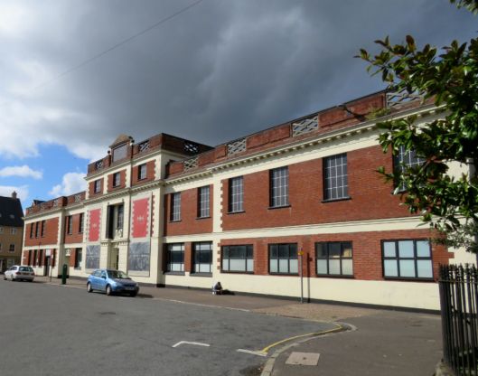
Norwich Thorpe station.JPG

The station forecourt is still enclosed by fine examples of Victorian ironwork.

railings.jpg

Barnards also cast the columns and spandrels  for Norwich City station. This station near the St Crispin’s roundabout was the terminus of the Midland and Great Northern Joint Railway whose hub was at Melton Constable. It closed to passengers in 1959.

Norwich city station.JPG

 Norwich City station. Courtesy of The Museum of Norwich NWHCM 118.959.51

In 1882, a river bridge was built to provide access to the new City Station. St Crispin’s Bridge, which was manufactured by Barnards, became part of the ring road in 1970 taking traffic in clockwise direction.  A new bridge built parallel to it takes traffic in the opposite direction.

Barnards bridge.JPG

Charles Barnard died in 1871 but the firm lived on as Barnards Limited (from 1907).

Mr and Mrs Charles Barnard.jpg

Mr and Mrs Charles Barnard in later life. Image courtesy of Norfolk Record Office via http://www.picture.norfolk.gov.uk 

The managing director James Bower played a direct part in the running of the company, rebuilding and re-designing the wire netting machines. In 1921 they purchased part of the old Mousehold Aerodrome where, in the Second World War, they manufactured gun shells and parts for the Hurricane fighter. This attracted the attention of the Luftwaffe who bombed the site in July 1942, killing two people [6].
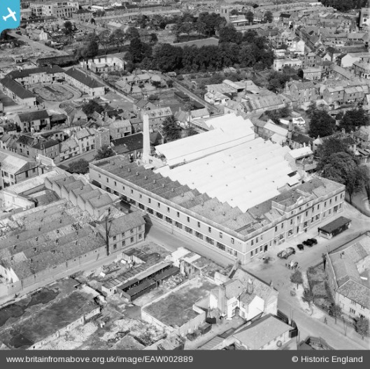
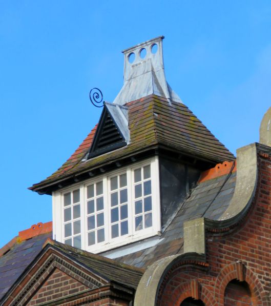
The Norwich engineering firm, Boulton and Paul, made aircraft (including the Overstrand and Sidestrand) but who knew that Barnards helped make planes? Barnards also made buses …

Barnards bus.jpg

Bus made by Barnards Ltd in Cathedral Close.  Image courtesy of Norfolk Record Office via http://www.picture.norfolk.gov.uk

 … and at their factory in Salhouse Road they produced steam traction engines.

steam roller.jpg

Image courtesy of Norfolk Record Office via http://www.picture.norfolk.gov.uk

 Barnards Ltd ceased trading in 1991. The Coslany site is now occupied by social housing – Barnards’ Yard.

Barnards2017.jpg

Barnards’ Ironworks now Barnards’ Yard social housing

Barnards yard sign.jpg

©2017 Reggie Unthank

Sources

  1. Williams, Nick (2013). Norwich, City of Industries (an excellent book on industrial Norwich).
  2. https://colonelunthanksnorwich.com/2015/12/26/two-bs-or-not-tw…s-thomas-jeckyll/
  3. https://colonelunthanksnorwich.com/2016/04/15/thomas-jeckyll-the-boileau-family/
  4. https://colonelunthanksnorwich.com/2016/01/06/jeckyll-and-the-sunflower-motif/
  5. https://colonelunthanksnorwich.com/2016/11/10/jeckyll-and-the-japanese-wave/
  6. http://www.heritagecity.org/research-centre/industrial-innovation/barnards.htm

Thanks to Hannah Henderson of The Museum of Norwich for kindly showing me the Barnards collection, and I also thank David Holgate-Carruthers for his help. Do visit the Museum of Norwich, which has a section devoted to Barnards and Jeckyll and gives a fascinating glimpse into Norwich as it once was. I am grateful to Clare Everitt of Picture Norfolk for allowing me to reproduce photographs. Clare manages (https://norfolk.spydus.co.uk/cgi-bin/spydus.exe/MSGTRN/PICNOR/HOME), which contains a searchable collection of 20,000 images of Norfolk life.

Public art, private meanings

Tags

,

Once, I took part in an alternative sculpture-trail, visiting unexpected art in public spaces: pieces hidden in full view, works that had outlived their original purpose and unseen eroticism in a monument to a national heroine.

Cavell2.jpg

Edith Cavell monument by Henry Pegram 1918 [1]. Originally sited in the road outside the Maid’s Head Hotel (left) it is now placed beside the Erpingham Gate of the cathedral (right).

This was in May 1999 and the sculpture trail was led by Krzysztof Fijalkowski, a young lecturer from the Norwich School of Art [2]. Here, I retrace some of his steps and add a few of my own.

Open secrets.jpg

Edith Cavell, born in nearby Swardeston, was a nurse during WW1. In 1915 she was shot by a German firing squad in Belgium for assisting the escape of Allied prisoners and – according to former head of MI5, Dame Stella Rimington – for espionage [3]. Notes on the guided tour (price 20p) gave a Freudian interpretation of the Cavell Memorial, mentioning the wreaths that mark Cavell’s breasts and the soldier’s erect rifle “pointing straight to her sex”. Works of art can hold many meanings although not everyone agrees with them, as Tony Hall’s cartoon shows.

Cavell cartoon.jpg

Eastern Daily Press May 20 1999 ©Tony Hall

Not far away we visited a curved mural, tucked away from passers-by at the top of London Street. Betfred.jpg

Boldly commissioned in 1974 by the Abbey National Building Society, Tadeusz Zielinski’s ‘Symbol of Norwich’ depicts a modern family, sheltered under the Society’s roof, against the background of the walled city with its cathedral (three panels up from the right). The modernist treatment is reminiscent of the Festival of Britain style of the early 1950s [4] but any obscurity of meaning will only have been increased by Betfred’s logo that – drilled and screwed into the artwork – now blocks the first row of panels. Aaaagh!

Who, when buying half a pound of six inch nails in Thorns the ironmongers in Exchange Street, has failed to notice the wall paintings on the first floor? On a recent visit, an assistant moved some ladders for me to see the paintings behind the protective screen. Emily Duke, a member of the Paston family – partners of the founder RE Thorn – told me that before the business was opened in the early C19th the building had been a hotel in which an artist painted the rooms in return for accommodation. The remaining figures seem to represent People of All Nations.

Thorns 3.jpg

Courtesy of Emily Duke at Thorns, Exchange Street, Norwich [5]

The redundant church of St Laurence is one of five along St Benedict’s Street. It has one of the most prominent towers in the city yet it and the west doorway are easy to miss as you concentrate on the steep steps down St Laurence’ s Passage [6]. In the spandrels above the door are two gruesome deaths: the roasting of the eponymous saint on a gridiron and St Edmund riddled with Viking arrows. His head was thrown into a forest but rescuers were guided to it by a Latin-speaking wolf (bottom right) crying hic, hic, hic.

The Saints.jpg

High above Orford Hill stands a stag with moulting antlers – a 1984 fibreglass replica of the statue placed there about 100 years earlier.

Stag1.jpg

Its original meaning is likely to be obscure for the bold wooden sign ‘GUNMAKER’, which advertised the trade of occupants George Jeffries then Darlows, has disappeared in recent years [7].

Orford Hill 8 [2707] 1938-08-13 A.jpg

No8 Orford Hill in 1938. Edwards’ saddlery and Darlow & Co gunmaker. Courtesy georgeplunkett.co.uk

Another stop on the trail was to see one of the first purchases by the Norfolk Contemporary Art Society in 1978. At the time this work by Peter Hide, a former lecturer at the School of Art, was situated on a piece of wasteland behind the Duke Street carpark. Hide may have intended this as a formal exercise in ‘horizontality’ and balance but in its original location – a stone’s throw from Barnard, Bishop and Barnards’ Victorian ironworks – the girders provided an incidental link with the city’s industrial past.

Girderrs.jpg

Some time over the intervening years the sculpture has been re-sited next to the busy St Crispin’s roundabout near Halford’s store, gaining a further – less welcome – layer of meaning. The Girder Structure is now near the site of Norwich’s City Station, which was bombed in the 1942 Baedeker raids and eventually closed in 1959. This does add a further resonance to The Girder Structure in its new position but the industrial-strength attachment of the M&GN logo (presumably by the Midland and Great Northern Joint Railway Preservation Society?) overrides the artist’s original intentions.

choo choo.jpg

The following examples of public art come from my own travels. At the corner of St Stephens and Surrey Streets, opposite Marks and Spencer, is a postwar block decorated with identical stone carvings hidden beneath the keystones of the three curved window arches.

Hog3.jpg

Even if you can discern them without the aid of a telephoto lens (I couldn’t) it is not obvious that these animals commemorate the previous building on the site – the Boar’s Head public house, destroyed by a Baedeker raid in April 1942. The surname of the C19 licensee, Richard Norgate of Cawston, can just be made out on the pub sign below [8].

Old Boar Inn.jpg

A basket-maker’s shop on nearby Ber Street was also destroyed in the 1942 air raids. The reconstructed building is now occupied by Gerald Giles’ home-electricals store but the wooden carving on the tympanum above the door recalls a different post-war life. The panel by Joseph Lloyd Royal depicts dockers unloading ships, suggesting that the building was once a warehouse for storing goods from Norwich docks [9].

gerald giles1.jpg

The Wensum was still navigable by quite large vessels until the 1980s.

norwichport_cigcard.jpg

Coasters at the Port of Norwich ca 1936 broadlandmemories.co.uk

The Norfolk and Norwich Agricultural Hall (now occupied by Anglia TV), at the top of Prince of Wales Road, is built from alien Cumberland sandstone [10]. The Prince of Wales feathers relate to the prince’s involvement and to the road itself; however, there is no record of the identity of the worthies whose terracotta heads decorate the keystones of the ground floor windows. The bull’s head could simply be symbolic of agricultural trade but once you recognise the name of local philanthropist JJ Colman on the foundation stone it is impossible not to see the beast as an allusion to his family’s mustard business.

New Colmans montage.jpg

Around the year 2000, the City Council commissioned a sculpture of the Three Wise Monkeys to go on top of the pavilion at Waterloo Park. As well as seeing, hearing and speaking no evil, the monkeys have – with the passage of time – come to illustrate the speed with which technology becomes dated. Now, a monkey with an iPhone could do all three jobs.

Three Monkeys.jpg

Alex Johannsen ca 2000 [11]

Palimpsests – traces of past use – can be seen all around the city. Some of my favourites are the mosaics advertising what once were household names. The initials, FH&W, were used as a symbol to advertise national shoe chain Freeman Hardy and Willis in the 1960s but by the 1990s the chain had disappeared. The Maypole dairy chain was known, paradoxically, for promoting non-dairy margarine. Their name was phased out in the 1970s.

FHW Maypole.jpg

Magdalen Street, Norwich

Norwich, fortunately, isn’t blighted by equestrian statues of Victorian luminaries …

There once was a very famous man
On his famous horse he’d ride through the land
The people used to see him everywhere
When he died they put a statue in the square
(Hurray)

The Equestrian Statue, (click audio link) by The Bonzo Dog Doo-Dah Band (composer Neil Innes) 

… but it does have a statue that commands an entire square – the statue of Sir Thomas Browne (1605-1689) on Hay Hill, near his house. Here he is contemplating a Roman burial urn found at Brampton, which was the subject of his book ‘Urne Burial’ (“man is pompous in the grave“).
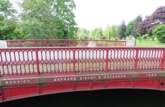
browne.jpg

Sir Thomas Browne by Henry Pegram 1905

At the foot of the Browne statue are several pieces of marble statuary comprising a work entitled, Homage to Thomas Browne. In his esoteric book, The Garden of Cyrus, Browne discusses the power of the quincunx – an interlocking figure where four points mark the corners of a diamond with the fifth point at the centre. The marble blocks do not, at first, appear to be arranged in a particular fashion but by phasing out the other blocks it can be discerned that the five high-backed seats are arranged in a quincunx [12].

Quinkx2.jpg

Left, the Quincunx from The Garden of Cyrus 1658 (Wikipedia); right, one of five marble seats, part of the Homage to Thomas Browne by Anne and Patrick Poirier 2007  

In the 1980s, the smell of chocolate would float over the city – usually on Sundays – from the Nestlé/Rowntree chocolate factory next to Chapelfield Gardens. Originally this had been Caley’s Fleur de Lys chocolate factory; it was another victim of the 1942 bombing raids but the building was reconstructed in the early 1950s. The site is now occupied by the Chapelfield Shopping Mall and the lost chocolate factory is commemorated by two pairs of panels, one either side of the St Stephen’s Street entrance. These sculptures were initially made for the postwar building by local artist Edward Barker who celebrated the ingredients: cocoa, exotic fruits, maize and milk [13].

Caley4.jpg

The layering of history can also be seen inside the shopping mall. Two sets of 18 panels, high up on the top floor of the arcade, are based on the 18 relief panels decorating the bronze doors to the City Hall (1938) [14]. Their designer, James Woodford, depicted trades that were then associated with a thriving industrial city but which, like chocolate-making, have gone the way of the city’s shoe and aeronautical industries shown below.
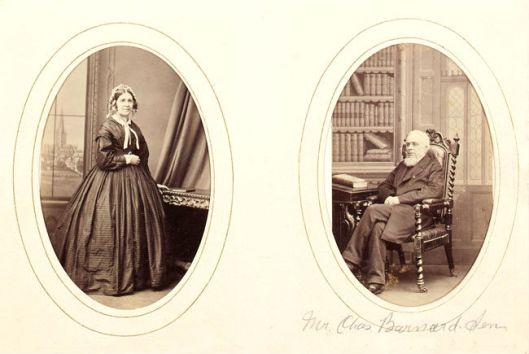
Mall7.jpg

On the left,  in intuChapelfield Shopping Mall, are copies of James Woodford’s roundels (right) originally designed in the 1930s for the bronze doors of Norwich City Hall

©ReggieUnthank 2017. 

Sources

  1. http://www.racns.co.uk/sculptures.asp?action=getsurvey&id=289.
  2. Krzysztof Fijalkowski and Rachel Fijalkowski (1999) Open Secrets: Unexpected Art in Norwich (pamphlet produced as part of Norfolk Visual Arts Festival) see [4].
  3. http://www.telegraph.co.uk/news/bbc/11861398/Revealed-New-evidence-that-executed-wartime-nurse-Edith-Cavells-network-was-spying.html
  4. http://www.racns.co.uk/sculptures.asp?action=getsurvey&id=86
  5. http://www.thornsdiy.co.uk/pages/ourstory.html
  6. http://www.norfolkchurches.co.uk/norwichlawrence/norwichlawrence.htm
  7. http://www.racns.co.uk/sculptures.asp?action=getsurvey&id=169
  8. http://www.norridge.me.uk/pubs/areasrch/centre/pubs83/indiv/boar.htm
  9. http://www.racns.co.uk/sculptures.asp?action=getsurvey&id=316
  10. https://colonelunthanksnorwich.com/2016/07/28/norwichs-pre-loved-buildings/
  11. http://racns.co.uk/sculptures.asp?action=getsurvey&id=283
  12. http://racns.co.uk/sculptures.asp?action=getsurvey&id=591
  13. http://racns.co.uk/sculptures.asp?action=getsurvey&id=363
  14. http://www.heritagecity.org/research-centre/social-innovation/norwich-city-hall.htm

I have drawn heavily on the essential website for local sculpture in Norfolk and Suffolk  www.racns.co.uk and thank Sarah Cocke for patiently answering my queries. Do visit this fascinating archive.

Thanks: to Professor Krzysztof Fijalkowski for his blessing; to Tony Hall and the EDP for permission to use the cartoon; to Emily Duke for the Thorns photographs; Carol Gingell of Broadland Memories for the photograph of ships on the Wensum; and the georgeplunkett.co.uk website for the 1938 photo of the stag on Orford Hill.

The Norwich Society helps people enjoy and appreciate the history and character of Norwich.   Visitwww.thenorwichsociety.org.uk

NorwichSocLogo.jpg